- Home
- :
- All Communities
- :
- Products
- :
- Mapping and Charting Solutions
- :
- Mapping and Charting Questions
- :
- Create Buffer of Percentage of Visits around Store
- Subscribe to RSS Feed
- Mark Topic as New
- Mark Topic as Read
- Float this Topic for Current User
- Bookmark
- Subscribe
- Mute
- Printer Friendly Page
Create Buffer of Percentage of Visits around Store
- Mark as New
- Bookmark
- Subscribe
- Mute
- Subscribe to RSS Feed
- Permalink
- Report Inappropriate Content
Hi,
I have a map that shows the location of one of my stores, as well as points representing customer addresses. My question is. Is there a way to create a buffer around a certain percentage of the customers that are closest to the store? For example, a buffer that encompasses 80% of the customers that are closest to the store.
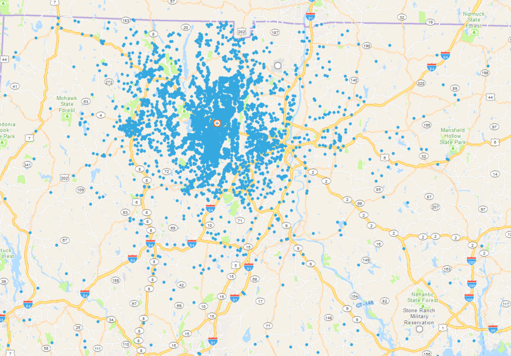
Here is a screenshot of what my map looks like right now:
- Blue Dots = customers
- Orange/White/Blue image = store
If this is not possible with points, could something similar be done with polygons? For example, only show the Block Groups that contain 80% of customers that are closest to the store?
It may be helpful to know that I'm working in ArcMap and have access to Business Analyst, Spatial Analyst, and Network Analyst.
Any help/advice would be greatly appreciated. Thanks
- Mark as New
- Bookmark
- Subscribe
- Mute
- Subscribe to RSS Feed
- Permalink
- Report Inappropriate Content
Crow-flies distance? ArcGIS Pro...
Calculate the distance from the origin to all the destinations
Sort them from closest to farthest.
Query for the distance that encompasses 80%
Produce a concave hull
Point tools for distance calculations https://carleton-u.maps.arcgis.com/home/item.html?id=f96ede37dcd04c2e96dc903a4ce26244
Table tools for sorting/ranking
- https://www.arcgis.com/home/item.html?id=90d9ca933e8c4b96bf341a20ae1f2514
- https://community.esri.com/blogs/dan_patterson/2018/02/12/table-tools-a-set-of-tools-for-working-wit... for pictures
Concave hull for containment