- Home
- :
- All Communities
- :
- Developers
- :
- JavaScript Maps SDK
- :
- JavaScript Maps SDK Blog
- :
- Earth's Crust - Custom JavaScript App
Earth's Crust - Custom JavaScript App
- Subscribe to RSS Feed
- Mark as New
- Mark as Read
- Bookmark
- Subscribe
- Printer Friendly Page
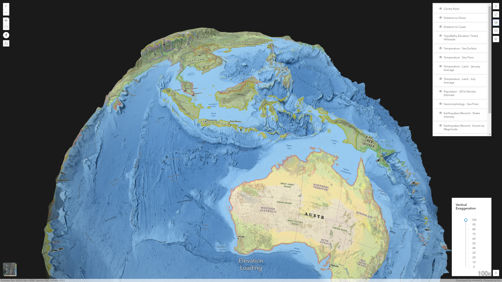
I have just created an app with Esri's JavaScript API. It shows an exaggerated form of Earth's Crust - go find some mountains hidden in the ocean!
You can check it out via the following link: Earth's Crust
It is built with Esri's 4.x JavaScript API which allows end users exaggerate topobathy elevation layers for more insightful visuals. A number of custom widgets have been built to enhance the experience:
- Layer List
- Select layers from the Living Atlas are available for overlaying on the map
- Shuffle
- Various slides have been added to the underlying Web Scene. Every time you click the widget, you are guided to a new location and the relevant title is displayed. The vertical exaggeration and basemap get updated according to slide settings
- Map Screenshot
- Download a .png image of the current map view. Layer List settings are honored
- Contact/Feedback Form
- Contact the developer and look for information or provide feedback (via Survey123 form)
- Share
- Copy the current URL to clipboard
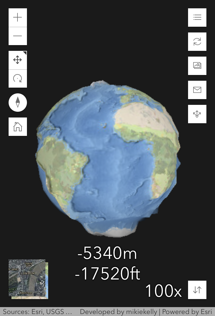
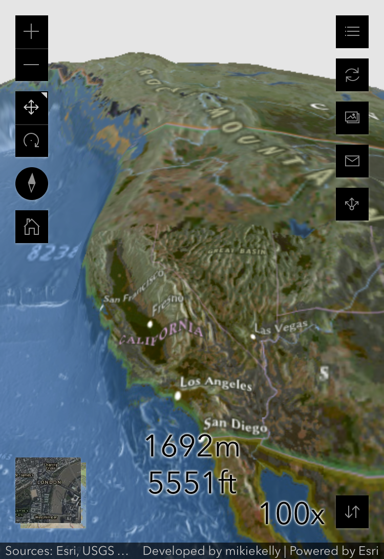
- Vertical Exaggeration
- Alter the vertical exaggeration of the elevations from 0 to 100 using a slider
- Basemap
- Toggle between Esri Imagery and National Geographic basemaps
Other Features
- Elevation
- As you pan the scene, view the elevation of the map center point in meters and feet
- URL Parameters
- x, y, z, wkid, heading, tilt, fov: These are updated as you browse the 3D Scene so you can bookmark areas of interest
- basemap: Updates as you toggle basemaps
- exaggeration: Stores the current vertical exaggeration
- Mobile Friendly
- Original screen resolution determines whether vertical exaggeration widget is expanded by default
Cool Living Atlas layers available through the app are listed below:
- Distance to Shore
- Distance to Coast
- TopoBathy Elevation Tinted Hillshade
- Temperature - Sea Surface
- Temperature - Sea Floor
- Temperature - Land - January Average
- Temperature - Land - July Average
- Population - 2016 Density Estimate
- Geomorphology - Sea Floor
- Earthquakes (Recent) - Shake Intensity
- Earthquakes (Recent) - Events by Magnitude
- Earthquakes (Major) - Historic Records
- Volcanic Eruptions (Significant) - Historic Records
- World Exclusive Economic Zone Boundaries
Suggestions and feedback welcome 
Here are some of screenshots of the app:
Via Desktop Browser:
Via Mobile Browser:
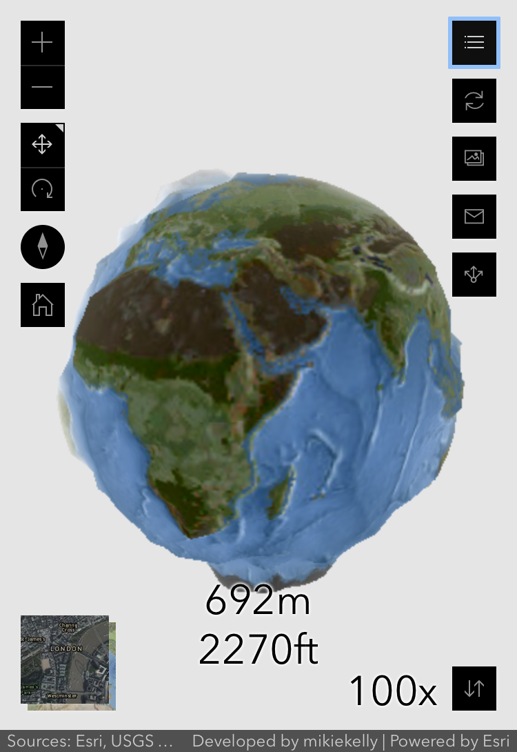
Photos downloaded through app widget:
.png)
.png)
.png)
.png)
.png)
.png)
Suggestions and feedback welcome 
You must be a registered user to add a comment. If you've already registered, sign in. Otherwise, register and sign in.