- Home
- :
- All Communities
- :
- Products
- :
- ArcGIS Explorer
- :
- ArcGIS Explorer Questions
- :
- Make tile package (.tpk) Visible at All Scales
- Subscribe to RSS Feed
- Mark Topic as New
- Mark Topic as Read
- Float this Topic for Current User
- Bookmark
- Subscribe
- Mute
- Printer Friendly Page
Make tile package (.tpk) Visible at All Scales
- Mark as New
- Bookmark
- Subscribe
- Mute
- Subscribe to RSS Feed
- Permalink
We are using a tile package as a base map for offline use inside the Explorer for ArcGIS.
If I create Map Tile Package for a high-resolution satellite image inside the ArcGIS Pro, it only allows me to see the image in between Minimum and Maximum level of detail. However, in order to reduce the file size for offline use on tablets, we only can create it at some maximum level around 16. But we also want to let field staff can see whatever image as background even they zoom the map beyond the Maximum level of details because it would be better than nothing.
After reading this 2014 blog post https://community.esri.com/people/palavido/blog/2014/07/18/creating-a-tile-cache-or-package-that-is-...Scales, I realized there are two ways to do that:
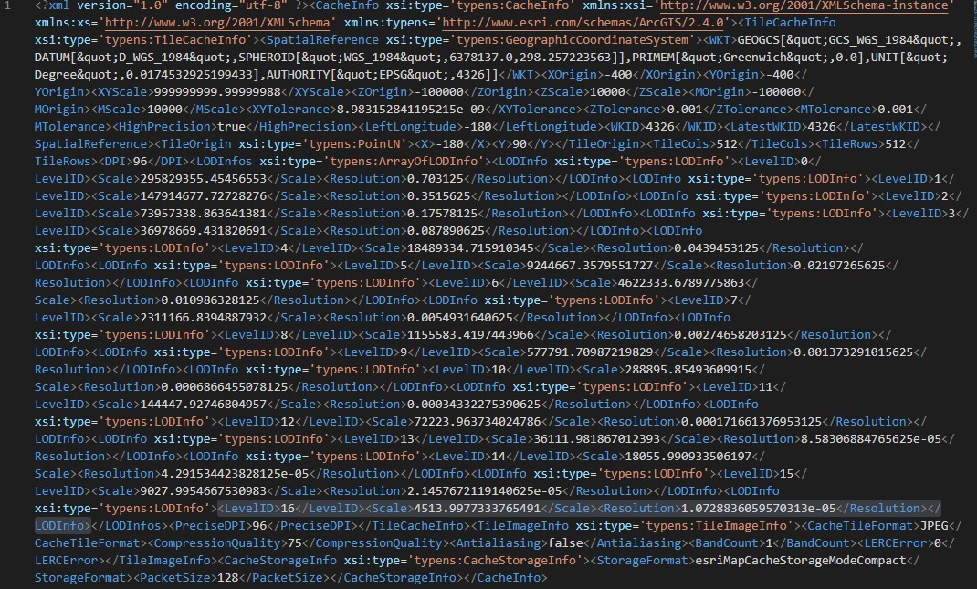
1. Unzipped .tpk file, edit the "conf.xml" under the "v101" folder. Instead of changing the scale value for the lower level, we just delete those un-necessary levels. For example, if you only create your tile package at a maximum level of 16, you just delete the other lower levels. Save the edit file and replace the original one in .tpk (see below image).
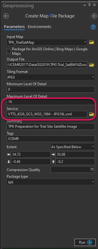
2. The other way is when you create a map tile package, prepare your service file only have the level you need, for example, level 16. I attached a service file example for jpg at level 16.
- Mark as New
- Bookmark
- Subscribe
- Mute
- Subscribe to RSS Feed
- Permalink
How to you zip the unzipped file back to a .tpk?
I have tried editing the conf.xml (deleting all unused scales) and using Export Tile Cache, using the unzipped .tpk, however when I load the output to AGOL the Item Description Settings tab stays stuck on "loading"