- Home
- :
- All Communities
- :
- Products
- :
- ArcGIS Enterprise
- :
- ArcGIS Enterprise Questions
- :
- Changing the coordinate system for published image...
- Subscribe to RSS Feed
- Mark Topic as New
- Mark Topic as Read
- Float this Topic for Current User
- Bookmark
- Subscribe
- Mute
- Printer Friendly Page
Changing the coordinate system for published image service.
- Mark as New
- Bookmark
- Subscribe
- Mute
- Subscribe to RSS Feed
- Permalink
- Report Inappropriate Content
Hi All,
I am wondering how can I change the coordinate system for published image service?
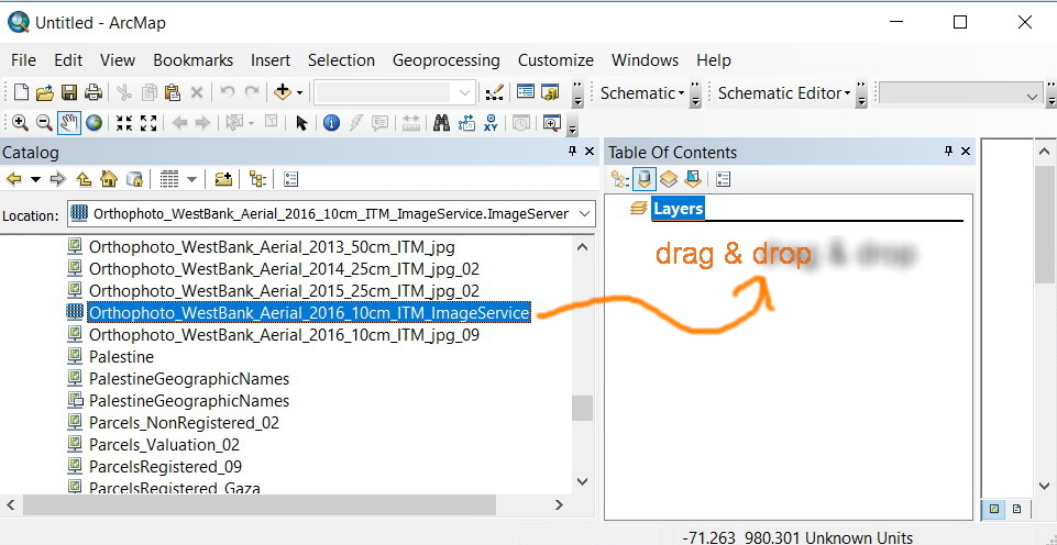
I read this service from public ArcGIS Server: http://geomolg.ps:6080/arcgis/services
However, when I drag & drop this service, this service took its original coordinate system.
How can I change the current coordinate system in my data-frame, so I can download study zone from this image service with wanted coordinate?
Kindly find the attached screenshots.


Thank you in Advance.
Fatin Rimawi
- Mark as New
- Bookmark
- Subscribe
- Mute
- Subscribe to RSS Feed
- Permalink
- Report Inappropriate Content
Open a blank map.
Define the coordinate system of the data frame.
Then add the image service to Table of Contents.
The map service will be transformed on-the-fly according to the coordinate system of the data frame.
Note: The coordinate system of the image service won't change in the above process.
Think Location
- Mark as New
- Bookmark
- Subscribe
- Mute
- Subscribe to RSS Feed
- Permalink
- Report Inappropriate Content
Hi Jayanta,
Thank you for your replay.
I am aware of transformation method.
My point here is changing the coordinate system of the image service itself.
What do you think?
Best,
Fatin