- Home
- :
- All Communities
- :
- Products
- :
- ArcGIS Enterprise
- :
- ArcGIS Enterprise Questions
- :
- Re: ArcGIS Server fails to show the Map services e...
- Subscribe to RSS Feed
- Mark Topic as New
- Mark Topic as Read
- Float this Topic for Current User
- Bookmark
- Subscribe
- Mute
- Printer Friendly Page
ArcGIS Server fails to show the Map services even though the server is working fine.
- Mark as New
- Bookmark
- Subscribe
- Mute
- Subscribe to RSS Feed
- Permalink
- Report Inappropriate Content
ArcGIS Server fails to show the Map services even though the server is working fine.
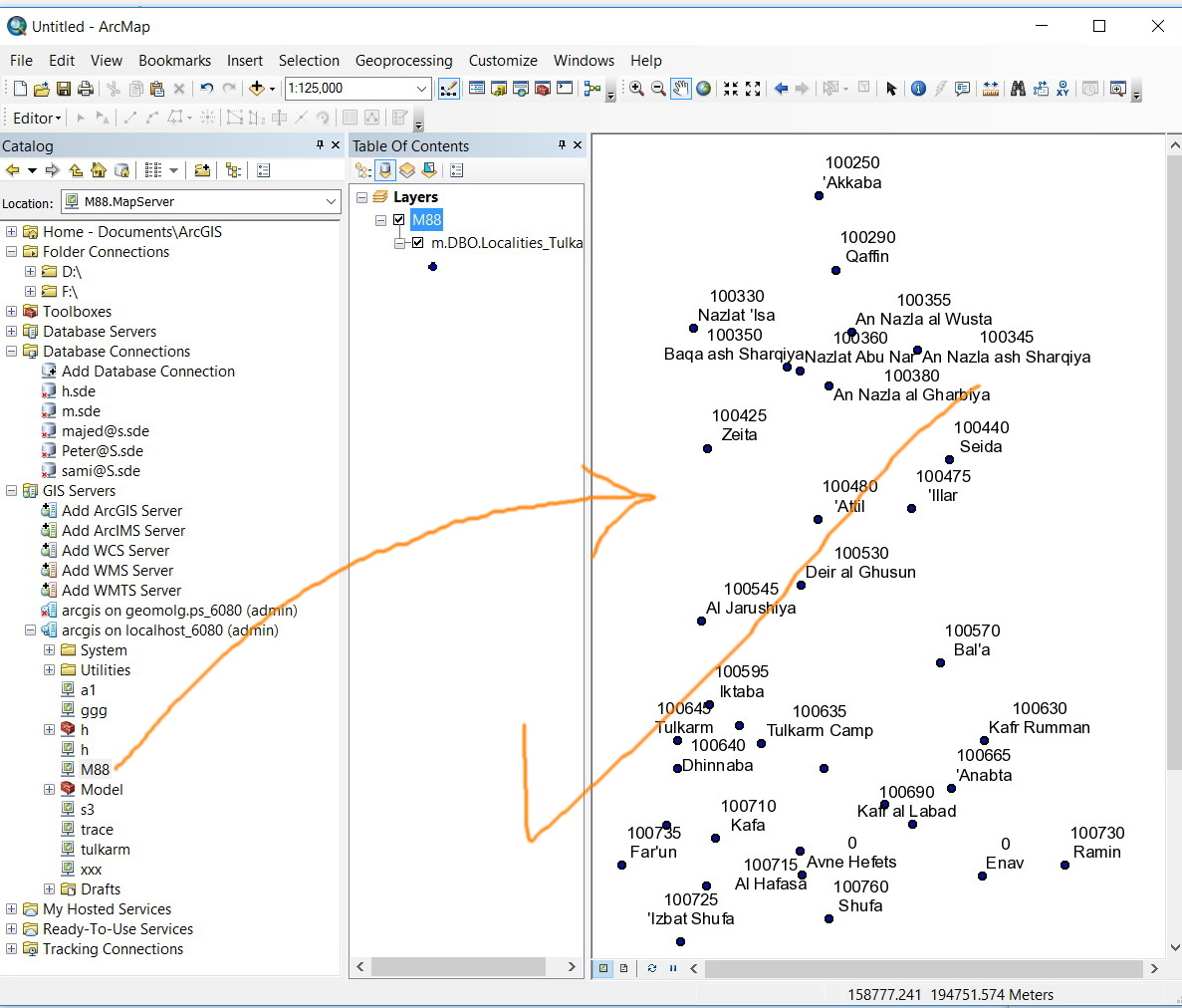
Despite the fact that the ArcGIS Server is working fine, it fails to show the map services when i try to view/consume it.
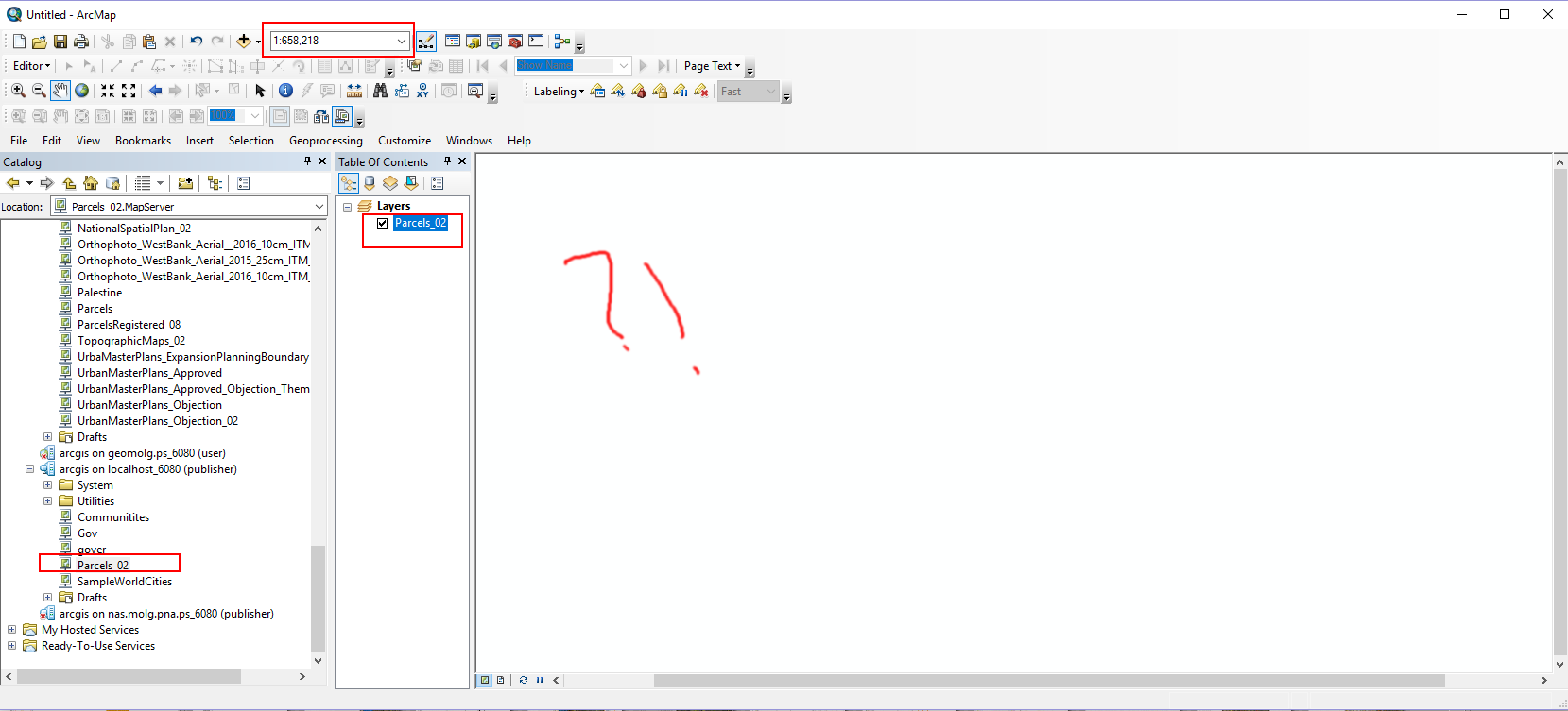
For example, I tried to publish map service “parcel_02” & when I try to consume this service it fails to appear. Attached
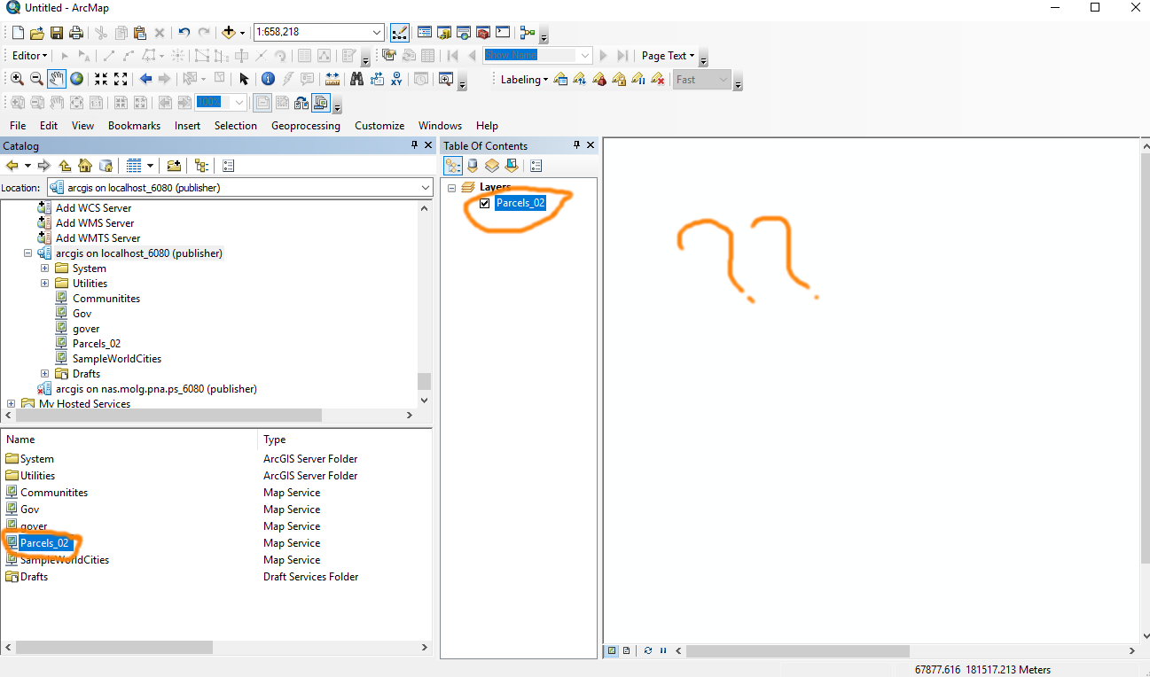
What might be the issue here?
I used ArcMap & ArcGIS Server 10.5
Best,
Rawan
- Mark as New
- Bookmark
- Subscribe
- Mute
- Subscribe to RSS Feed
- Permalink
- Report Inappropriate Content
I would first make sure that the data is visible in ArcMap at the same scales you can't see it in the service. If you can't see it, then that's an indication it's a spatial index issue. You can try to recreate the spatial index. You can also copy the data to create a new feature class or use the FC2FC tool, which would recreate the spatial index.
If you can see the data at all scales, then it's a problem with the Server, not the data. It's definitely not a permissions issue, as you wouldn't be able to see the data at all at any scale and the publishing process would tell you that the service couldn't come up as it couldn't find the data.
Definitely look at the logs under Verbose to analyze the different operations within the export map request. You should see data access, symbolizing, etc. There may be errors when trying to draw the data.
Also experiment with different data sources, similar to the suggestions in the first paragraph. If it's in SDE, export it to a FGDB feature class. If it's in an FGDB feature class, export it to a shapefile. Then, open a new map, add the data, and publish the service.
- Mark as New
- Bookmark
- Subscribe
- Mute
- Subscribe to RSS Feed
- Permalink
- Report Inappropriate Content
Dear Jonathan,
Thanks for your reply,
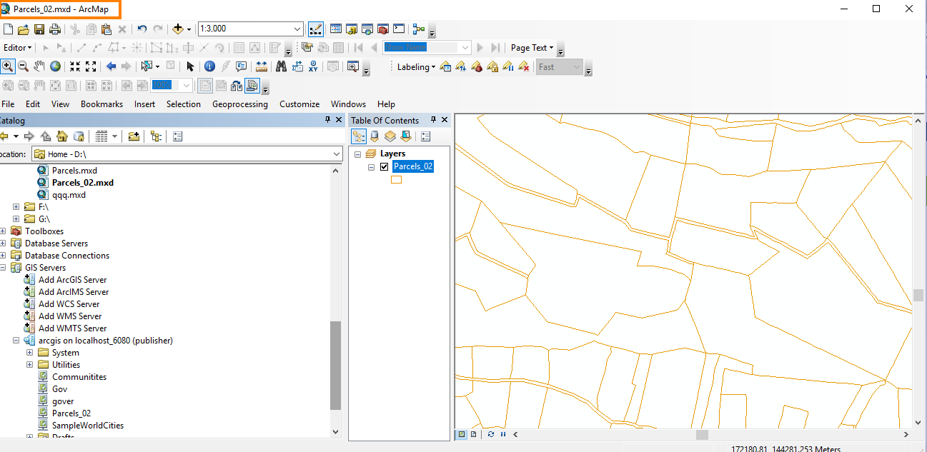
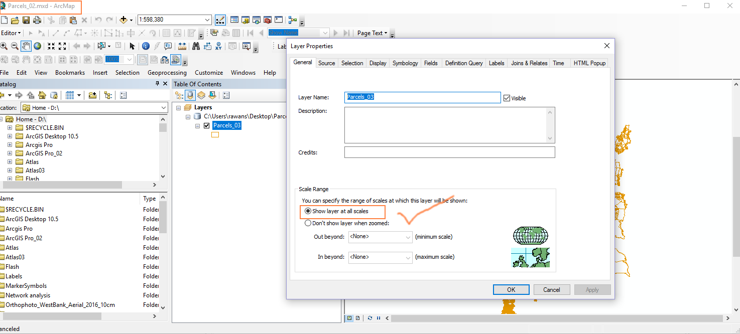
As you can see from below that the layer is appear at that scale when I open it from mxd while it fails to do so from service.
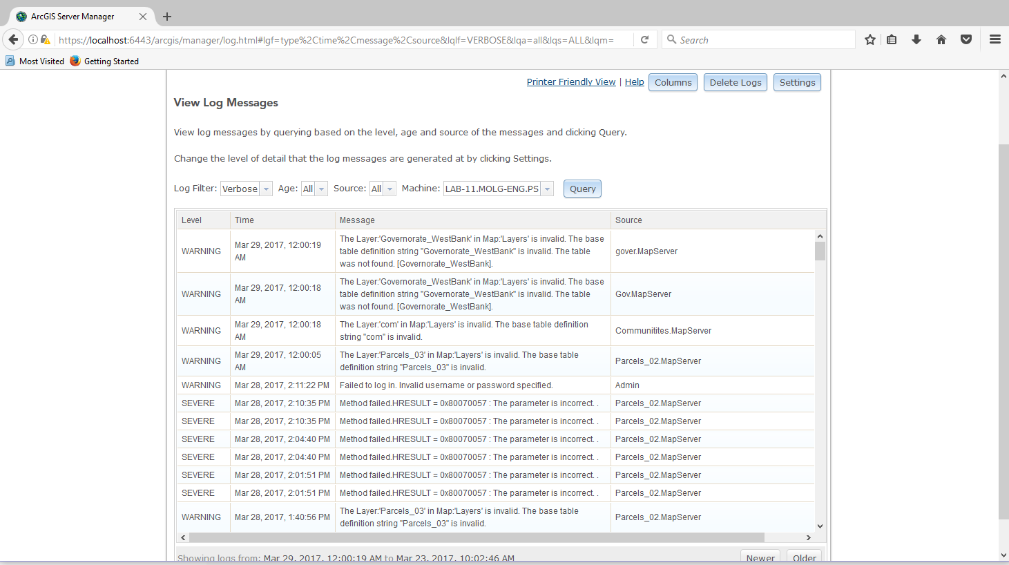
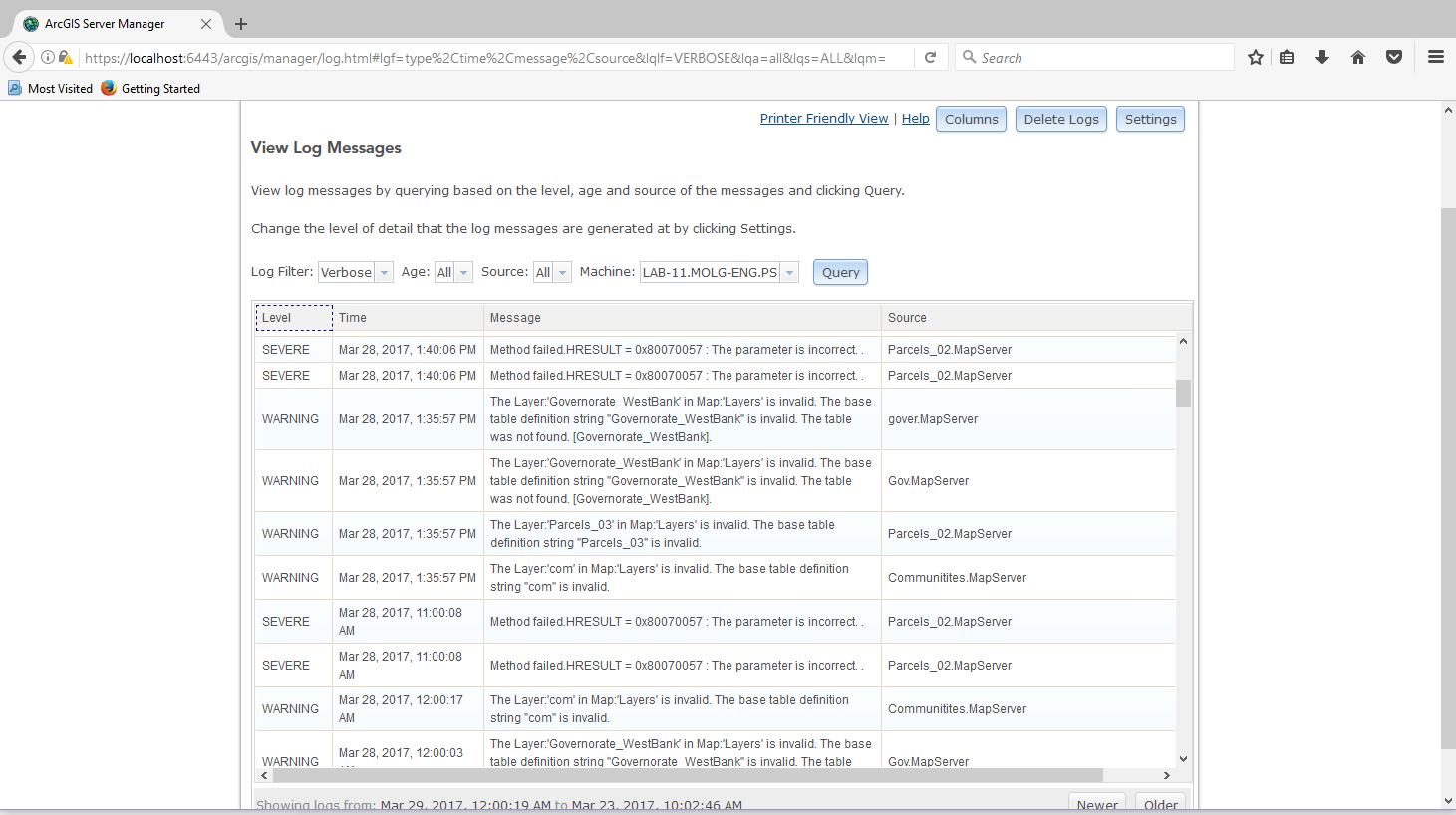
According to logs under verbose it keep showing this “Method failed.HRESULT = 0x80070057 : The parameter is incorrect. .” & “Method failed.HRESULT = 0x80070057 : The parameter is incorrect. .”. attached
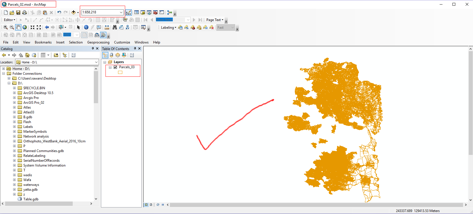
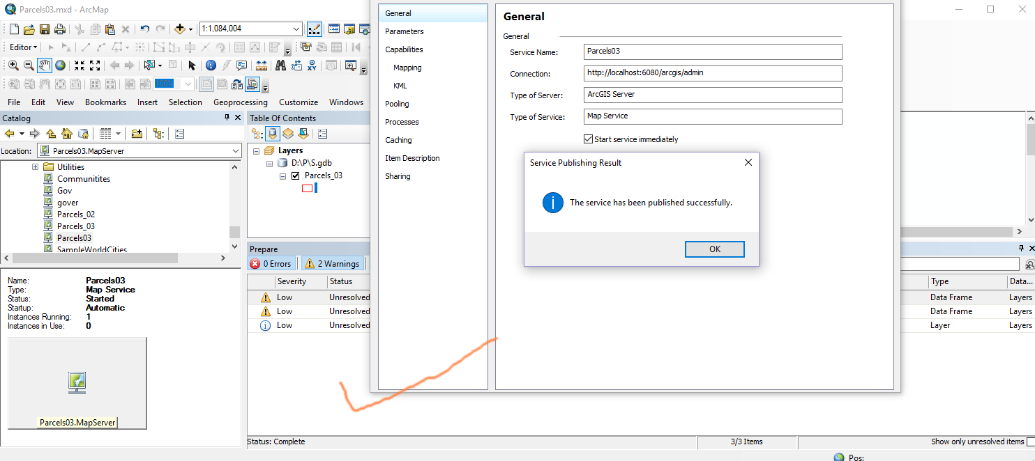
When I tried to export the data to another file geodatabase and publish it again it’s working fine.


Does that mean I should change all the data source and republish all my services to get them works fine?
One more thing in another machine I faced the same issue and the service is working fine suddenly today.
I think this is an unexpected behavior, I couldn’t catch the reason for this issue.
What do you think?
Best,
Rawan
- Mark as New
- Bookmark
- Subscribe
- Mute
- Subscribe to RSS Feed
- Permalink
- Report Inappropriate Content
You shouldn't need to republish the data. From your screenshot, you do have a lot of permission related problems given the "base table definition string is invalid" error. Are you using DB authentication or OS authentication to access your database? Those errors would cause the data to not display at all, instead of not displaying at certain scales. Does the layer name in the service match up with the errors in the logs about base table definition string being invalid?
- Mark as New
- Bookmark
- Subscribe
- Mute
- Subscribe to RSS Feed
- Permalink
- Report Inappropriate Content
Dear JQuinn,
Thanks for your reply, actually I read from file geodatabase with OS authentication.
As you can see from the logs that all services have the same warning “base table definition string is invalid" . I can’t believe that all my layers will have an invalid base table definition.

And kindly note that my services are working fine at beginning then stopped to work suddenly. Does that mean that when I made changes on my windows that will affect my services?
Best,
Rawan
- Mark as New
- Bookmark
- Subscribe
- Mute
- Subscribe to RSS Feed
- Permalink
- Report Inappropriate Content
And kindly note that my services are working fine at beginning then stopped to work suddenly. Does that mean that when I made changes on my windows that will affect my services?
I think this is the first you have mentioned that you made changes to your Windows. What kind of changes? To which machine? Server machine or client machine? "Changes" is a broad description and depending on what the changes were, yes I might effect it....
- Mark as New
- Bookmark
- Subscribe
- Mute
- Subscribe to RSS Feed
- Permalink
- Report Inappropriate Content
Hi All,
Actually I didn’t made any changes on my Local Machine/ server.
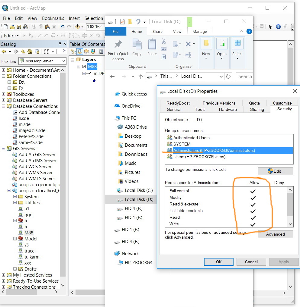
Anyway It’s working fine now after giving the Arcgis User Administrator privileges. See below


Thanks All for help.
Best,
Rawan
- Mark as New
- Bookmark
- Subscribe
- Mute
- Subscribe to RSS Feed
- Permalink
- Report Inappropriate Content
I don’t have the arcgis user in the admin group in my test machine, nevertheless, I’m able to drag\drop services without any issue. Then how this issue is related to permissions?

Jamal Numan
Geomolg Geoportal for Spatial Information
Ramallah, West Bank, Palestine
- Mark as New
- Bookmark
- Subscribe
- Mute
- Subscribe to RSS Feed
- Permalink
- Report Inappropriate Content
I wonder if the Admin group had more privileges on the directory storing the data. Once the user was part of the admin group, the account would then inherit those privileges.
- Mark as New
- Bookmark
- Subscribe
- Mute
- Subscribe to RSS Feed
- Permalink
- Report Inappropriate Content
These are the privileges for users and admins. Nothing looks special

Jamal Numan
Geomolg Geoportal for Spatial Information
Ramallah, West Bank, Palestine
- Mark as New
- Bookmark
- Subscribe
- Mute
- Subscribe to RSS Feed
- Permalink
- Report Inappropriate Content
Right, but this is in your environment, where you didn't see the problem to begin with?
On Rawan's machine, perhaps the local account did not have read access to the directory, or perhaps the Users group was also not granted read access to the directory, (which I think by default, local accounts are added to). The Administrators group may have already had at least read access to the directory. Either way, we can only speculate, as there isn't enough information to determine exactly why that fixed the problem.