Turn on suggestions
Auto-suggest helps you quickly narrow down your search results by suggesting possible matches as you type.
Cancel
- Home
- :
- All Communities
- :
- Products
- :
- ArcGIS Enterprise
- :
- ArcGIS Enterprise Portal Questions
- :
- Projections and Map Scale Bar Error with Base Maps
Options
- Subscribe to RSS Feed
- Mark Topic as New
- Mark Topic as Read
- Float this Topic for Current User
- Bookmark
- Subscribe
- Mute
- Printer Friendly Page
Projections and Map Scale Bar Error with Base Maps
Subscribe
2637
0
06-29-2012 01:32 PM
06-29-2012
01:32 PM
- Mark as New
- Bookmark
- Subscribe
- Mute
- Subscribe to RSS Feed
- Permalink
- Report Inappropriate Content
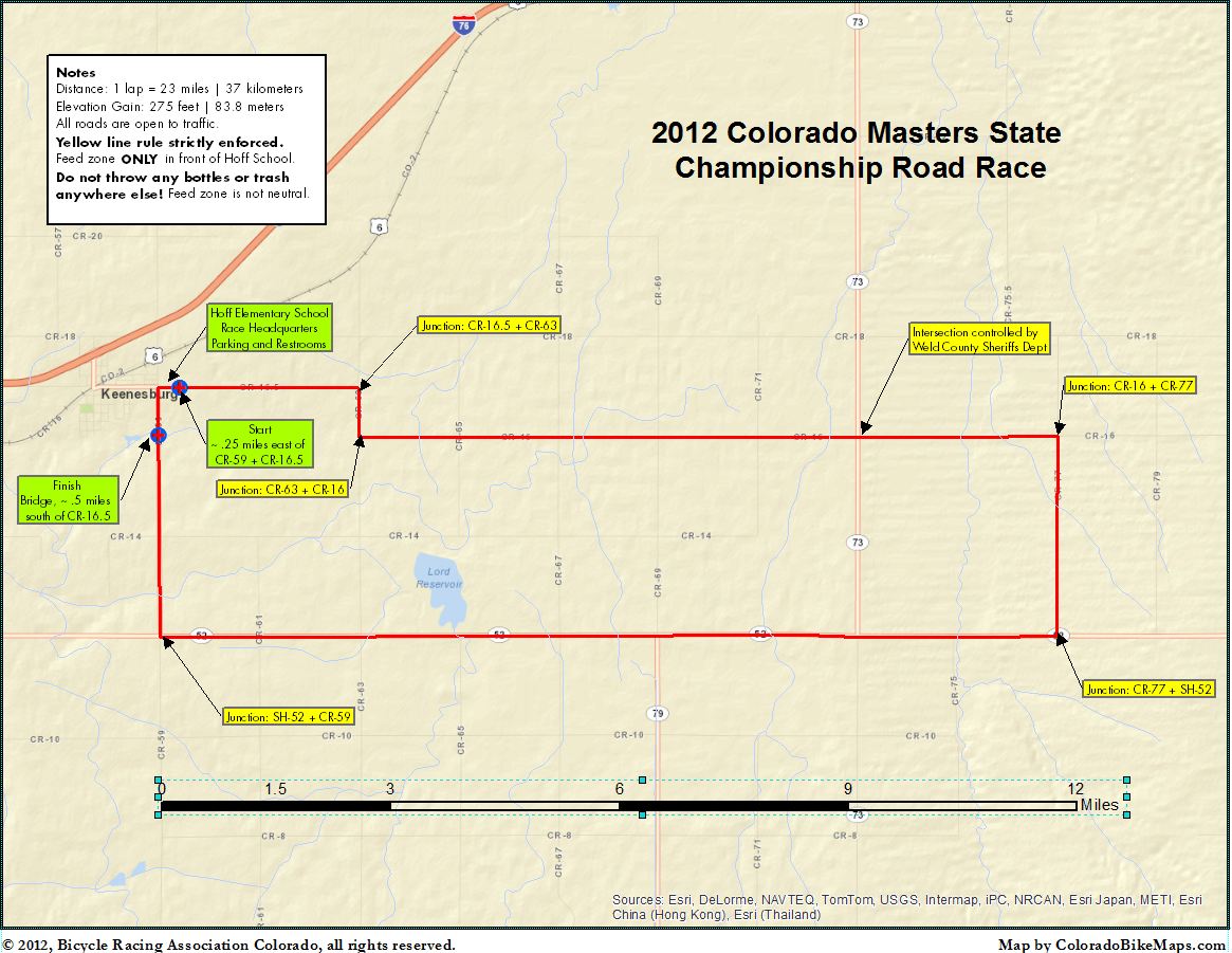
I created a polyline shapefile and projected it to UTM 13N NAD 83. It is roughly a rectangle. Using the measure tool and calculate geometry function, I get the same total distance, about 23 miles. That matches other sources. But when I add an ESRI base map such as World Street Map, I cannot insert a precise map scale bar. When I add the base map and then measure using the measure tool, the length of the feature is now 30 miles (planar) and 23 (geodesic). I'm sort of math challenged but understand that the coordinate system of the WSM layer is based upon a sphere, thus requiring geodesic instead of planar to be checked in the measuring tool. The calculate geometry function still returns the same 23 miles measurement. So far, sort of good.
But when I insert a map scale, it is seemingly based on the WSM base map layer and thus looks wrong. For example, a 9 mile leg of the rectangle will look, by comparison to the map scale, to be 12 miles long, more or less.
I am posting an example so you can see the problem: the east/west legs of the attached map are about 9 miles but read as if they were 12 miles according to the map.
What I'm wondering and asking for help on is whether there is a way to tweak the map scale bar setting so that it creates a scale bar in the same coordinate and measurement system as the underlying feature that's the heart of the map.
Thanks,
Jay
0 Replies