Turn on suggestions
Auto-suggest helps you quickly narrow down your search results by suggesting possible matches as you type.
Cancel
- Home
- :
- All Communities
- :
- Products
- :
- ArcGIS Enterprise
- :
- ArcGIS Enterprise Portal Questions
- :
- Displaying Multiple Polygons On Map With Shared Bo...
Options
- Subscribe to RSS Feed
- Mark Topic as New
- Mark Topic as Read
- Float this Topic for Current User
- Bookmark
- Subscribe
- Mute
- Printer Friendly Page
Displaying Multiple Polygons On Map With Shared Boundaries
Subscribe
1546
2
11-29-2013 10:54 AM
11-29-2013
10:54 AM
- Mark as New
- Bookmark
- Subscribe
- Mute
- Subscribe to RSS Feed
- Permalink
- Report Inappropriate Content
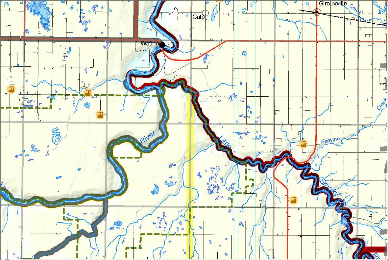
Just wondering if anyone might have any advice on how best to display multiple polygons with a shared boundary on a map. I've attached the map I am working on where you can see there are at least three polygons that share the river as a boundary and simply changing the outline width is starting to make the map look a little too busy. I have to admit I am definitely lacking on the cartography side of things since I spend most of my time doing analysis. Any sort of advice would be most appreciated!
[ATTACH=CONFIG]29471[/ATTACH]
[ATTACH=CONFIG]29471[/ATTACH]
2 Replies
11-29-2013
11:13 AM
- Mark as New
- Bookmark
- Subscribe
- Mute
- Subscribe to RSS Feed
- Permalink
- Report Inappropriate Content
Hi,
Some things I would do in your situation might be to give the polygon a fill but make it very transparent so it doesn't interfere too much with everything else that's going on. If that's not possible having thick but transparent boundaries may also decrease how distracting the boundaries are while still being visible. I would also consider making the other features in the map which are not the focus of the display much lighter and also more transparent so the most important data stands out best.
If you can, editing the boundaries so they don't fall in the middle of the river would look a little nicer and easier to see.
I'm definitely no expert but I hope I gave you a few ideas to play with!
12-04-2013
08:17 AM
- Mark as New
- Bookmark
- Subscribe
- Mute
- Subscribe to RSS Feed
- Permalink
- Report Inappropriate Content
Another option is tint bands.
See http://blogs.esri.com/esri/arcgis/2007/04/17/how-to-produce-tint-bands-for-boundaries/ and http://blogs.esri.com/esri/arcgis/2009/03/06/quick-tint-bands/
See http://blogs.esri.com/esri/arcgis/2007/04/17/how-to-produce-tint-bands-for-boundaries/ and http://blogs.esri.com/esri/arcgis/2009/03/06/quick-tint-bands/