- Home
- :
- All Communities
- :
- Products
- :
- ArcGIS Enterprise
- :
- ArcGIS Enterprise Documents
- :
- Utility Network Technical FAQ
- Subscribe to RSS Feed
- Mark as New
- Mark as Read
- Bookmark
- Subscribe
- Printer Friendly Page
- Report Inappropriate Content
Utility Network Technical FAQ
Utility Network Technical FAQ
The goal of this document is to keep a running, updated list of the common technical questions that users are asking related to Esri's utility network. Please feel free to post questions to the bottom of the blog post and we will work on incorporating these answers into the updated post.
There are already of wealth of resources available through the ArcGIS Pro help documentation and other sources. Please ensure your questions are not already answered on this site: What is a utility network?
- Can any device be choosen as a subnetwork controller?
- For a partitioned network, a device with directional terminals is required, for a hierarchical network, devices with directional or bi-directional terminals is required. The device requires the Subnetwork Controller Category and also be defined as a controller in the subnetwork definition.(revised 3/27/2019)
- Revision history:
- First Posted: 3/26/2019
- Revised: 3/27/2019
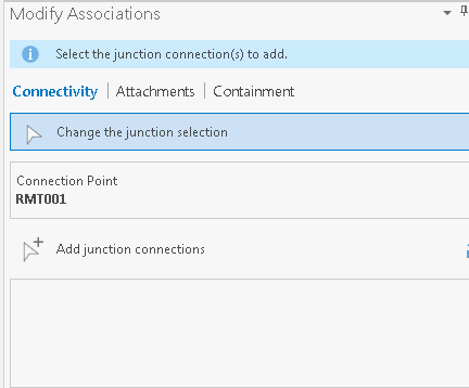
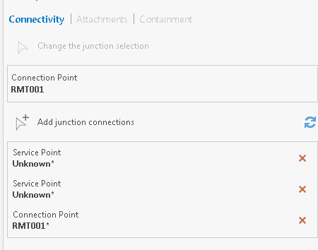
- Is there a way to create multiple connectivity associations at a time?
- Connectivity associations can be built into the migration framework using Data Interoperability or the FME workbenches. The Import Associations geoprocessing tool can be used to load associations in bulk from a CSV file after the network has been created and features loaded.
- Revision history:
- First Posted: 3/26/2019
- Revised: 3/27/2019
- Where are group and pre-set templates stored?
- These templates are stored in the map inside an ArcGIS Pro Project. The maps can be exported to Mapx and shared to other projects. At this time, there is no process to export the templates to a file themself.
- Revision history:
- First Posted: 3/26/2019
- Revised: 3/27/2019
- If I need to make an update to the 'service territory' feature, what do I do?
- You cannot expand the extent of an existing Utility Network. The easiest process is to export the Utility Network to an Asset Package. In the Asset Package, expand or adjust the extent. Create a brand new EGDB, stage a new Utility Network and apply the asset package. Then republish your services. If you use the same name or overwrite your services, this should not affect any downstream maps.
- Note: This will not bring any versioning information or history, so that information will be lost.
- Revision history:
- First Posted: 3/26/2019
- Revised: 3/27/2019
- What domain values should be used? Should everything use unique domain codes?
- As a field may be used for different values across the asset group, it is best practice to not use the same code for different descriptions.
- Example:
- Layer: Water Network Device
- Asset Groups: Valve and Hydrant:
- Valid values for Valves
- 1: Open
- 2: Closed
- Valid values for Hydrants
- 3: In Service
- 4: Out of Service
- We could use the same code, of 1 for hydrants and use the description of In Service, but when we run a query or perform a trace and are looking to stop of open Valves, we would have to add a second part to that configure to ensure we are stopping at open valve and not open hydrants. By ensure codes are unique, we can ensure we are only stopping or returning open devices, not other devices that happen to share the same code, but the descirption is completely different.
- Example:
- Revision history:
- First Posted: 3/26/2019
- Revised: 3/27/2019
- As a field may be used for different values across the asset group, it is best practice to not use the same code for different descriptions.
- I would like to support the utility network in my application, how should I interact with the layers.
- You will need to be able to interact with services. Your software will interact with either a Feature Service(for read and write) or layers in a Map Service(Read only).
- We recommend you support a web map as the interface into those services. The industry solution templates ship with a Network Viewer. This network viewer is very similar and look and feel to the Editor maps we provide. The difference is it is not using Subtype layers. For each subtype in a subtype layer, a web map layer is used with an definition expression by subtype.
- If you cannot use a web map and need to interact with a service, in the Utility Network solution template includes a simple network publishing map. This map replaces the subtype layers with group layers with definition expressions per layer. This is designed for a Map Service and cannot be published as a Feature Service. You software can interact with the individual layers of this service, similar to the layers in a Feature Service.
- If you want to use the Utility Network feature service, you will have to take advantage of the Query Data Elements capabilities of the feature service to interact with the schema of that data
- Revision history:
- First Posted: 3/26/2019
- Is there any way to validate the schema of the Asset Package without having to create an EGDB and apply it?
- We shared a simple pyt to help you validate the Asset Package, available here:
- Revision history:
- Moved from parking lot: 3/26/2019
- Parking Lot: Please ask your questions in the comments and we will add them here and work on answers
- Can I change an Asset Group in the utility network?
- Can I change an Asset Type in the utility network?
- Can I add or remove fields in the utility network?
- How do you(Esri) design and develop the models? Do you work in the asset package, do you work in scripts, do you work in the utility network?
- If I add an asset group in the Asset Package, what are my steps to ensure the schema is valid?
- Mark as Read
- Mark as New
- Bookmark
- Permalink
- Report Inappropriate Content
Brian,
I have a few questions about your question/answer above
- Where are group and pre-set templates stored? (3/15/2019)
- You mentioned templates can be saved within project file. To me this implies there are other places where this can be saved. What are these other places where these can be saved?
- If I need to make an update to the 'service territory' feature, what do I do? (3/15/2019)
- Can you please expand on this answer. Do you have to rebuilt the EGDB first, or just apply the modified asset package over the top of the previous implementation? I'm trying to gauge the overall effort required to determine do I just substantively oversize the territory polygon upfront
- Can you change the features classes or layer names? (3/15/2019)
- Asset types can be added, but the best practice is to add a new asset group - Can you please expand this in further details as I don't understand if a new asset type for a given asset group is to be added, how do you perform the best practice of adding it to a new asset group?
Thanks for any feedback
- Mark as Read
- Mark as New
- Bookmark
- Permalink
- Report Inappropriate Content
Brian, looking for a bit more understanding on some of these.
Is there a way to create multiple connectivity associations at a time?
- Connectivity associations can be built into the migration framework using Data Interoperability or the FME workbenches, but there is no GP tool. (3/15/2019)
What about in pro itself. A user can select a structure (for associations) or junction (for connectivity) then do a group selection for the connections. I can understand not being able to update multiple locations at once.
What domain values should be used? Should everything use unique domain codes? (3/15/2019)
- For each feature class, you should use the same code for identical values (ex. 'unknown') for all asset types in the asset group.
Make the asset codes unique through all asset groups
Not sure i understand what you mean here. So the asset code can be shared across the different asset groups but not within the asset group. Are there any risks with sharing these values across asset groups? Does this imply it is the same feature?
- Mark as Read
- Mark as New
- Bookmark
- Permalink
- Report Inappropriate Content
The asset package will not modify your service territory. If you want to resize, you would need to recreate your utility network
- Mark as Read
- Mark as New
- Bookmark
- Permalink
- Report Inappropriate Content
Paul what is the point of the service territory?
And if you need to do a rebuild (effort to be defined - entire EGDB or just asset package over previous build) why wouldn't a utility build a service territory significantly larger than their current operating area to future proof their stand up?
- Mark as Read
- Mark as New
- Bookmark
- Permalink
- Report Inappropriate Content
Hi Damien, (in case you missed it) - Larry updated the FAQ with answers to your first question. As you mentioned, you could update the associations using our modify associations pane, or you could use 'Import Associations geoprocessing tool' to load associations in bulk from a CSV file after the network has been created and features loaded.
Regarding your question on Domain values - http://solutions.arcgis.com/electric/help/electric-utility-network-configuration/DataDictionary/Data... document will give you a list of domain values that are reserved for ESRI in UN (scroll to the end of the list to find domain values used in UN). You can find there that the domain values are the same for all 'unknown' values (which is 0), while the codes are unique for other domain values.
- Mark as Read
- Mark as New
- Bookmark
- Permalink
- Report Inappropriate Content
I removed the last question and broke it down into multiple parts. I added it to the parking lot and we will work on getting them answered.
- Mark as Read
- Mark as New
- Bookmark
- Permalink
- Report Inappropriate Content
Hi,
GlobalID field appears to be zero in the Service Territory layer. What is the reason of this?
Thanks for any feedback

- Mark as Read
- Mark as New
- Bookmark
- Permalink
- Report Inappropriate Content
Hello,
I was wondering if anyone has encountered the error while tracing that interacts with multiple subnetwork controllers?
"ERROR 001890: Invalid subnetwork connectivity, multiple subnetwork controllers with different subnetwork names found."
I have an area that includes a loop where there are two separate source circuit breakers (the subnetwork controllers located within a substation) that make up each side of the loop. The loop is connected with a series of switchgears and when performing tracing I receive the error listed above.
The only solution I have found that works is breaking the associations between certain features, however, this seems to be counter productive as these features are in fact connected. Having certain switches set to "Open" does not seem to work either when performing the tracing.
Hoping someone might have some insight into this issue.
Cheers,
Dave
- Mark as Read
- Mark as New
- Bookmark
- Permalink
- Report Inappropriate Content
I'm having an issue when attempting to upgrade a Electric UN to v4. Using Pro 2.6.3 and 'Update Dataset'. I've checked all features participating and none have any records with empty geometries. Getting this response:
ERROR 999999: Something unexpected caused the tool to fail. Contact Esri Technical Support (http://esriurl.com/support) to Report a Bug, and refer to the error help for potential solutions or workarounds.
The operation was attempted on an empty geometry.
Failed to execute (UpgradeDataset).
- Mark as Read
- Mark as New
- Bookmark
- Permalink
- Report Inappropriate Content
- Mark as Read
- Mark as New
- Bookmark
- Permalink
- Report Inappropriate Content
Hi @contuber
Basically I have been doing a slight work around. I am able to trace and include open switches in the trace so the trace will terminate at the open switch as it should (without removing the association between the features to stop the trace). So, performing traces on already updated Subnetworks works fine. The issue comes back once I use the "Update Subnetwork" tool.
Lets say a switch in this situation is set to be OPEN and there is still an association that is connecting one Subnetwork to another via that switch, running "Update Subnetwork" will fail because that tool does not take into account the status of a device (the OPEN switch). Maybe I am wrong but it seems like it is updating all connected features within that subnetwork and if there is another subnetwork in the mix and connected in this manner it tries to update those features as well. So, I have been removing the association if elements have been added to either subnetwork prior to running "Update Subnetwork".
- Mark as Read
- Mark as New
- Bookmark
- Permalink
- Report Inappropriate Content
Would be possible to establis relationships between entities belonging to 2 different UN domains?
Some organisations have implemented GIS and CAD systems to manage different scales of representation of the same network.
When considering the migration of these two systems to the UN model if it is mandatory to keep the two different representation, would it be possible to implement tow separated but related domains. The infrastructure data with be shared with relationships to both representations.
Would this technically be possible?
Would it be better to implement this double representation and geometries between different domains, tiers or through the specialisation of Asset groups or types?
The resulting representation of the same physical reality should be associated with n-m relationships.
Thanks in advance.
- Mark as Read
- Mark as New
- Bookmark
- Permalink
- Report Inappropriate Content
Hello,
I've added an Immediate Attribute Rule that execute a calculation if the subnetworkname field of a structure junction layer change, but the only way two update the subnetworname field is when the Update subnetwork geoprossesing runs, unfortunately I realized that the geoproseesing doesn´t trigger any update event that the Attribute rule can catch, anybody knows how an Immediate Attribute Rule can catch the event of change the value of subnetworname field
- Mark as Read
- Mark as New
- Bookmark
- Permalink
- Report Inappropriate Content
Is it possible to convert the layers from the example (foundations) APRX that symbolize as unique values by Asset Group to a Subtype Group Layer? I'd like to be able to take advantage of the control the subtype group layer offers but get the default symbology.
Alternatively, can the symbology be imported? Also, where are the symbols actually located? i.e. is it a font?