- Home
- :
- All Communities
- :
- Products
- :
- ArcGIS Collector
- :
- ArcGIS Collector Questions
- :
- Re: Offline Map Areas - Collector
- Subscribe to RSS Feed
- Mark Topic as New
- Mark Topic as Read
- Float this Topic for Current User
- Bookmark
- Subscribe
- Mute
- Printer Friendly Page
Offline Map Areas - Collector
- Mark as New
- Bookmark
- Subscribe
- Mute
- Subscribe to RSS Feed
- Permalink
- Report Inappropriate Content
Hello,
I am trying to download two areas for offline use in the new Collector (formally known as Aurora), I have two question regarding this topic.
1. How can I have offline areas downloaded to my device and still use the enter map if I have service and choose to. For example, an Inspector is out in the field visiting a location that was downloaded to the device for use offline, after collecting the inspector moves onto a new location, how can that inspector access the entire map on collector even when there are offline areas downloaded?
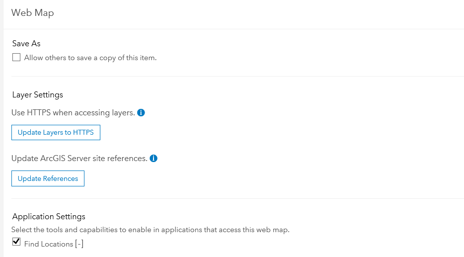
2. On AGOL on my computer, in the settings tab for my map used in Collector, In the Offline tab there is a section labeled "Map Areas" the description says that this is where you can create offline areas on the computer and these areas will be pushed out to the devices using the map. I have created two areas and waited all night for them to "package". I come to work this morning and open collector on my iPad only to find the two areas are still "generating" on my device. My question is, does this feature actually work? Has anyone else been able to use it?
Thanks
- Mark as New
- Bookmark
- Subscribe
- Mute
- Subscribe to RSS Feed
- Permalink
- Report Inappropriate Content
Additionally, when I view the settings for the Map Area I specified, I do not see the streets map listed anywhere - it only displays my map layers and the Hybrid Imagery: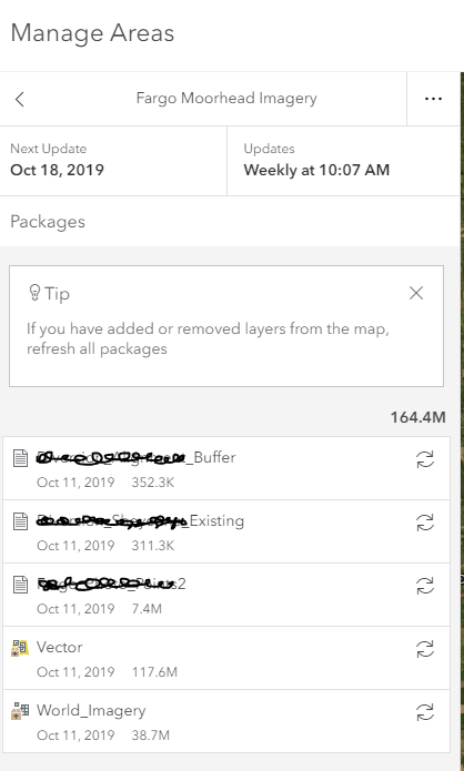
- Mark as New
- Bookmark
- Subscribe
- Mute
- Subscribe to RSS Feed
- Permalink
- Report Inappropriate Content
I tried taking an area of your map offline on my iPhone with Collector 19.1.0 and it downloaded successful, but it also shows the streets.
I made a copy of the map, and when using that map without downloading it (but using it connected) I do see the imagery. I downloaded a map area (on my device, not defining it through ArcGIS Online) and then I see the streets.
I also reproduced this in another map using the Imagery Hybrid basemap in the default basemaps group of ArcGIS Online, so my feeling now is that it is tied to that basemap. Let me dig in a bit and get back to you.
- Mark as New
- Bookmark
- Subscribe
- Mute
- Subscribe to RSS Feed
- Permalink
- Report Inappropriate Content
Kylie Donia - thanks so much for your testing and assistance with this. When you downloaded the map on your iPhone, did you successfully download the features too or just the streets basemap?
Thank you!
Jacquie
- Mark as New
- Bookmark
- Subscribe
- Mute
- Subscribe to RSS Feed
- Permalink
- Report Inappropriate Content
Hi Jacquie -- I'm seeing that the features were downloaded, but as they are displayed under the streets, it's hard to tell. I tapped at the location where I knew one was, and then I did see the details for it. So it is there.
I've logged this as an issue.
- Mark as New
- Bookmark
- Subscribe
- Mute
- Subscribe to RSS Feed
- Permalink
- Report Inappropriate Content
Hi Kylie Donia,
Thanks for all your testing on this. I'm glad you logged it as an issue - hopefully the development team can implement a fix for it.
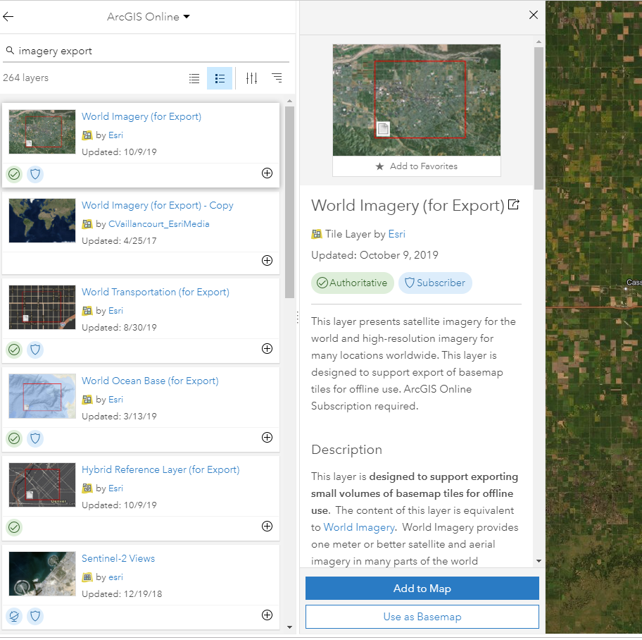
I wanted to share a tip I received from Esri support today, in case anyone else runs into this issue. A workaround is to replace the standard Imagery or Hybrid Imagery basemap with the "World Imagery (for Export)" and "Hybrid Reference Layer (for Export)" from ArcGIS Online. Apparently these export-specific layers have been optimized for offline use. I had no idea they even existed, but was able to replace my imagery basemap with them and successfully take my map offline.
Best,
Jacquie
- Mark as New
- Bookmark
- Subscribe
- Mute
- Subscribe to RSS Feed
- Permalink
- Report Inappropriate Content
I'm glad you have a workaround. I just want to mention here that while it will work, the workaround should be considered temporary as those layers aren't designed for referencing directly. The regular basemap should work, and will once we fix this issue 
- Mark as New
- Bookmark
- Subscribe
- Mute
- Subscribe to RSS Feed
- Permalink
- Report Inappropriate Content
Kylie, I have been reviewing all the posts about this issue. I similarly have been preparing staff for using the new Collector to begin implementation December 1 and all of a sudden I have "offline areas" when connected to wifi. We all use iPhone 7s currently. I also do not see the offline tab in my web map settings so I cannot even try to download areas to see if this will work. Many of my hosted feature layers have subtypes but only one date field. Until 2 weeks ago, this was all working great in the office and in the field. #kylie donia
Office of Conservation Planning
- Mark as New
- Bookmark
- Subscribe
- Mute
- Subscribe to RSS Feed
- Permalink
- Report Inappropriate Content
Thank you Jacquie for this most helpful tip!!
Office of Conservation Planning
- Mark as New
- Bookmark
- Subscribe
- Mute
- Subscribe to RSS Feed
- Permalink
- Report Inappropriate Content
Sorry, group name is "Test Esri".
- Mark as New
- Bookmark
- Subscribe
- Mute
- Subscribe to RSS Feed
- Permalink
- Report Inappropriate Content
Thanks! I'll take a look. Map is "Fargo Moorhead - Alignment", correct?