- Home
- :
- All Communities
- :
- Products
- :
- ArcGIS Collector
- :
- ArcGIS Collector Ideas
- :
- Collector - Geotag attached photos
- Subscribe to RSS Feed
- Mark as New
- Mark as Read
- Bookmark
- Follow this Idea
- Printer Friendly Page
- Report Inappropriate Content
Collector - Geotag attached photos
- Mark as New
- Bookmark
- Subscribe
- Mute
- Subscribe to RSS Feed
- Permalink
- Report Inappropriate Content
It would be useful to have the geotag data in addition to the location from the feature photos are attached to. I collect many linear feautures, for example, and it is useful to know where along the line a photo was recorded. Geotagging also records the direction the camera was facing, another useful datapoint.
- « Previous
-
- 1
- 2
- Next »
- Mark as Read
- Mark as New
- Bookmark
- Permalink
- Report Inappropriate Content
We also ran into this problem when taking thousands of photos of storm drain structures and pipes.
We sometimes needed to know the direction the picture was taken and the date and time on the photo name.
We used a DROPBOX APP on the IOS iPAD which was set to sync the pictures to dropbox whenever we had WIFI. The pictures were taken at the site (with Location info on) and the dropbox would load pictures to a shared folder back in the office (we could see pictures come in-in realtime from the field when WIFI was available (read McDonalds lunch).
We would then copy into a network folder (The dropbox app renames the picture from standard IOS picture IMAGE# name to standardized date & time name (i.e. - 2017-01-12 09.51.18.jpg). This latter name allows dropbox to keep track of what pictures have already been synced, even from multiple iPADS accessing the same dropbox (very rarely are two pictures taken at the SAME second). We then use the Photos 2 Points tool in the ESRI ArcMAP toolbox to dreate a photo layer or multiple photo layers that contain ALL the EXIF info including the direction which can be map to a field in a Chevron Symbol to point the direction the photo was taken. the photo then come in close to the collected point but showing how in relation to the point /Structure they were taken
- Mark as Read
- Mark as New
- Bookmark
- Permalink
- Report Inappropriate Content
Photos to Points is another tool that will read all the EXIF info, create a point and rotate a symbol based on the bearing, and capture all of the other related data like date/time, etc.
A side note on the rotations, they are pretty valuable. But they do need to be verified by the picture taker after you get them on a map. We have seen many occasions where the rotation shown is bogus. Sometimes, I am sure, the picture taker is too quick to snap the photo before the direction settles out. Also we know that different cameras have a different basis of rotation. Some are 0° being due North and some being 0° being due East. So mixed photos on a project require adjusting the rotation values to all be on the same basis.
Thanks for sharing, Steve.
- Mark as Read
- Mark as New
- Bookmark
- Permalink
- Report Inappropriate Content
Have you guys looked into the Survey123 application and the use of Photo EXIF data capabilities?
BOOOOOMMMMMMMMM!!!!!!!!!! Yeah my mind went nuts when this blog was released. No it is not Collector, but it does get you what you want in most cases...
- Mark as Read
- Mark as New
- Bookmark
- Permalink
- Report Inappropriate Content
Currently Collector does not offer this function. I have used the Theodolite app and another one called Solocator.
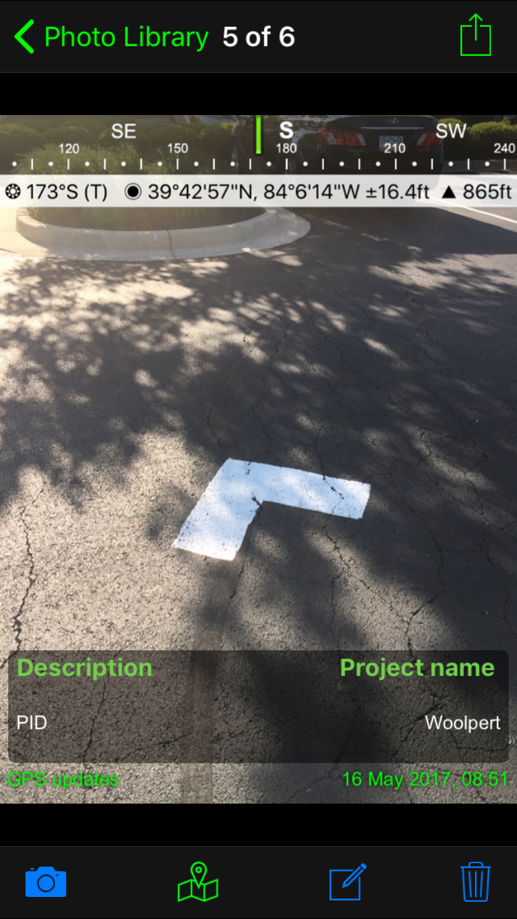
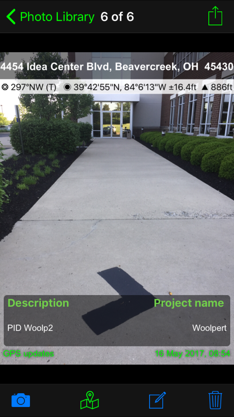
I lean more towards using Solocator I like how GPS data is displayed and can include project information on the photo.
I then use these photos taken with other Geotaging/ GeoStamping app and add them into Collector through attachments. This process gets the photos and GPS information I want but its not an efficient process. Collecting hundreds of points and multiple photos for each one is very time consuming when you have to swap back and forth between apps. It has also been my experience with a cell phone of tablet, when your using Collector it runs down the battery the more apps you have running.
- Mark as Read
- Mark as New
- Bookmark
- Permalink
- Report Inappropriate Content
Sometimes you are taking photos only. Then are a variety of ways that have been mentioned where you end up with a geo-smart point shapefile, with hyperlinks to open the actual photo using the Identify tool. Even publish to an ArcGIS Online map for web consumption.
But if you are also using Collector to set field points and attaching other attributes from the field before submitting, then it is a pretty big deal to add the photo from the mobile device and have that already permanently attached to the correct point, when, like you say, you are doing hundreds of points. No adding attachments later. I do not take the photo directly from Collector because 1) power consumption you mention and 2) it will NOT be stored in your iOS device camera roll. So you can't do a direct photo download from the camera, if you wanted to. Photos have to be retrieved from the SDE server probably.
We could use some of the better photo functionality in some of these other apps, maybe ESRI jump it up. WE are definitely "app swamped" for sure..
- Mark as Read
- Mark as New
- Bookmark
- Permalink
- Report Inappropriate Content
Indeed, it would be good to add EXIF to Collector.
- Mark as Read
- Mark as New
- Bookmark
- Permalink
- Report Inappropriate Content
In addition to header info, the ability to name files based on fields and to watermark fields on images (like GeoJot) would also improve workflows significantly.
- Mark as Read
- Mark as New
- Bookmark
- Permalink
- Report Inappropriate Content
The watermark function in GeoJot is awesome. We have a lot of users that prefer to use GeoJot over Collector just for that reason. They also like having the photo direction shapefile created and the PDF report. The issue is that GeoJot requires post-processing on our end to make all that happen and then it is also time-consuming to load the shapefile into feature classes with related photo attachments. As a result users have to wait to see their collected data on web maps or dashboards.
- Mark as Read
- Mark as New
- Bookmark
- Permalink
- Report Inappropriate Content
This is from 2014. FIVE (5) years ago. Has this been done on Collector? Does this feature exist on any other ESRI mobile apps?
- Mark as Read
- Mark as New
- Bookmark
- Permalink
- Report Inappropriate Content
Hi michael.barber@rrc.texas.gov ,
It can be done with Survey123. See: https://community.esri.com/groups/survey123/blog/2017/12/12/working-with-exif-image-metadata-in-surv...
You must be a registered user to add a comment. If you've already registered, sign in. Otherwise, register and sign in.