- Home
- :
- All Communities
- :
- Products
- :
- ArcGIS Collector
- :
- ArcGIS Collector Blog
- :
- Collector - The Aurora Project
Collector - The Aurora Project
- Subscribe to RSS Feed
- Mark as New
- Mark as Read
- Bookmark
- Subscribe
- Printer Friendly Page
- Report Inappropriate Content
Update: Collector's Aurora Beta is available. Already have it? Join the discussion in our Early Adopter Community.
Collector for ArcGIS launched in the Apple App Store and Google Play in January 2013, followed by the Windows Store in December 2015. Since its initial release Collector has evolved considerably, and as its capabilities have grown, so has its adoption and we are very thankful for your support.
Now the time has come for a refresh. A refresh in user experience, a refresh in technology, a refresh in field data collection workflows. So… here comes the Aurora Project.
Through the Aurora project, Collector is getting a number of improvements you have requested:
- Better maps
- Improved user experience
- Smarter forms
- Streamlined offline workflows
- Enhancements to high accuracy 3D data collection
Most importantly, the Aurora Project brings a new foundation we will build upon to advance data collection workflows in the ArcGIS platform. Let’s take a deeper look at some of these improvements:
Better maps
Collector is adding support for vector basemaps (both online and offline), so that you can view crisp, high quality cartography that takes advantage of the amazing pixel density of your iPad Pro or Samsung S8+ device. Downloading vector tiles to your device will dramatically reduce the footprint of offline content on your device as well.
Rich symbology and smart mapping capabilities you rely on to effectively represent your spatial information and publish using ArcGIS Pro will look great in Collector. In addition, it will support displaying labels in your map, the top idea you’ve asked for in Collector.
With these improved mapping capabilities, your maps will look great rotated, too!
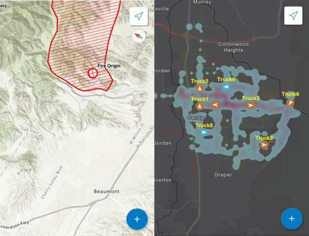
FIMT symbology, Labeling and Heat Maps
Improved user experience
Significant improvements to the user experience (UX) of Collector are coming and you will see this in the very first beta release. We have spent time redesigning the collect experience so that we can streamline workflows. Some improvements include:
- Better layout to support your workflows – Core tools like Collect are more accessible to promote the scenarios you use every day.
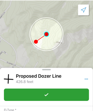
- Easier capture of accurate data locations – use cross hairs that provide a “cursor-on-target” experience to precisely define location.
- Better use of screen real estate - let’s face it, working on a phone often leaves you wanting a bit more screen real estate. Sometimes you want to see the map, sometimes you want to see the form, sometimes you want to see a bit of both. With our new sliding panel design, move between these views seamlessly by sliding the panel up or down to seamlessly move between map-centric and form-centric views to fit your workflow.
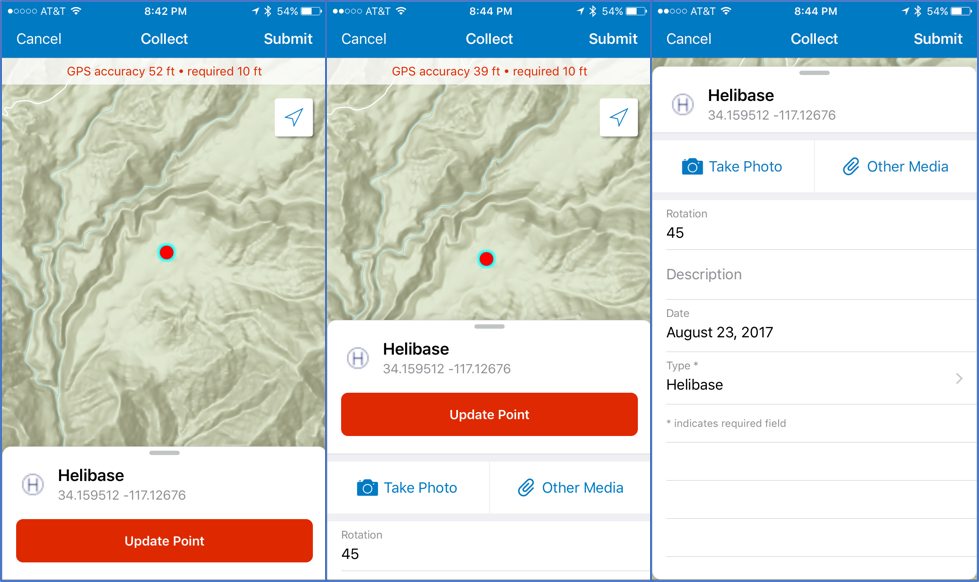
- Smarter data entry - have a lot of exciting work planned for the form, starting with the UX. Take a photo in fewer taps, capture additional media (audio, video), read information from QR and bar codes, edit in place on the form, and use a proper keyboard when editing numeric fields.
Smarter Forms
Forms are improving more than just the UX: you’ll find they honor the modern capabilities of the ArcGIS platform.
Collector is founded on the principles of the web map. Layers that you collect data into follow the guidelines set by feature layers you author and feature services you publish. The dictionary of feature types are based upon feature templates you create, and the forms experience is driven by popups you configure from the information model you create. But within that popup, support for validation of required fields, Arcade expressions, and attribute rules will be added.
Arcade Expressions are particularly exciting, as they will drive a smarter forms experience when editing in Collector, in web apps, and in ArcGIS Pro. Conditional logic, enrichment of data, inheritance of values from other features, grouping, and ordering of attributes will all come with this update.
Streamlined Offline Workflows
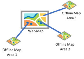
Collector works anywhere, anytime you need it. Maps can be downloaded to your device and you can synchronize changes when you gain connectivity. This release brings a simplified download experience, improved management of offline map areas, and the ability to keep working when you drift in and out of connectivity.
Within your ArcGIS organization, you will be able to plan ahead: prepare the areas to go offline, store them in your content, and share them throughout your organization. Mobile workers simply select the map areas they need and download them to their devices.
We are simplifying the interactive download experience as well as managing local content on the device. One key aspect is how you work with basemaps. In addition to packaged tile map services, Collector will support packaged mobile maps built with ArcGIS Pro and vector tiles. In the app, you’ll be able to download and manage a collection of offline basemaps.
Enhancements to High Accuracy 3D Data Collection
As part of this project, Collector is adding support for direct capture of 3D data. In addition, vertical datum transformations will allow you to transform elevations on the fly, eliminating office workflows usually required to achieve accurate elevations.
Collector - Aurora Project Schedule
The Aurora development project is underway and the first beta of Collector’s new dawn will be this fall! We will release a series of betas, bringing new capabilities with each update. To participate in the beta, please email collectorbeta@esri.com and then join our Early Adopter Program. Your feedback throughout the beta is important to us – we want to hear from you!
Our current target for release is Q3 of 2018 for the iOS platform and Q4 for the Android platform. We have not set a release date for the Windows platform yet. We know Collector is an essential part of your mobile workflows, and our goal is to make the transition easy for you. Starting with the beta releases, Collector as you know it today and this significant update will happily live side-by-side on your device.
Collector Team
- « Previous
- Next »
You must be a registered user to add a comment. If you've already registered, sign in. Otherwise, register and sign in.