- Home
- :
- All Communities
- :
- Products
- :
- ArcGIS Business Analyst
- :
- ArcGIS Business Analyst Questions
- :
- Re: How do I buffer regions in Business Analyst On...
- Subscribe to RSS Feed
- Mark Topic as New
- Mark Topic as Read
- Float this Topic for Current User
- Bookmark
- Subscribe
- Mute
- Printer Friendly Page
How do I buffer regions in Business Analyst Online?
- Mark as New
- Bookmark
- Subscribe
- Mute
- Subscribe to RSS Feed
- Permalink
- Report Inappropriate Content
I'd like to create a color-coded map in Business Analyst Online. I'd like to include data out to a distance of 5 miles beyond the boundary of my study region, usually counties but sometimes metro areas or small states. I could create this buffer region as a hand-drawn polygon, but I'd rather use a more consistent method. Any suggestions?
- Mark as New
- Bookmark
- Subscribe
- Mute
- Subscribe to RSS Feed
- Permalink
- Report Inappropriate Content
Hi Pete,
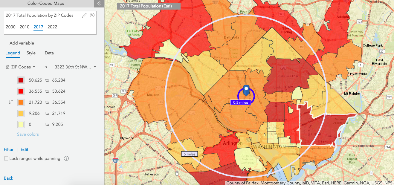
Do you want to create something like below where blue ring shows your study region and the white ring shows the 5 miles distance from your study region that captures all the zip codes intersecting it shown in color coded maps.
Thanks,
Praveen
- Mark as New
- Bookmark
- Subscribe
- Mute
- Subscribe to RSS Feed
- Permalink
- Report Inappropriate Content
Yes, this is what I'm looking for. (Except this example looks like it was created using rings. My study region is unlikely to be a point site or a ring.)
- Mark as New
- Bookmark
- Subscribe
- Mute
- Subscribe to RSS Feed
- Permalink
- Report Inappropriate Content
Hello Pete,
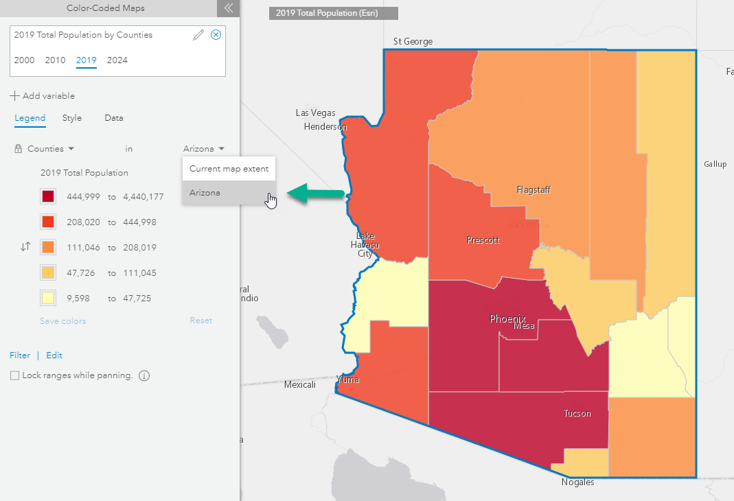
You can also use Geography boundaries as follows:
Go to Define Areas > Select Geography > Select from the map > select the desired intersecting geographies > you can choose to merge these geographies into one > then click Options and select No fill > Ok.

Then create your CCM and use this boundary as an extent. For example, here I created a CCM of all the counties in AZ showing a total population.
Hope this helps,
Fasil T.
Business Analyst Team