- Home
- :
- All Communities
- :
- Products
- :
- ArcGIS Business Analyst
- :
- ArcGIS Business Analyst Ideas
- :
- Business Analyst Fusion Reports - Map Image improv...
- Subscribe to RSS Feed
- Mark as New
- Mark as Read
- Bookmark
- Follow this Idea
- Printer Friendly Page
- Report Inappropriate Content
Business Analyst Fusion Reports - Map Image improvement
- Mark as New
- Bookmark
- Subscribe
- Mute
- Subscribe to RSS Feed
- Permalink
- Report Inappropriate Content
In ArcMap desktop - Business Analyst extension - Fusion Report Designer, there is an option to Insert - Map Image, which definitely can be an added bonus to some of our demographic reports. We batch demos very often, several sites / trade areas at once, and this Map Image is smart enough to pan-to, center, and set extent to see the full trade area for the respective demographic values / report. That is great, but it would be incrediably value if it goes a step further. Several times we'll have drive-time polygons and they'll overlap our other sites. Since BA can pan to the right polygon, can we get the option to only show that trade area that that report is for? We only care about the polygon(s) in that Map Image that go to the values on that report. I have talked with ESRI Tech services, he agreed it was a great idea but I had to submit it here because there is nothing we could do for this to work - other than running a report one at a time with definition queries - way too manual for how many reports we can batch run at a time. Please message me if you have any questions or suggestions!! Thanks!!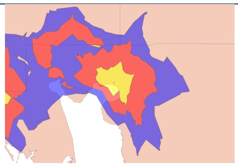
You must be a registered user to add a comment. If you've already registered, sign in. Otherwise, register and sign in.