- Home
- :
- All Communities
- :
- Developers
- :
- JavaScript Maps SDK
- :
- JavaScript Maps SDK Questions
- :
- Is it possible to add a georeferenced image to a m...
- Subscribe to RSS Feed
- Mark Topic as New
- Mark Topic as Read
- Float this Topic for Current User
- Bookmark
- Subscribe
- Mute
- Printer Friendly Page
Is it possible to add a georeferenced image to a map?
- Mark as New
- Bookmark
- Subscribe
- Mute
- Subscribe to RSS Feed
- Permalink
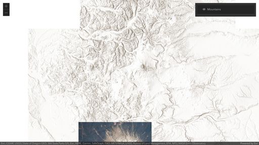
Is it possible to add a georeferenced image to a map, like the one attached? I know in 3.x I can use MapImage and MapImage layer to georeference an image using the extents of the image (see my demo here). But what if I already have a georeferenced image, like the one attached? Can I add it to a map without having to specify the extents?
- Mark as New
- Bookmark
- Subscribe
- Mute
- Subscribe to RSS Feed
- Permalink
if the image is properly georeferenced you should be able to simply open it in the map.
- Mark as New
- Bookmark
- Subscribe
- Mute
- Subscribe to RSS Feed
- Permalink
How? Using what class? I tried using MapImage, but it did not recognize the extents of the image.
- Mark as New
- Bookmark
- Subscribe
- Mute
- Subscribe to RSS Feed
- Permalink
We are releasing the ability to overlay images and videos in 4.24 next week! You can try it out now using the /next early access release, and we are looking to get some feedback on it. The functionality is even better than 3.x… you can overlay both images and videos in 2D and 3D, add/remove multiple images on the fly very easily, and use it with other 4.x capabilities like layer blending (note: so far you can only do layer blending with MediaLayers in 2D).
Here's a simple example: https://codepen.io/U_B_U/pen/MWQGWdb?editors=1000
Note that you will have to specify the location of the image explicitly in your app (image corners/extent).
