- Home
- :
- All Communities
- :
- Developers
- :
- JavaScript Maps SDK
- :
- JavaScript Maps SDK Questions
- :
- Re: Help!! TOC not showing up.....
- Subscribe to RSS Feed
- Mark Topic as New
- Mark Topic as Read
- Float this Topic for Current User
- Bookmark
- Subscribe
- Mute
- Printer Friendly Page
- Mark as New
- Bookmark
- Subscribe
- Mute
- Subscribe to RSS Feed
- Permalink
- Report Inappropriate Content
I'm trying to learn programming with ArcGIS API for Javascript. This is my first attempt at this so please excuse my ignorance.
Anyhow, what I want is very simple...use a dynamic map service with 23 layers (yes...I know...but my audience "needs them all") to be able to check off/on within a TOC.
Thus, I downloaded the Table of Contents (TOC)/Legend Widget for JavaScript API and incorporated into my script. I haven't been very successful at all. I'm using Notepad ++ and have tried opening it with several different browsers (Firefox v. 31, Chrome v. 37, & IE v.8). Debugging with Chrome's developer tools mostly.
I've put the TOC widget folder and .html on my webserver to test. No results! Not happening! What I'm I doing wrong? 
This is my script so far:
<!DOCTYPE html>
<html>
<head>
<meta http-equiv="Content-Type" content="text/html; charset=utf-8">
<meta http-equiv="X-UA-Compatible" content="IE=edge">
<meta name="viewport" content="initial-scale=1, maximum-scale=1, user-scalable=no">
<title>Blabla....</title>
<link rel="stylesheet" href="http://js.arcgis.com/3.10/js/dojo/dijit/themes/claro/claro.css">
<link rel="stylesheet" href="http://js.arcgis.com/3.10/js/esri/css/esri.css">
<link rel="stylesheet" type="text/css" href="../src/agsjs/css/agsjs.css" />
<style>
html, body
.
.
.
.
</style>
<script src="http://js.arcgis.com/3.10/">
</script>
<script type="text/javascript">
// helpful for understanding dojoConfig.packages vs. dojoConfig.paths:
// http://www.sitepen.com/blog/2013/06/20/dojo-faq-what-is-the-difference-packages-vs-paths-vs-aliases/
var dojoConfig = {
paths: {
//if you want to host on your own server, download and put in folders then use path like:
agsjs: location.pathname.replace(/\/[^/]+$/, '') + '/../src/agsjs'
}
};
</script>
<script type="text/javascript">
var map, toc, dynaLayer1;
require(["dojo/_base/connect",
"dojo/on",
"esri/map",
"esri/dijit/Geocoder",
"esri/geometry/Extent",
"esri/layers/FeatureLayer",
"esri/layers/ArcGISTiledMapServiceLayer",
"esri/symbols/SimpleFillSymbol",
"esri/renderers/ClassBreaksRenderer",
"agsjs/dijit/TOC",
"esri/graphic",
"esri/symbols/SimpleMarkerSymbol",
"esri/geometry/screenUtils",
"dojo/dom",
"dojo/dom-construct",
"dojo/query",
"dojo/_base/Color",
"esri/dijit/Scalebar",
"esri/dijit/HomeButton",
"esri/dijit/OverviewMap",
"dijit/layout/BorderContainer",
"dijit/layout/ContentPane",
"esri/dijit/BasemapGallery",
"esri/arcgis/utils",
"dojo/parser",
"esri/layers/ArcGISDynamicMapServiceLayer",
"dojo/fx",
"dojo/domReady!"
], function(connect, on,
Map, Geocoder, Extent, FeatureLayer, ArcGISTiledMapServiceLayer, SimpleFillSymbol,
ClassBreaksRenderer, TOC,
Graphic, SimpleMarkerSymbol, screenUtils,
dom, domConstruct, query, Color, Scalebar, HomeButton, OverviewMap,
BorderContainer, ContentPane, BasemapGallery, arcgisUtils, parser, ArcGISDynamicMapServiceLayer
) {
// call the parser to create the dijit layout dijits
parser.parse(); // note djConfig.parseOnLoad = false;
// create a map
var map = new Map("map", {
sliderOrientation : "horizontal",
basemap: "topo",
center: [-93.745776,32.513614],
zoom: 14
});
//variable REST service Shreveport as a layer
dynaLayer1 = new ArcGISDynamicMapServiceLayer("http://noonecares/rest/services/MapServer", {
opacity: 0.9
});@
alert("1"); //shows up when it runs
//Add a TOC widget
map.on('layers-add-result', function(evt){
// overwrite the default visibility of service.
// TOC will honor the overwritten value.
dynaLayer1.setVisibleLayers([3, 7, 8, 23]);
// {
toc = new TOC({
map: map,
layerInfos: [{
layer: dynaLayer1,
title: "Base Map"
//collapsed: true, // whether this root layer should be collapsed initially, default false.
//slider: true, // whether to display a transparency slider.
//autoToggle: true //whether to automatically collapse when turned off, and expand when turn on for groups layers. default true.
}]
}, 'tocDiv');
toc.startup();
alert("2"); //it skipped when it runs
toc.on('load', function(){
alert("3"); //it skipped when it runs
if (console)
console.log('TOC loaded');
dom.byId("InsertNewLayer").disabled = false;
});
});
map.addLayers([dynaLayer1]);
alert("4"); //shows up when it runs
on(dom.byId("SetOpacity"), 'click', function(evt){
if (dynaLayer1 != null) {
dynaLayer1.setOpacity(0.2);
}
});
//adding geocoder widget
var geocoder = new Geocoder({
arcgisGeocoder: {
placeholder: "Find an address"
},
autoComplete: true,
map: map
}, dom.byId("search"));
map.on("load", enableSpotlight);
geocoder.on("select", showLocation);
geocoder.on("clear", removeSpotlight);
//adding scalebar widget
var scalebar = new Scalebar({
map: map,
attachTo: "bottom-left",
scalebarUnit: "dual"
});
//adding home button widget
var home = new HomeButton({
map: map
}, "HomeButton");
home.startup();
//adding overview map widget
var overviewMapDijit = new OverviewMap({
map: map,
visible: true,
attachTo: "bottom-right",
opacity: .40
});
overviewMapDijit.startup();
//add the basemap gallery, in this case we'll display maps from ArcGIS.com including bing maps
var basemapGallery = new BasemapGallery({
showArcGISBasemaps: true,
map: map
}, "basemapGallery");
basemapGallery.startup();
basemapGallery.on("error", function(msg) {
console.log("basemap gallery error: ", msg);
});
//showing Lat, Long location on the bottom of map
function showLocation(evt) {
map.graphics.clear();
var point = evt.result.feature.geometry;
var symbol = new SimpleMarkerSymbol().setStyle(
SimpleMarkerSymbol.STYLE_SQUARE).setColor(
new Color([255,0,0,0.5])
);
var graphic = new Graphic(point, symbol);
map.graphics.add(graphic);
map.infoWindow.setTitle("Search Result");
map.infoWindow.setContent(evt.result.name);
map.infoWindow.show(evt.result.feature.geometry);
var spotlight = map.on("extent-change", function(extentChange) {
var geom = screenUtils.toScreenGeometry(map.extent, map.width, map.height, extentChange.extent);
var width = geom.xmax - geom.xmin;
var height = geom.ymin - geom.ymax;
var max = height;
if ( width > height ) {
max = width;
}
var margin = '-' + Math.floor(max/2) + 'px 0 0 -' + Math.floor(max/2) + 'px';
query(".spotlight").addClass("spotlight-active").style({
width: max + "px",
height: max + "px",
margin: margin
});
spotlight.remove();
});
}
//adding point spot holder
function enableSpotlight() {
var html = "<div id='spotlight' class='spotlight'></div>"
domConstruct.place(html, dom.byId("map_container"), "first");
}
//removing point spot holder
function removeSpotlight() {
query(".spotlight").removeClass("spotlight-active");
map.infoWindow.hide();
map.graphics.clear();
}
});
</script>
</head>
<body class="claro">
<div id="content" data-dojo-type="dijit/layout/BorderContainer" design="headline" gutters="true" style="width: 100%; height: 100%; margin: 0;">
<div id="header" data-dojo-type="dijit/layout/ContentPane" region="top">
<div>
<ul style="margin:15px">
<b>Blabla....</b>
<div id="search"></div>
</ul>
</div>
</div>
<div data-dojo-type="dijit/layout/ContentPane" id="leftPane" region="left" splitter="true">
<div id="tocDiv">
</div>
</div>
<div id="map" data-dojo-type="dijit/layout/ContentPane" region="center">
<div id="HomeButton"></div>
<div style="position:absolute; right:50px; top:10px; z-Index:999;">
<div data-dojo-type="dijit/TitlePane"
data-dojo-props="title:'Switch Basemap', closable:false, open:false">
<div data-dojo-type="dijit/layout/ContentPane" style="width:380px; height:280px; overflow:auto;">
<div id="basemapGallery"></div>
</div>
</div>
</div>
</div>
</div>
</body>
</html>
Solved! Go to Solution.
- Mark as New
- Bookmark
- Subscribe
- Mute
- Subscribe to RSS Feed
- Permalink
- Report Inappropriate Content
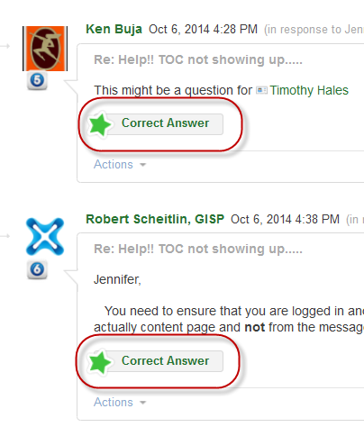
This might be a question for Timothy Hales
- Mark as New
- Bookmark
- Subscribe
- Mute
- Subscribe to RSS Feed
- Permalink
- Report Inappropriate Content
When you are logged in you should see a "Correct Answer" button for each reply.
- Mark as New
- Bookmark
- Subscribe
- Mute
- Subscribe to RSS Feed
- Permalink
- Report Inappropriate Content
Jennifer,
You need to ensure that you are logged in and that you click on the Actions Menu from the actually content page and not from the message in your inbox.
- Mark as New
- Bookmark
- Subscribe
- Mute
- Subscribe to RSS Feed
- Permalink
- Report Inappropriate Content
Sorry Timothy Hales and Robert Scheitlin but I do not see that button.
I'm not in my inbox. I'm actually on the thread post itself and again....all I see in the Actions drop down menu is 'Report Abuse'.
I'm logged in with my user name and yet I can't post this as resolved.
Should I contact ESRI Support to do a screen share?
Thanks,
- Mark as New
- Bookmark
- Subscribe
- Mute
- Subscribe to RSS Feed
- Permalink
- Report Inappropriate Content
Jennifer,
You would also only get this option (the option to mark as "Correct Answer") if you are the original poster.
- Mark as New
- Bookmark
- Subscribe
- Mute
- Subscribe to RSS Feed
- Permalink
- Report Inappropriate Content
This issue here is that you have used two different accounts within this thread. The question was originally posted with 'cosgisadmin' and you are currently logged in using 'jenzumbado'. You will need to be logged in with 'cosgisadmin' to mark the question as correct.
- Mark as New
- Bookmark
- Subscribe
- Mute
- Subscribe to RSS Feed
- Permalink
- Report Inappropriate Content
You were right Timothy Hales I was logged into my personal account and not my organization account. I wish I can name them differently.
Thanks so much for all your help guys. Sorry for being such a pain. Again, I'm new at this 
- « Previous
-
- 1
- 2
- Next »
- « Previous
-
- 1
- 2
- Next »