- Home
- :
- All Communities
- :
- Developers
- :
- JavaScript Maps SDK
- :
- JavaScript Maps SDK Questions
- :
- Lasso map region and download selected parcels as ...
- Subscribe to RSS Feed
- Mark Topic as New
- Mark Topic as Read
- Float this Topic for Current User
- Bookmark
- Subscribe
- Mute
- Printer Friendly Page
Lasso map region and download selected parcels as KML or CSV
- Mark as New
- Bookmark
- Subscribe
- Mute
- Subscribe to RSS Feed
- Permalink
- Report Inappropriate Content
I have a website with a map that shows parcel data, you know...houses, buildings, land. I am looking for guidance on how to lasso a region of the map to select every parcel in the selected range. The parcels in the selection could then be downloaded as KML or CSV files. This feature would be added to the map as a widget built with Typescript. My design approach to building this tool is to first get something working to be able to lasso a region and show the selected parcels in it. Step two is to figure out how to do the exporting of the selected parcels. I was informed at DS2019 to use sketch tool, but I need deeper documentation on it if that is true.
- Mark as New
- Bookmark
- Subscribe
- Mute
- Subscribe to RSS Feed
- Permalink
- Report Inappropriate Content
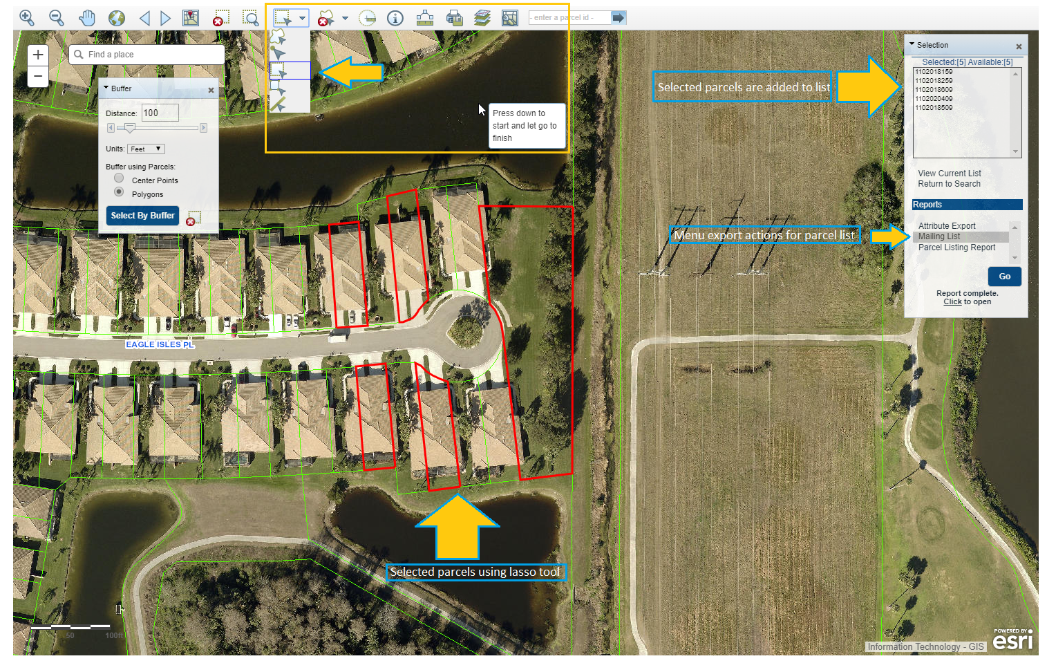
Update to my post. I believe what I am looking for is a toolbar with buffer tools as shown in the screenshot here.