- Home
- :
- All Communities
- :
- Developers
- :
- JavaScript Maps SDK
- :
- JavaScript Maps SDK Questions
- :
- Labels missing in Print output
- Subscribe to RSS Feed
- Mark Topic as New
- Mark Topic as Read
- Float this Topic for Current User
- Bookmark
- Subscribe
- Mute
- Printer Friendly Page
- Mark as New
- Bookmark
- Subscribe
- Mute
- Subscribe to RSS Feed
- Permalink
- Report Inappropriate Content

 Hi,
Hi,
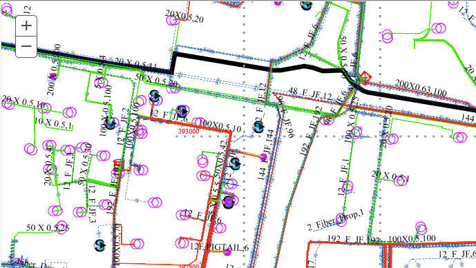
I am trying to print secured services and it works fine for most of the part except that the labeling info does not show on the print output.
While I am preparing the map, the labels do appear, but do not show up on print output.
I am using ESRI JS API v3.25.
var labelJson = {
"labelExpressionInfo": { "expression": "" },
"useCodedValues": false,
"labelPlacement": ""
};
labelJson.labelExpressionInfo.expression = "CONCATENATE([$feature.NAME, $feature.CLASS], ' / ')";
labelJson.labelPlacement = "above-right";
var labelSymbol = new textSymbol();
var lblClass = new labelClass(labelJson);
lblClass.symbol = labelSymbol;
printFeatLyrEquipment.setLabelingInfo([lblClass]); //this is a Feature layer
map.addLayer(printFeatLyrEquipment);
Not sure why is it not printing the labels...any clues?
Thanks in advance!
~UJ
Solved! Go to Solution.
Accepted Solutions
- Mark as New
- Bookmark
- Subscribe
- Mute
- Subscribe to RSS Feed
- Permalink
- Report Inappropriate Content
Okay...so feature layers don't seem to support labels while printing.
I turned on the relevant layers from the dynamic service using setVisibleLayers() and apply definition query/label expression using setDefinitionExpression() & setDynamicLayerInfos() respectively - and the labels appear beautifully in the print output!!!
Regards
UJ
- Mark as New
- Bookmark
- Subscribe
- Mute
- Subscribe to RSS Feed
- Permalink
- Report Inappropriate Content
Is it possible to post your solution here? We have the same problem. We are using FeatureLayer and labels are missing when exported as pdf/image. Thanks
- Mark as New
- Bookmark
- Subscribe
- Mute
- Subscribe to RSS Feed
- Permalink
- Report Inappropriate Content
- Mark as New
- Bookmark
- Subscribe
- Mute
- Subscribe to RSS Feed
- Permalink
- Report Inappropriate Content
Just to chime in here, there are a couple of caveats about printing labels with FeatureLayers:
- Labels currently cannot be printed as part of a FeatureLayer with ArcGIS Server 10.5.1 or any Printing Service published with ArcMap.
PrintTask | API Reference | ArcGIS API for JavaScript 4.9
- Currently the
labelsVisibleproperty must be explicitly set totruefor labels to be printed.
FeatureLayer | API Reference | ArcGIS API for JavaScript 4.9
-Noah
- Mark as New
- Bookmark
- Subscribe
- Mute
- Subscribe to RSS Feed
- Permalink
- Report Inappropriate Content
So if I understand well with 4.9 API it is not possible to print FeatureLayer labels but with older 3.xx this is possible?
I have same problem and I'm using 4.9 js API.
- Mark as New
- Bookmark
- Subscribe
- Mute
- Subscribe to RSS Feed
- Permalink
- Report Inappropriate Content
This should work fine at 4.9. I am pretty sure that printing labels has been supported since labeling was introduced to 2D MapViews at version 4.8. What sort of issue are you seeing?
- Mark as New
- Bookmark
- Subscribe
- Mute
- Subscribe to RSS Feed
- Permalink
- Report Inappropriate Content
We now use view.takeScreenshot() but labels added to view as labelClass didn't show on result image of PrintTask
cluLayer = new w.FeatureLayer({url: url,
labelingInfo: [labelClass],
renderer: renderer
})
map.add(cluLayer);
- Mark as New
- Bookmark
- Subscribe
- Mute
- Subscribe to RSS Feed
- Permalink
- Report Inappropriate Content
I think in this case the labelsVisible property must be explicitly set to true for labels to be printed.