Turn on suggestions
Auto-suggest helps you quickly narrow down your search results by suggesting possible matches as you type.
Cancel
- Home
- :
- All Communities
- :
- Developers
- :
- JavaScript Maps SDK
- :
- JavaScript Maps SDK Questions
- :
- JS API 3.x - Select multiple features by mouse cli...
Options
- Subscribe to RSS Feed
- Mark Topic as New
- Mark Topic as Read
- Float this Topic for Current User
- Bookmark
- Subscribe
- Mute
- Printer Friendly Page
JS API 3.x - Select multiple features by mouse click event
Subscribe
12-30-2020
12:54 AM
- Mark as New
- Bookmark
- Subscribe
- Mute
- Subscribe to RSS Feed
- Permalink
- Report Inappropriate Content
I am trying to select multiple features in a feature layer by using "hold 'ctrl' button and mouse click event". I am using ArcGIS JS API 3.x.
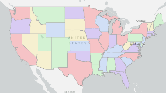
I am creating the US State boundary by using FeatureCollection, [Able to display the boundary on map] I have to select multiple states by mouse click while holding 'ctrl' or 'alt' key.
var featureLayer = new esri.layers.FeatureLayer(featureCollection, {
    id: stateLayer,
    opacity: 0.30,
    visible: true,
    infoTemplate: infoTemplate
});
g_esri.map.addLayer(featureLayer);
featureLayer.on("click", onBoundaryClick);

function onBoundaryClick(evt) {
    var g = evt.graphic;
    g_esri.map.infoWindow.setContent(g.getContent());
    g_esri.map.infoWindow.show(evt.screenPoint, g_esri.map.getInfoWindowAnchor(evt.screenPoint));
    formatInfotemplate(false, g);
}
I tried to follow some of the below links,
But couldn't able to get through,
Any help welcome
Regards,
Kishor
Solved! Go to Solution.
1 Solution
Accepted Solutions
04-15-2021
04:23 AM
- Mark as New
- Bookmark
- Subscribe
- Mute
- Subscribe to RSS Feed
- Permalink
- Report Inappropriate Content
Follow the example below.,
When adding just check if the desire keys are pressed.
<!DOCTYPE html>
<html>
  <head>
    <meta http-equiv="Content-Type" content="text/html; charset=utf-8">
    <meta name="viewport" content="initial-scale=1, maximum-scale=1, user-scalable=no">
    <title>Labeling features client-side</title>
    <link rel="stylesheet" href="https://js.arcgis.com/3.35/esri/css/esri.css">
    <style>
      html, body, #map {
        height: 100%; width: 100%; margin: 0; padding: 0;
      }
    </style>

   <script src="https://js.arcgis.com/3.35/"></script>
    <script>
      var map;

      require([
        "esri/map",
        "esri/geometry/Extent",
        "esri/layers/FeatureLayer",
        "esri/layers/GraphicsLayer",
        "esri/symbols/SimpleLineSymbol",
        "esri/symbols/SimpleFillSymbol",
        "esri/renderers/SimpleRenderer",
        "esri/Color",

        "dojo/domReady!"
      ], function(Map, Extent, FeatureLayer, GraphicsLayer,
                  SimpleLineSymbol, SimpleFillSymbol,
                  SimpleRenderer, Color)
      {
        const bbox = new Extent({"xmin": -1940058, "ymin": -814715, "xmax": 1683105, "ymax": 1446096, "spatialReference": {"wkid": 102003}});

        const map = new Map("map", {
          extent: bbox
        });


        const statesUrl = "https://sampleserver6.arcgisonline.com/arcgis/rest/services/Census/MapServer/3";
        const states = new FeatureLayer(statesUrl, {
          id: "states",
          outFields: ["*"]
        });

        map.addLayer(states);

        const color = new Color("#00ffff");
        const line = new SimpleLineSymbol("solid", color, 1.5);
        const symbol = new SimpleFillSymbol("solid", line, null);
        const renderer = new SimpleRenderer(symbol);
        const selected = new GraphicsLayer();
        selected.setRenderer(renderer);
        map.addLayer(selected);

        let ctrl = false;
        let shift = false;

        map.on("key-down", function (evt) {
          if (evt.key === "Control") {
            ctrl = true;
          } else if (evt.key === "Shift") {
            shift = true;
          }
        });

        map.on("key-up", function (evt) {
          if (evt.key === "Control") {
            ctrl = false;
          } else if (evt.key === "Shift") {
            shift = false;
          }
        });

        states.on("click", function (evt) {
          if (!ctrl && !shift) {
            selected.clear();
          }
          selected.add(evt.graphic.clone());
          console.log(`Selected: ${selected.graphics.length}`);
        });

      });
    </script>
  </head>
  <body>
    <div id="map"></div>
  </body>
</html>
1 Reply
04-15-2021
04:23 AM
- Mark as New
- Bookmark
- Subscribe
- Mute
- Subscribe to RSS Feed
- Permalink
- Report Inappropriate Content
Follow the example below.,
When adding just check if the desire keys are pressed.
<!DOCTYPE html>
<html>
  <head>
    <meta http-equiv="Content-Type" content="text/html; charset=utf-8">
    <meta name="viewport" content="initial-scale=1, maximum-scale=1, user-scalable=no">
    <title>Labeling features client-side</title>
    <link rel="stylesheet" href="https://js.arcgis.com/3.35/esri/css/esri.css">
    <style>
      html, body, #map {
        height: 100%; width: 100%; margin: 0; padding: 0;
      }
    </style>

   <script src="https://js.arcgis.com/3.35/"></script>
    <script>
      var map;

      require([
        "esri/map",
        "esri/geometry/Extent",
        "esri/layers/FeatureLayer",
        "esri/layers/GraphicsLayer",
        "esri/symbols/SimpleLineSymbol",
        "esri/symbols/SimpleFillSymbol",
        "esri/renderers/SimpleRenderer",
        "esri/Color",

        "dojo/domReady!"
      ], function(Map, Extent, FeatureLayer, GraphicsLayer,
                  SimpleLineSymbol, SimpleFillSymbol,
                  SimpleRenderer, Color)
      {
        const bbox = new Extent({"xmin": -1940058, "ymin": -814715, "xmax": 1683105, "ymax": 1446096, "spatialReference": {"wkid": 102003}});

        const map = new Map("map", {
          extent: bbox
        });


        const statesUrl = "https://sampleserver6.arcgisonline.com/arcgis/rest/services/Census/MapServer/3";
        const states = new FeatureLayer(statesUrl, {
          id: "states",
          outFields: ["*"]
        });

        map.addLayer(states);

        const color = new Color("#00ffff");
        const line = new SimpleLineSymbol("solid", color, 1.5);
        const symbol = new SimpleFillSymbol("solid", line, null);
        const renderer = new SimpleRenderer(symbol);
        const selected = new GraphicsLayer();
        selected.setRenderer(renderer);
        map.addLayer(selected);

        let ctrl = false;
        let shift = false;

        map.on("key-down", function (evt) {
          if (evt.key === "Control") {
            ctrl = true;
          } else if (evt.key === "Shift") {
            shift = true;
          }
        });

        map.on("key-up", function (evt) {
          if (evt.key === "Control") {
            ctrl = false;
          } else if (evt.key === "Shift") {
            shift = false;
          }
        });

        states.on("click", function (evt) {
          if (!ctrl && !shift) {
            selected.clear();
          }
          selected.add(evt.graphic.clone());
          console.log(`Selected: ${selected.graphics.length}`);
        });

      });
    </script>
  </head>
  <body>
    <div id="map"></div>
  </body>
</html>