- Home
- :
- All Communities
- :
- Developers
- :
- JavaScript Maps SDK
- :
- JavaScript Maps SDK Questions
- :
- draw path and 3d line
- Subscribe to RSS Feed
- Mark Topic as New
- Mark Topic as Read
- Float this Topic for Current User
- Bookmark
- Subscribe
- Mute
- Printer Friendly Page
draw path and 3d line
- Mark as New
- Bookmark
- Subscribe
- Mute
- Subscribe to RSS Feed
- Permalink
- Report Inappropriate Content
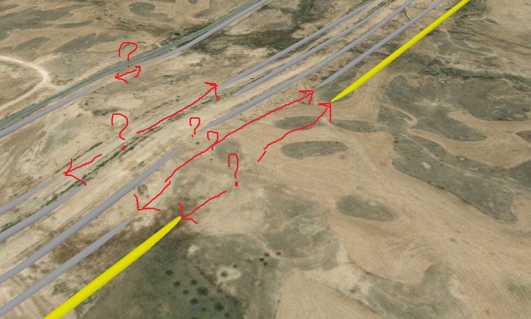
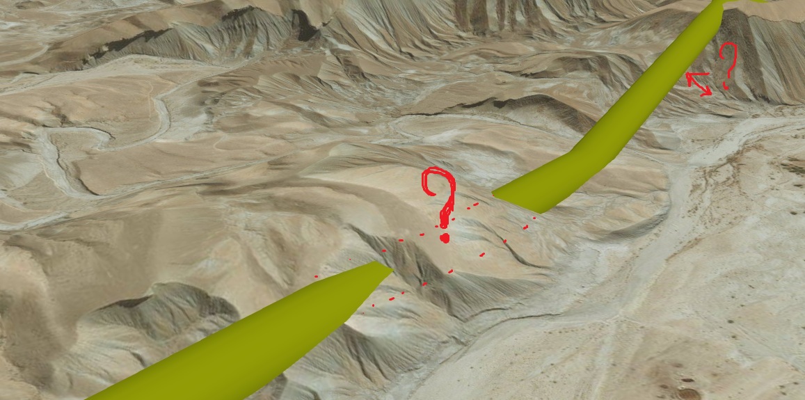
Hi
I,m working on showing 3d line as a path in arcgis java script api 4.X in scene viewe. but I have a big problem:
some piece of my lines have drawn underground. I am using : "relative-to-ground" for elevation info of my 2d feature layer and image service for topographic of earth.
please check attached files.
- Mark as New
- Bookmark
- Subscribe
- Mute
- Subscribe to RSS Feed
- Permalink
- Report Inappropriate Content
Anjelina,
Specify an offset in your layers elevationInfo.
- Mark as New
- Bookmark
- Subscribe
- Mute
- Subscribe to RSS Feed
- Permalink
- Report Inappropriate Content
but what about other parts? In this case, those parts that were previously correct are corrupted and moved upward!!
- Mark as New
- Bookmark
- Subscribe
- Mute
- Subscribe to RSS Feed
- Permalink
- Report Inappropriate Content
Anjelina,
Does your data contain Z (elevation) info?
- Mark as New
- Bookmark
- Subscribe
- Mute
- Subscribe to RSS Feed
- Permalink
- Report Inappropriate Content
No, my data is 2d. I tried to convert my line to 3d, but because of that my DEM is surface(not TIN), conversion is just applicable by Bilinear method(Arc map) and this method interpolate 4 pixel to 1 pixel and my 3d line move down or up !!!
- Mark as New
- Bookmark
- Subscribe
- Mute
- Subscribe to RSS Feed
- Permalink
- Report Inappropriate Content
Anjelina,
Have you tried "on-the-ground"?
- Mark as New
- Bookmark
- Subscribe
- Mute
- Subscribe to RSS Feed
- Permalink
- Report Inappropriate Content
yes, but result is not better!
- Mark as New
- Bookmark
- Subscribe
- Mute
- Subscribe to RSS Feed
- Permalink
- Report Inappropriate Content
Have you tried densifying the feature polyline geometries? Not sure, but it could be that only vertices are "relative-to-ground" and the sections between vertices are not?