- Home
- :
- All Communities
- :
- Developers
- :
- JavaScript Maps SDK
- :
- JavaScript Maps SDK Questions
- :
- About adding layers to LayerList
- Subscribe to RSS Feed
- Mark Topic as New
- Mark Topic as Read
- Float this Topic for Current User
- Bookmark
- Subscribe
- Mute
- Printer Friendly Page
- Mark as New
- Bookmark
- Subscribe
- Mute
- Subscribe to RSS Feed
- Permalink
- Report Inappropriate Content
Hello there.
Im a little bit confused on how is the way to add layers into a LayerList obj. Im using Arcgis Api 3.17.
My code is the following:
var mapp = mymap.createMap("map","topo",-71.5215, -32.9934,9);
var interrClienteSED = new ArcGISDynamicMapServiceLayer(layers.read_dyn_layerClieSED(),{id:"po_interrupciones"});
interrClienteSED.setInfoTemplates({
3: {infoTemplate: myinfotemplate.getNisInfo()},
1: {infoTemplate: myinfotemplate.getIsolatedNisFailure()},
0: {infoTemplate: myinfotemplate.getSubFailure()}
});
interrClienteSED.refreshInterval = 1;
interrClienteSED.setImageFormat("png32");
interrClienteSED.show();
var chqmapabase = new ArcGISDynamicMapServiceLayer(layers.read_mapabase(),{id:"gis_chqmapabase"});
chqmapabase.hide();
var heatmapFeatureLayerOptions = {
id: "gis_heatmapsed",
mode: FeatureLayer.MODE_SNAPSHOT,
outFields: ["*"]
};
var heatmapFeatureLayerOptions2 = {
id: "gis_heatmapclientes",
mode: FeatureLayer.MODE_SNAPSHOT,
outFields: ["*"]
};
var heatmapFeatureLayer = new FeatureLayer(layers.read_heatmapSED(), heatmapFeatureLayerOptions);
var heatmapFeatureLayer1 = new FeatureLayer(layers.read_heatmapClientes(), heatmapFeatureLayerOptions2);
var heatmapRenderer = new HeatmapRenderer({
colors: ["rgba(0,255,0, 0)","rgb(255, 255, 0)","rgb(255, 0, 0)"],
blurRadius: 16,
maxPixelIntensity: 250,
minPixelIntensity: 5
});
heatmapFeatureLayer.setRenderer(heatmapRenderer);
heatmapFeatureLayer.hide();
heatmapFeatureLayer1.setRenderer(heatmapRenderer);
heatmapFeatureLayer1.hide();
var gpsCars = new ArcGISDynamicMapServiceLayer(layers.read_GPS(), {id:"gis_gps"});
gpsCars.setInfoTemplates({
0: {infoTemplate: myinfotemplate.getCarsInfo()}
});
gpsCars.refreshInterval = 0.1;
gpsCars.setImageFormat("png32");
gpsCars.show();
var gpsNew = new ArcGISDynamicMapServiceLayer(layers.read_gps_new(), {id:"gis_gps_new"});
mapp.addLayers([chqmapabase,interrClienteSED, heatmapFeatureLayer, heatmapFeatureLayer1, gpsCars]);
var layerList = new LayerList({
map: mapp,
showLegend: true,
showSubLayers: true,
showOpacitySlider: true,
layers: [interrClienteSED, gpsCars]
},"layerlist");
layerList.startup();Then i have only this in my html:
<div className="map_container">
<div id="layerlist"></div>
<div id="map"></div>
<Simbology />
</div>The result i have is this one:

I was trying with the layers that i already have added in the map, but actually i want to use another service where i have sublayers according this structure:
Layers :
One (0)
• One - 1 (1)
Two (3)
• Two - 2 (4)
I want to see in the layerlist all of them, see the legend and turn on/off each one.
Thanks in advice!.
Solved! Go to Solution.
Accepted Solutions
- Mark as New
- Bookmark
- Subscribe
- Mute
- Subscribe to RSS Feed
- Permalink
- Report Inappropriate Content
Evelyn,
Hope this sample will help:
<!DOCTYPE html>
<html>
<head>
<meta http-equiv="Content-Type" content="text/html; charset=utf-8">
<meta name="viewport" content="initial-scale=1, maximum-scale=1,user-scalable=no">
<title>Layer List Dijit</title>
<link rel="stylesheet" href="http://js.arcgis.com/3.25/dijit/themes/claro/claro.css">
<link rel="stylesheet" href="http://js.arcgis.com/3.25/esri/css/esri.css">
<style>
html,
body,
.container,
#map {
height: 100%;
width: 100%;
margin: 0;
padding: 0;
margin: 0;
font-family: "Open Sans";
}
#map {
padding: 0;
}
#layerListPane {
width: 25%;
}
.esriLayer {
background-color: #fff;
}
.esriLayerList .esriList {
border-top: none;
}
.esriLayerList .esriTitle {
background-color: #fff;
border-bottom: none;
}
.esriLayerList .esriList ul {
background-color: #fff;
}
</style>
<script>
var dojoConfig = {
parseOnLoad: true
};
</script>
<script src="http://js.arcgis.com/3.25/"></script>
<script>
require([
"esri/map",
"esri/layers/ArcGISDynamicMapServiceLayer",
"esri/dijit/LayerList",
"dojo/query",
"dojo/dom-construct",
"dojo/dom-class",
"dojo/dom-style",
"dojo/on",
"dojo/_base/array",
"dijit/layout/BorderContainer",
"dijit/layout/ContentPane",
"dojo/domReady!"
], function (
Map,
ArcGISDynamicMapServiceLayer,
LayerList,
query,
domConstruct,
domClass,
domStyle,
on,
array
) {
var map = new Map("map", {
basemap: "topo",
center: [-123, 47],
zoom: 8,
sliderStyle: "small"
});
var atlasLayer = new ArcGISDynamicMapServiceLayer("http://sampleserver6.arcgisonline.com/arcgis/rest/services/Census/MapServer", {
"id": "atlasLayer",
"showAttribution": false
});
var recreationLayer = new ArcGISDynamicMapServiceLayer("http://sampleserver6.arcgisonline.com/arcgis/rest/services/Recreation/MapServer", {
"id": "recreationLayer",
"showAttribution": false
});
var waterNetLayer = new ArcGISDynamicMapServiceLayer("http://sampleserver6.arcgisonline.com/arcgis/rest/services/Water_Network/MapServer", {
"id": "waterNetworkLayer",
"showAttribution": false
})
map.addLayers([atlasLayer, recreationLayer, waterNetLayer]);
var llWidget = new LayerList({
map: map,
layers: [{
layer: atlasLayer,
id: "Atlas layers",
subLayers: true
},{
layer: recreationLayer,
id: "Recreation Layer",
subLayers: true
},{
layer: waterNetLayer,
id: "Water Network Layer",
subLayers: true
}],
showLegend: true,
showOpacitySlider: true
},"layerList");
llWidget.startup();
});
</script>
</head>
<body class="claro">
<div class="container" data-dojo-type="dijit/layout/BorderContainer" data-dojo-props="design:'headline',gutters:false">
<div id="layerListPane" data-dojo-type="dijit/layout/ContentPane" data-dojo-props="region:'right'">
<div id="layerList"></div>
</div>
<div id="map" data-dojo-type="dijit/layout/ContentPane" data-dojo-props="region:'center'"></div>
</div>
</body>
</html>
- Mark as New
- Bookmark
- Subscribe
- Mute
- Subscribe to RSS Feed
- Permalink
- Report Inappropriate Content
Evelyn,
The doc for the LayerList dijit gives some good examples of what it expected:
https://developers.arcgis.com/javascript/3/jsapi/layerlist-amd.html#layers
layers = [
{
layer: Layer object // required unless featureCollection.
featureCollection: featureCollection, // required unless layerObject. If the layer is a feature collection, should match AGOL feature collection response and not have a layerObject.
showSubLayers: true, // optional, show sublayers for this layer. Defaults to the widget's 'showSubLayers' property.
showLegend: true, // optional, display a legend for the layer items.
content: <domNode>, // optional, custom node to insert content. It appears below the title.
showOpacitySlider: true, // optional, display the opacity slider for layer items.
button: <domNode>, // optional, custom button node that will appear within the layer title.
visibility: true, // optionally set the default visibility
id: "my_layer" // optionally set the layer's id
},
{
//additional layer
}
];- Mark as New
- Bookmark
- Subscribe
- Mute
- Subscribe to RSS Feed
- Permalink
- Report Inappropriate Content
I already saw that and idk what im doing wrong now.
What should i put in the featureCollection? the same layer that i made?
Actually the example (the only one) that shows the api is for AOL and im not using that, so i have to create the layers by myself.
Can u clarify me what i need to do ?
var gpsNew = new ArcGISDynamicMapServiceLayer(myLayers.read_gps_new(), {id:"gis_gps_new"});
var layers = [
{
layer: gpsNew, // required unless featureCollection.
featureCollection: gpsNew,
showSubLayers: true, // optional, show sublayers for this layer. Defaults to the widget's 'showSubLayers' property.
showLegend: true, // optional, display a legend for the layer items.
content: "layerlist", // optional, custom node to insert content. It appears below the title.
showOpacitySlider: true, // optional, display the opacity slider for layer items.
// optional, custom button node that will appear within the layer title.
visibility: true, // optionally set the default visibility
id: "GPS" // optionally set the layer's id
}
];
var layerList = new LayerList({
map: mapp,
showLegend: true,
showSubLayers: true,
showOpacitySlider: true,
layers:layers
},"layerlist");- Mark as New
- Bookmark
- Subscribe
- Mute
- Subscribe to RSS Feed
- Permalink
- Report Inappropriate Content
Evelyn,
featureCollection: should be null.
Here is another example:
http://www.arcgis.com/sharing/content/items/039c0beaee9944c09e721438da1827e4/data?f=pjson
- Mark as New
- Bookmark
- Subscribe
- Mute
- Subscribe to RSS Feed
- Permalink
- Report Inappropriate Content
Well im still trying to do something with the layerList widget and not to make something by myself from scratch.
So i have a service with 3 sublayers and i want to toggle the visibility like in this example with the census layer:
LayerList widget | ArcGIS API for JavaScript 3.25
The structure of the server is the following:
Mapserver
sL1
sL2
sL3
But for some reason it ended up showing all the 3 layers (i add it like dynamic) but now showing any button ">" like the example for individually to toggle the sublayers.
Any help will be really appreciate !
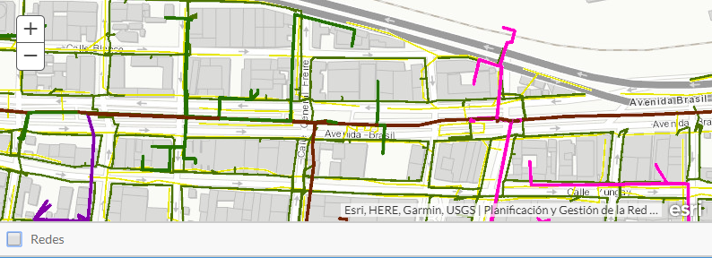
This is how it looks:
- Mark as New
- Bookmark
- Subscribe
- Mute
- Subscribe to RSS Feed
- Permalink
- Report Inappropriate Content
Evelyn,
Hope this sample will help:
<!DOCTYPE html>
<html>
<head>
<meta http-equiv="Content-Type" content="text/html; charset=utf-8">
<meta name="viewport" content="initial-scale=1, maximum-scale=1,user-scalable=no">
<title>Layer List Dijit</title>
<link rel="stylesheet" href="http://js.arcgis.com/3.25/dijit/themes/claro/claro.css">
<link rel="stylesheet" href="http://js.arcgis.com/3.25/esri/css/esri.css">
<style>
html,
body,
.container,
#map {
height: 100%;
width: 100%;
margin: 0;
padding: 0;
margin: 0;
font-family: "Open Sans";
}
#map {
padding: 0;
}
#layerListPane {
width: 25%;
}
.esriLayer {
background-color: #fff;
}
.esriLayerList .esriList {
border-top: none;
}
.esriLayerList .esriTitle {
background-color: #fff;
border-bottom: none;
}
.esriLayerList .esriList ul {
background-color: #fff;
}
</style>
<script>
var dojoConfig = {
parseOnLoad: true
};
</script>
<script src="http://js.arcgis.com/3.25/"></script>
<script>
require([
"esri/map",
"esri/layers/ArcGISDynamicMapServiceLayer",
"esri/dijit/LayerList",
"dojo/query",
"dojo/dom-construct",
"dojo/dom-class",
"dojo/dom-style",
"dojo/on",
"dojo/_base/array",
"dijit/layout/BorderContainer",
"dijit/layout/ContentPane",
"dojo/domReady!"
], function (
Map,
ArcGISDynamicMapServiceLayer,
LayerList,
query,
domConstruct,
domClass,
domStyle,
on,
array
) {
var map = new Map("map", {
basemap: "topo",
center: [-123, 47],
zoom: 8,
sliderStyle: "small"
});
var atlasLayer = new ArcGISDynamicMapServiceLayer("http://sampleserver6.arcgisonline.com/arcgis/rest/services/Census/MapServer", {
"id": "atlasLayer",
"showAttribution": false
});
var recreationLayer = new ArcGISDynamicMapServiceLayer("http://sampleserver6.arcgisonline.com/arcgis/rest/services/Recreation/MapServer", {
"id": "recreationLayer",
"showAttribution": false
});
var waterNetLayer = new ArcGISDynamicMapServiceLayer("http://sampleserver6.arcgisonline.com/arcgis/rest/services/Water_Network/MapServer", {
"id": "waterNetworkLayer",
"showAttribution": false
})
map.addLayers([atlasLayer, recreationLayer, waterNetLayer]);
var llWidget = new LayerList({
map: map,
layers: [{
layer: atlasLayer,
id: "Atlas layers",
subLayers: true
},{
layer: recreationLayer,
id: "Recreation Layer",
subLayers: true
},{
layer: waterNetLayer,
id: "Water Network Layer",
subLayers: true
}],
showLegend: true,
showOpacitySlider: true
},"layerList");
llWidget.startup();
});
</script>
</head>
<body class="claro">
<div class="container" data-dojo-type="dijit/layout/BorderContainer" data-dojo-props="design:'headline',gutters:false">
<div id="layerListPane" data-dojo-type="dijit/layout/ContentPane" data-dojo-props="region:'right'">
<div id="layerList"></div>
</div>
<div id="map" data-dojo-type="dijit/layout/ContentPane" data-dojo-props="region:'center'"></div>
</div>
</body>
</html>
- Mark as New
- Bookmark
- Subscribe
- Mute
- Subscribe to RSS Feed
- Permalink
- Report Inappropriate Content
Yea that help me out. Also because it is secured, i had to add this:
var t = {
"server": service_url(),
"userId": username,
"token": theToken,
"ssl": false,
"expires": 7200
};
kernel.id.registerToken(t);