- Home
- :
- All Communities
- :
- Developers
- :
- JavaScript Maps SDK
- :
- JavaScript Maps SDK Blog
- :
- Twitter Mapping: Using Twitter & ArcGIS JavaScript...
Twitter Mapping: Using Twitter & ArcGIS JavaScript APIs Together
- Subscribe to RSS Feed
- Mark as New
- Mark as Read
- Bookmark
- Subscribe
- Printer Friendly Page
- Report Inappropriate Content
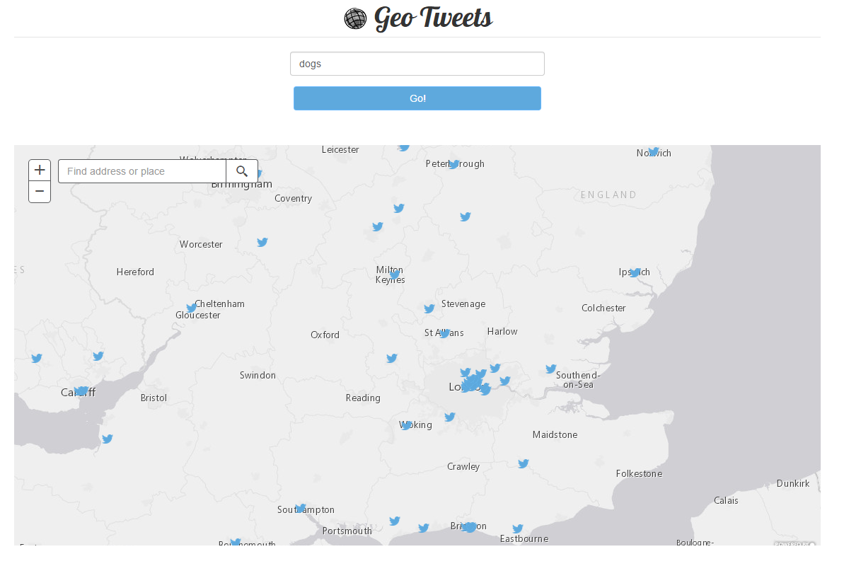
What is it ?
A simple map that allows users to search for tweets referring to a specific keyword in a given view extent. Currently the Twitter search API only allows you to pull back a maximum of 100 tweets, but it gives you a flavour for what you might be able to do if you had/have access to the Twitter firehose! The application also demonstrates how to do common tasks you might do in jQuery via Dojo. For example DOM querying, styling and AJAX using the requests module. This allows us as developers to not have to import an extra library whilst using the ArcGIS JavaScript API, reducing page weight.
What does it look like?
Live Demo
You can see the live demo at by following the link here. The Twitter API is rate limited so there is some possibility that the auth credentials used may hit their allocated limit.
GitHub Repository
The project is available from: https://github.com/JamesMilnerUK/esri-twitter
The Twitter Search API
The Twitter search API is defined here. The API allows users to get hold of tweets although it is important to note:
"[the] Twitter’s search service and, by extension, the Search API is not meant to be an exhaustive source of Tweets. Not all Tweets will be indexed or made available via the search interface. "
So, not suitable if you are looking for a full picture, but still useful for a bit of fun mapping tweets. An alternative if you need an exhaustive list of tweets may be to examine companies with Twitter Firehose access; for example Gnip (recently bought by Twitter) and DataSift (although their access appears to be ending in August 2015).
The Twitter Search API requires authentication. You can register a new app which will provide you with the authentication credentials required at Twitter Application Management. Once you have registered you can get hold of four things:
- Consumer Key (API Key)
- Consumer Secret (API Secret)
- Access Token
- Access Token Secret
From here I found the easiest way to get going with the API without having to worry about authentication implementation details was to use a helper library. In this case I've used TwitterAPIExchange (PHP) by J7mbo, but it appears there is a node.js module and also a Ruby Gem depending on how you roll.
The Twitter Search API has a few parameters that we are specifically interested in, in this case, geocode and count. Geocode represents a latitude, longitude (note the order!) and radius that we are interested in returning tweets from (km or miles are accepted as units). In the case of this application we use the centre point of the map and then get the extent in kilometres divided by two as the radius. For the count we keep this capped at 100, as this is the maximum!
Frontend and ArcGIS JavaScript API
We firstly check if HTML5 geolocation, if so then we instantiate a map at that part of the the world using the provide coordinates. If not then we instantiate a map near the middle of the Earth (0, 30) at a reasonable zoom level (8). We also provide the user with a box to provide the keyword we are looking for. We then do an AJAX request to the PHP script 'gettweets.php'. As mentioned we pass it the latitude, longitude, radius and the Twitter keyword we're interested. This is returned back to our map, and we create a graphic for each of the tweets at its geotagged location (from the geo object of the Twitter API JSON payload). We do this using a PictureMarkerSymbol and also a suitable InfoTemplate with the users avatar, the content of the tweet and the date (again from the payload). The layout uses Bootstrap to allow for a responsive design that is suitable for most devices. We also make use of the Search widget, to allow for simple location finding for users.
Where could this be taken?
You (or I for that matter!) could go on to compare how different tweets compare geographically, go on to use a heatmap renderer or cluster layer to explore distribution better (may be a little redundant with the 100 tweet limit however). Alternatively if you have Twitter firehose access it might be easy to switch out the API.
Other things that might interest you
You must be a registered user to add a comment. If you've already registered, sign in. Otherwise, register and sign in.