This blog posting was first published in August 2013 on the previous blog infrastructure.
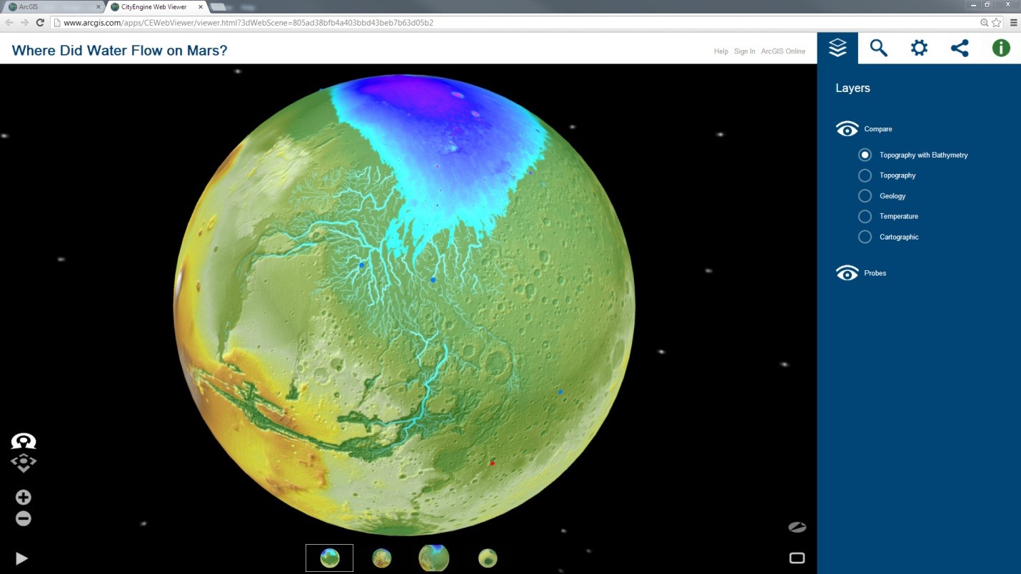
In the 2008 article ‘Where Did Water Flow on Mars? Modeling Mars’ surface in search of ancient rivers and oceans’ Witold Fraczek demonstrated how GIS can furnish support for the theory that at some time in the past, water did flow on the Martian surface. By utilizing NASA’s available Martian DEM and other supporting data layers, a hydrologic network was created by running a series of hydro functions. For this analysis, a selected section of the Martian DEM was treated in exactly the same way that a DEM from Earth would have been handled. A series of cylindrical projections were then exported from ArcMap and wrapped around 3D spheres to represent Mars. These 3D planet models were then imported into CityEngine as Collada where small selectable domes were added to represent the many probes that have successfully landed on Mars. Finally this model was exported as a 3D Web Scene and uploaded to ArcGIS online to easily share with the public. Since 3D Web Scenes are based on WebGL technology, no plug-in is required for most browsers.
To read more about how GIS helped to derive the Martian Ocean click here,
Exporting to a 3D Web Scene is currently available for CityEngine, ArcGlobe and ArcScene. 3D scenes and the ability to publish directly on the web is revolutionizing the way we share, collaborate, and communicate analysis results or design proposals with decision makers or the public. After all, our world is in 3D.
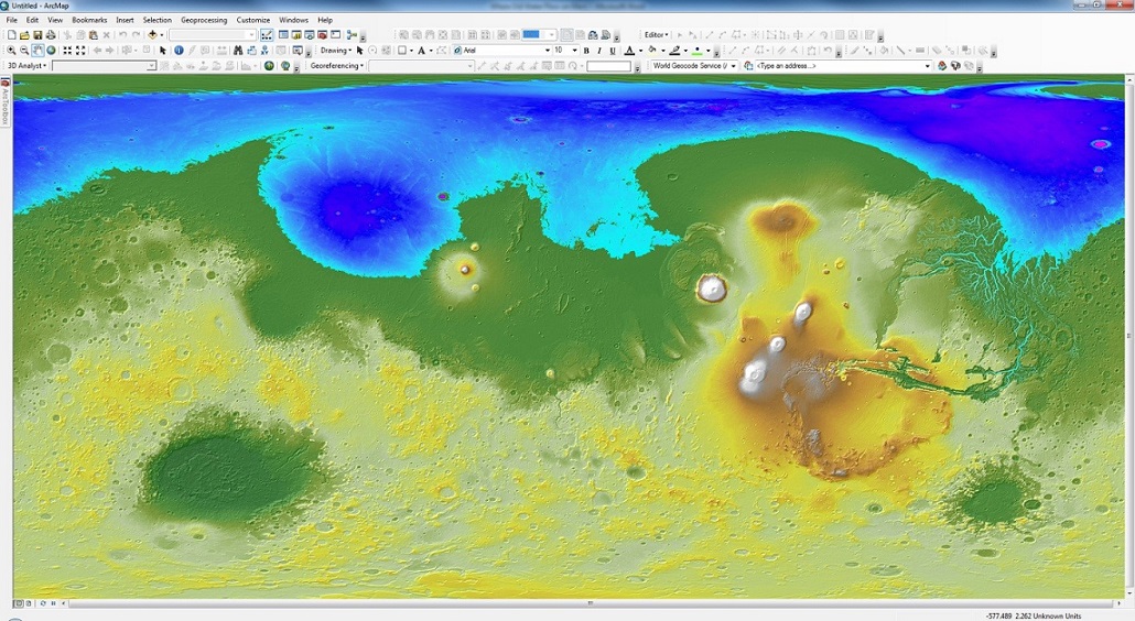
ArcMap is used to analyze the digital terrain model for Mars’ hydrological network.
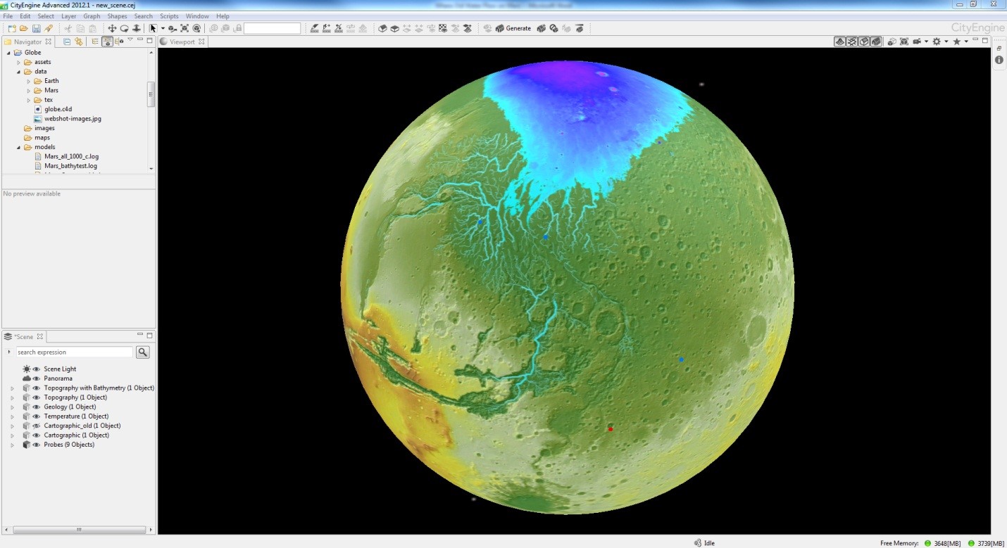
The cylindrical projection is then wrapped around a 3D sphere and imported into CityEngine as Collada.