- Home
- :
- All Communities
- :
- Products
- :
- 3D
- :
- 3D Questions
- :
- 3D feature's drawing interrupted by elevation sour...
- Subscribe to RSS Feed
- Mark Topic as New
- Mark Topic as Read
- Float this Topic for Current User
- Bookmark
- Subscribe
- Mute
- Printer Friendly Page
3D feature's drawing interrupted by elevation source
- Mark as New
- Bookmark
- Subscribe
- Mute
- Subscribe to RSS Feed
- Permalink
- Report Inappropriate Content
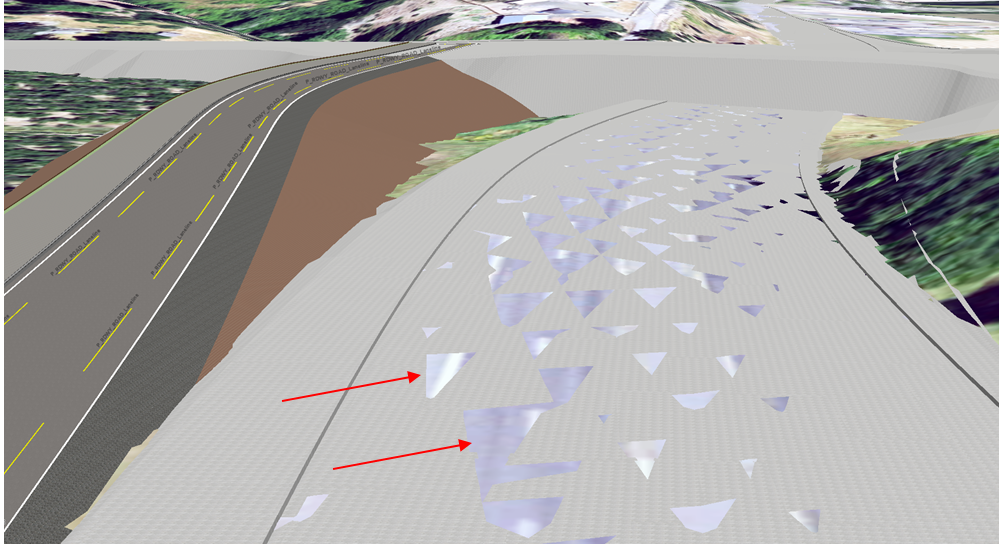
Using a custom PCS, I've converted some CAD road data from our roadway engineering department to GIS data. Things appear to be in the same coordinate system and matching up great most of the time.
Drawing in certain areas is conflicting with the 3D elevation source in a couple of places, though.
This is for a 3D model of an interchange and will be included in a story map, no need for it to be ultra-precise (don't tell the engineers!). I can't tell if the CAD data is off (possible) or I am missing a step...
My question is; is there a way to override the drawing order priorities in 3D mode? Or run a tool/processes that make the underlying imagery not artifact like the images below?
I've attempted to adjust the elevation heights of the roadway already. However, I can only adjust in 1/10ths of my unit of measurement (or .01) which is too much and makes the feature rise above the 3D source entirely.
I cannot seem to make the road layer elevation (+.001) for example, so it draws only ever-so-slightly above the feature underneath.
Your help is appreciated!
- Mark as New
- Bookmark
- Subscribe
- Mute
- Subscribe to RSS Feed
- Permalink
- Report Inappropriate Content


