- Home
- :
- All Communities
- :
- Products
- :
- 3D
- :
- 3D Blog
- :
- Extracting Building Footprints from Classified LiD...
Extracting Building Footprints from Classified LiDAR
- Subscribe to RSS Feed
- Mark as New
- Mark as Read
- Bookmark
- Subscribe
- Printer Friendly Page
- Report Inappropriate Content
As more and more organizations are obtaining High Density Airborne LiDAR, the opportunity to automate the extraction of Critical Infrastructural Data such as building footprints from such rich point-cloud is possible.
With properly classified LiDAR it is feasible to directly extract items of individual or multiple class codes into polygonal features. These class codes are used to seperate and denote features such as buildings, ground, bridges, vegetation, water, etc....
Learn More about LiDAR Class Codes here: Lidar point classification—Help | ArcGIS for Desktop
Using the "Attached" BuildingFootprintXtract toolbox for ArcGIS Pro, you can run through a 3 step process for generating building footprints from massive LiDAR Datasets.
Instructions:
Using ArcGIS Pro ensure that your Buildings are Classified in your LiDAR .las or .zlas files.
- You can visually assess Building Classification in the LiDAR Classification as Class Code 6


Run the LiDAR to Raster Tiles GP tool in the "Attached" BuildingFootprintXtract toolbox:
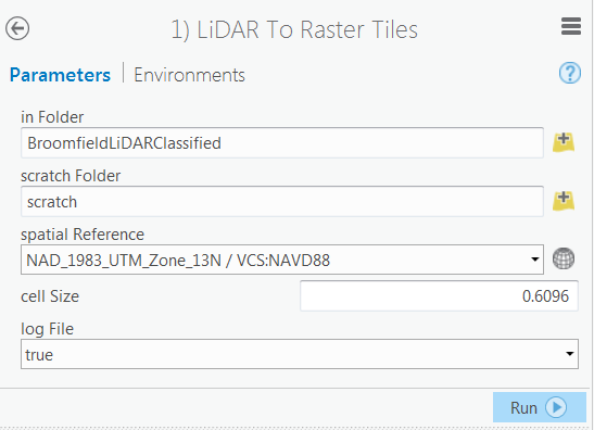
** The cell-Size will depend on the LiDAR Point Spacing. I typically run 2ft or 0.6096 meters here.**
*****We are currently in the process of optimizing this tool to process on multiple cores.******
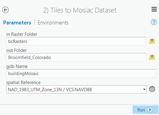
Run the Tiles to Mosaic Dataset tool in the "Attached" BuildingFootprintXtract toolbox:
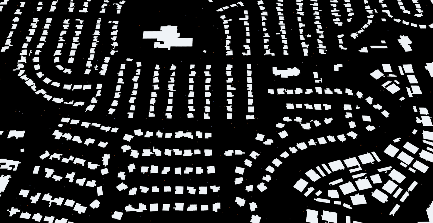
Run the Extract Footprints Polygons tool in the "Attached" BuildingFootprintXtract toolbox:


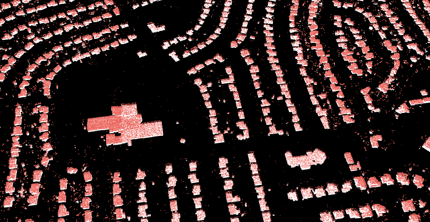
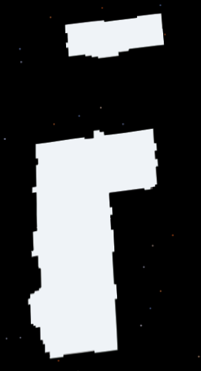
** Note the small artifacts that may exist where points were miss-classified in the LiDAR as buildings.**
To eliminate these.....
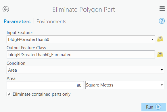
Run the Eliminate Polygon Part GP tool:
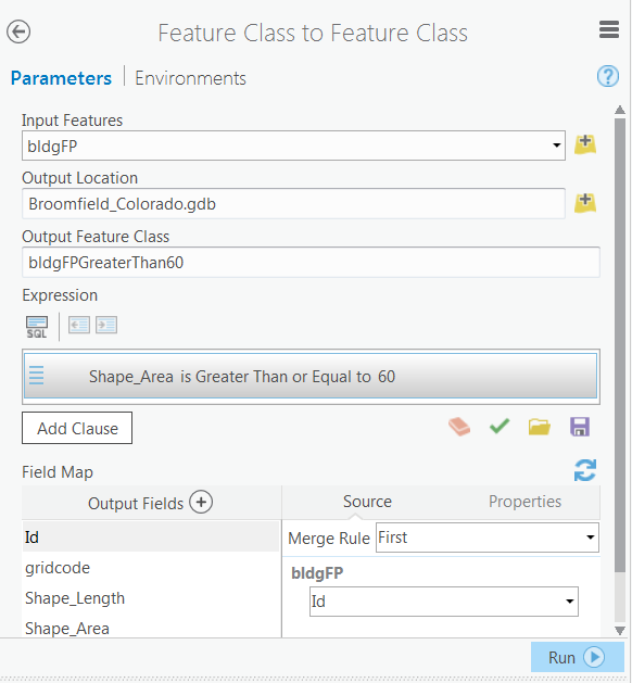

** I typically remove features smaller than 60sq meters or 645 feet.. **
In Some Cases Holes will exist in the middle of features where LiDAR point-clouds were either miss-classified or were non-existent.
To remove these holes run the "Eliminate Polgon Part" GP tool

Final Step:
Footprint Regularization.
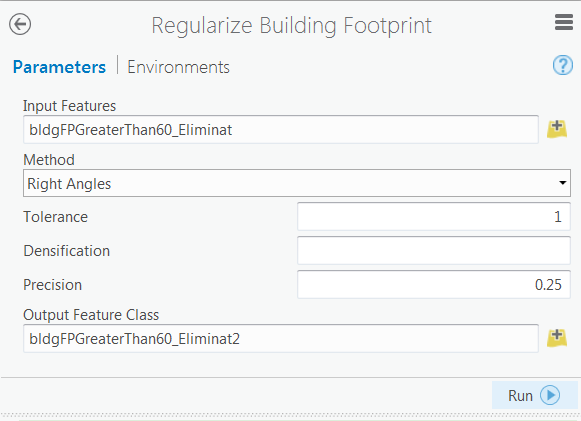
For further refinement of the extracted buildings please refer to Arthur Crawford's blog post concerning increased accuracy regularization of the extracted footprints:
Also, special thanks to Arthur for some of the key concepts behind the mosaic-approach to the footprint extraction process integrated leveraged in this toolbox.
To learn more about working with LiDAR come see us at the Esri IMF?

You must be a registered user to add a comment. If you've already registered, sign in. Otherwise, register and sign in.