Improve the reliability of ‘Flooding Prediction’ with 3D geospatial & geological modeling
- Subscribe to RSS Feed
- Mark as New
- Mark as Read
- Bookmark
- Subscribe
- Printer Friendly Page
- Report Inappropriate Content
In practice, many customers like hydrologists and water management are not satified with flooding analysis and prediction studies, especially, when those results are from GIS-based flooding modeling applications.
To improve the reliability of Flooding Disaster Prediction and Mapping, GIS experts with many hydrologists usally concentrate acquisition and processing high-resolution geospatial data like cloud points for higher DEM generation. Some flooding applications improve their analysis also via simulation...
However, the experiences show that those efforts would not produce more reliable analysis, because of differences in roughness, rock hardness of geological formations, flow depth, and slope, the timing of runoff from most parts of a watershed differing from that along the principal flow path (which is generally used to compute times of concentration).
Those GIS-based flooding apps are just 'simplified' hydrologic models. Besides, uncertainty analysis in those flooding models mostly ignores geological (and some of very important hydrologic) factors, which are usually major impacts on the reliability of flooding analysis and mapping. Hydrological modelling - Wikipedia, the free encyclopedia and Hydrological transport model - Wikipedia, the free encyclopedia
As well known, people commonly apply 3D geological modeling techology into groundwater analysis applications (attachment). In fact, when dealing with surface and surface-subsuface water applications, we also shouldn't ignore this important geological approach.
For example, when applying SWMM/RUNOFF algorithm in GIS-based flooding model, different rock hardness of geological formations, faults, soil and trees for infiltration, upland erosion (like CASC2D-SED, which simulates soil erosion from overland flow and routes sediment by size fractions to the outlet of a watershed) are hardly considered, even in some famous Surface Runoff Models (rainfalls, simplified recharges)…
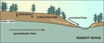
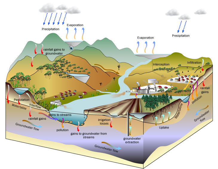
Illustration of water cycle
A similar intention (BUT, different implementation at all) to combine large quantities of outcrop data into a geodatabase can be referred at The SAFARI geodatabase: Exploring geological outcrop analogues for reservoir modeling | ArcGIS Blog
Certainly, without the details on both 3D surface and subsurface geology and hydrology, it is really chanlenging to get reliable flooding analysis and prediction...
You must be a registered user to add a comment. If you've already registered, sign in. Otherwise, register and sign in.