Mostly Mapping Map of the Day - July 26, 2017
- Subscribe to RSS Feed
- Mark as New
- Mark as Read
- Bookmark
- Subscribe
- Printer Friendly Page
- Report Inappropriate Content
Accidents happen, with more than six million crashes occurring annually on roads in the United States. But what if a web app could show you, on a map, where and when the current traffic crash risk is high in your community? Would you change the route you take or be more cautious? That web app is a reality for Indiana residents, who can visit the Daily Crash Prediction Map to find out the accident risk on roads throughout the state for the current day.
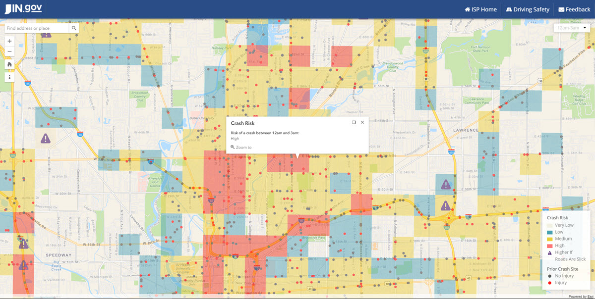
The interactive app, compiled and deployed using Esri technology, shows the probability of crashes across the state by time of day, using a predictive algorithm. The machine learning algorithm uses historical crash data, road conditions and characteristics, annual traffic volumes, population and employer information, gas prices, position of the sun, time of year and day, and other variables to predict the probability of a crash.
Read more about the app in Does Danger Lie Up the Road in the latest ArcWatch.
Public Safety https://community.esri.com/community/transportation?sr=search&searchId=18542516-cb7c-46d0-942b-b7bfb... https://community.esri.com/groups/departments-of-transportation?sr=search&searchId=c9894df6-ccf2-402...
You must be a registered user to add a comment. If you've already registered, sign in. Otherwise, register and sign in.