Mostly Mapping Map of the Day - August 27, 2014
- Subscribe to RSS Feed
- Mark as New
- Mark as Read
- Bookmark
- Subscribe
- Printer Friendly Page
- Report Inappropriate Content
When most people think of earthquakes in the United States, California usually comes to mind. There are thousands of significant faults in the state, but it's the San Andreas fault, forming the tectonic boundary between the Pacific and North American Plates, that is the most familiar. It's also along its southern reaches in the greater Los Angeles area where the San Andreas will be the likely source of the now overdue Big One—a quake exceeding magnitude 7.
When I first moved to California from tectonically tame Pennsylvania a friend joked that among other interesting benefits the state offers, I'd also enjoy a ringside seat to plate tectonics in action. I think of that every time I feel an earthquake. And as I look out from my patio, and view the mountain landscape created by the San Andreas and related faults, I sometimes fear the Big One.
A most recent, and destructive, example of California's earthquake activity was the South Napa earthquake, which struck California's Bay Area earlier this week on Sunday morning, August 24. The 6.0 magnitude temblor caused widespread damage, fires, hundreds of injuries, and knocked out power for tens of thousands of residents. Many buildings are currently uninhabitable. The damage costs are as yet unknown, but could potentially exceed a billion dollars.
Prior to the South Napa quake it had been 25 years since the last large temblor hit the area. In 1989 the Loma Prieta quake, weighing in at a magnitude 6.9, caused billions of dollars in damage, and killed dozens. The largest quake on record for the Bay Area was the 7.8 earthquake that hit San Francisco in 1906. According to Wikipedia the quake and associated fires are considered one of the worst natural disasters in the United States. The quake and ensuing fires, that burned for several days, destroyed nearly 80% of the city and claimed roughly 3,000 lives.
Our Mostly Mapping Map of the Day is a Story Map authored by Chris Ingram, of the Santa Clara County Fire Department, based in Los Gatos in California's Bay Area. The map tells the story of the disaster through the words of Henry Mitchell, a Captain in the San Francisco Fire Department at the time.
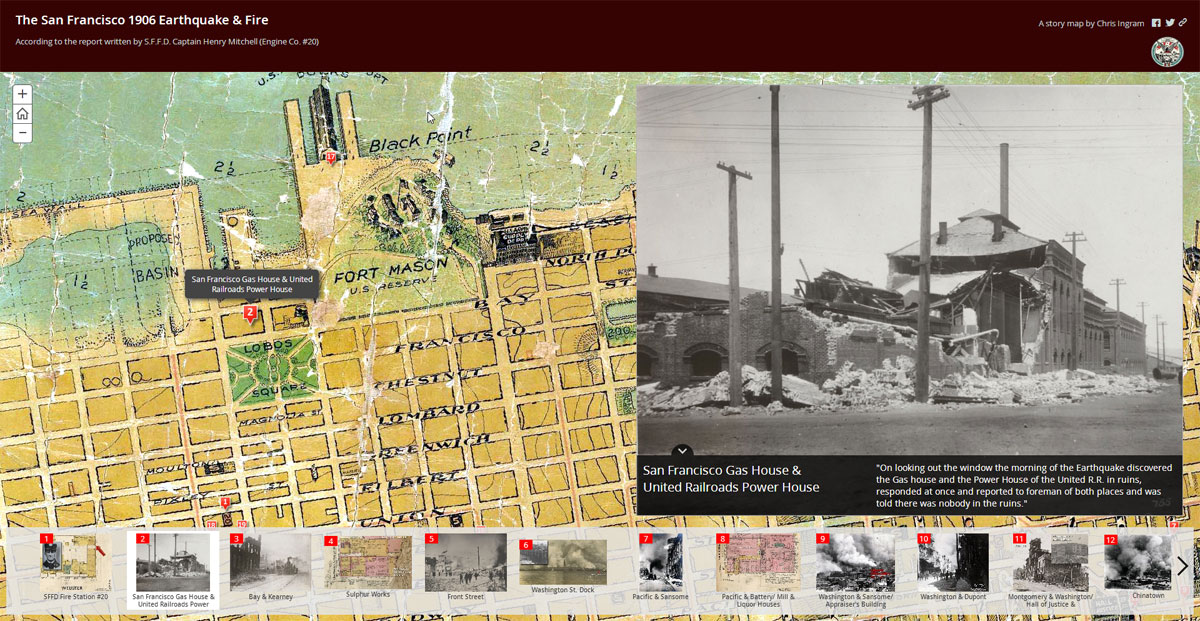
The Story Map uses an historic map of San Francisco that was georeferenced and published as a hosted tile service, along with photos and other historic maps to bring Mitchell's words in context. I think it's a great example of how words, photos, and old maps can tell a compelling story about past events, whose messages extend forward to today.
You must be a registered user to add a comment. If you've already registered, sign in. Otherwise, register and sign in.