Mostly Mapping Map of the Day - August 9, 2014
- Subscribe to RSS Feed
- Mark as New
- Mark as Read
- Bookmark
- Subscribe
- Printer Friendly Page
- Report Inappropriate Content
The Map of the Day today shows a near miss, actually two of them. Honolulu Mayor Kirk Caldwell said "We dodged a bullet" earlier today. It looks like he'll be able to say that once more.
Hurricane Iselle, which passed directly over the island, weakened to a tropical storm just hours before landfall. As it passed across the Big Island it caused only limited damage. The threat of a second storm—Hurricane Julio—also seems to be fading as it's forecast path will take it approximately 200 miles northeast from the nearest coastline.
The map below was captured from the Esri Disaster Response portal using the Hurricane and Cyclone Public Information Map. The application combines real-time weather data and forecasts from NOAA along with other layers (including social media), and shows hurricane paths across and around Hawaii.
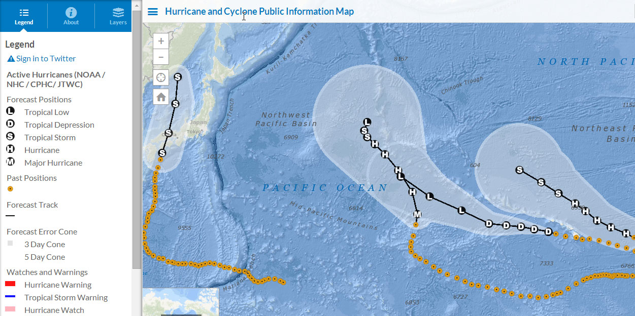
The Hurricane and Cyclone Map uses the Public Information app template—a hosted application template you can find and use from the Make A Web Application gallery.
You must be a registered user to add a comment. If you've already registered, sign in. Otherwise, register and sign in.