Excerpted LAS To Points Feature Class
- Subscribe to RSS Feed
- Mark as New
- Mark as Read
- Bookmark
- Subscribe
- Printer Friendly Page
- Report Inappropriate Content
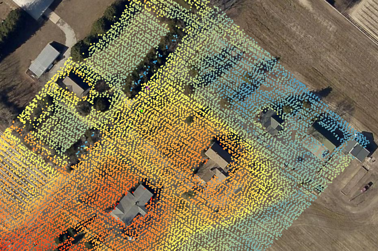
I looked around briefly this morning and was trying to determine how to get the class two bare earth point locations, for a specific area, into a point feature class (from QT Modeler to my project file geodatabase). My goal for this part of the project is to symbolize spot elevations based on elevations taken from the las file.
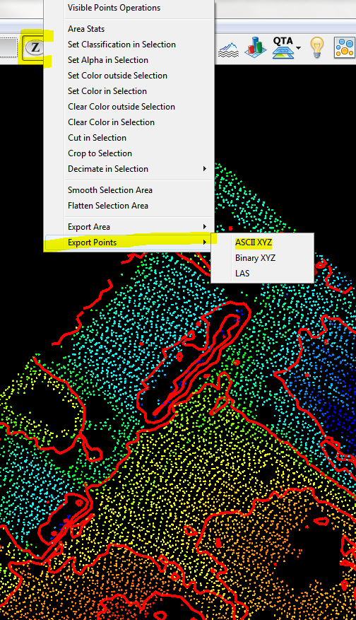
From within QT Modeler I used the Z-poly tool to first define my area of interest and then right-clicked to access the 'Export Point' menu.
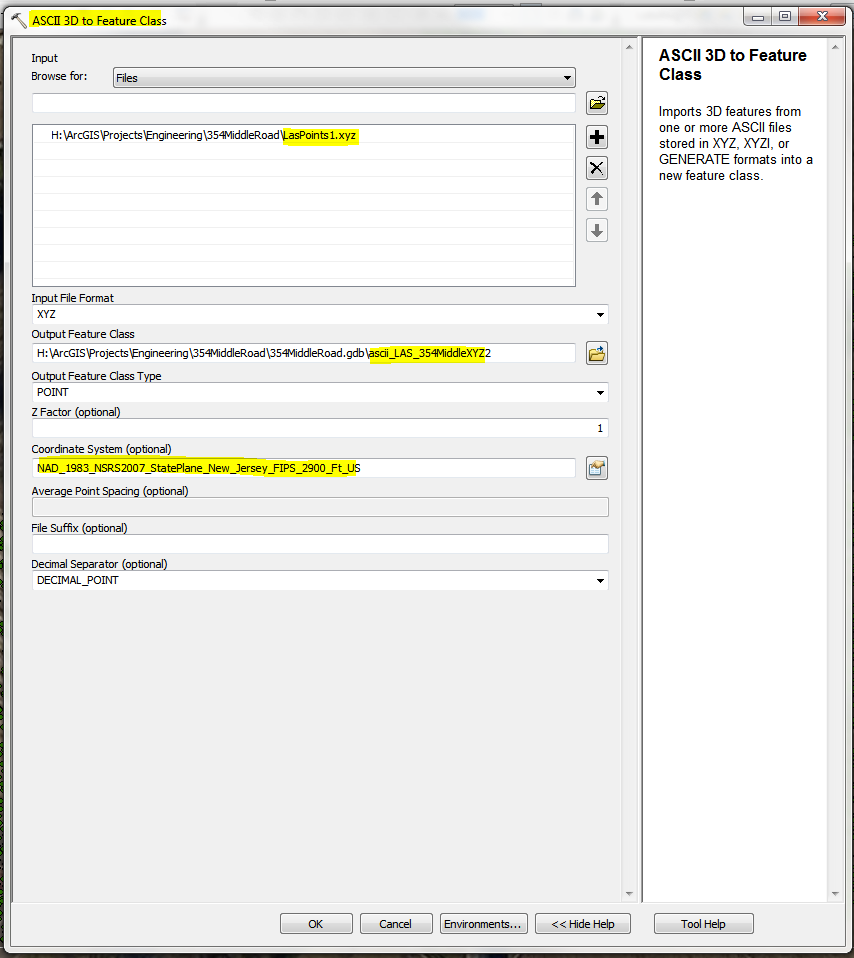
After activating the 3D Analyst extension, I was able to execute the 'ASCII 3D to Feature Class' tool and specified the feature class and input projection and coordinate system at the bottom
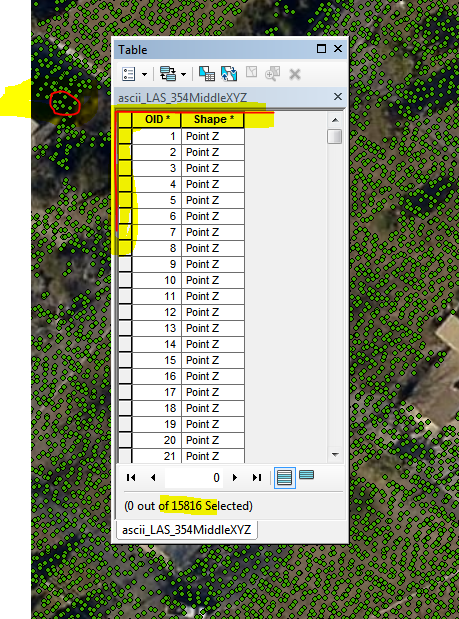
 This gave me a Z enabled point feature class that contained 15816 point features
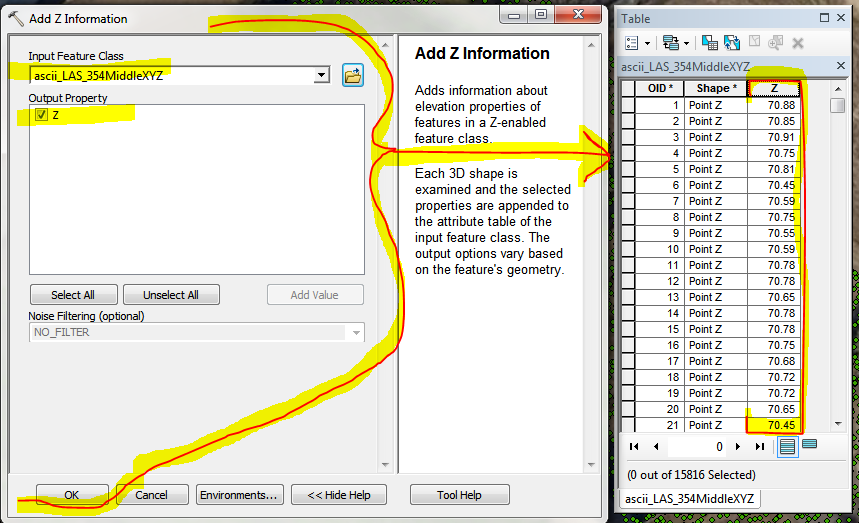
In order to symbolize by elevation, I will need the implicit Z values to be stored explicitly in the table.
'Add Z Information' tool menu:
Now I have all that I need for this aspect of the project, but its a dog and draws like a slow moving beast. In order to reduce the high level of redraw torture time, 'Dissolve':
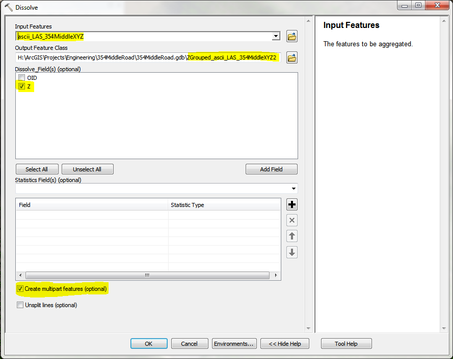
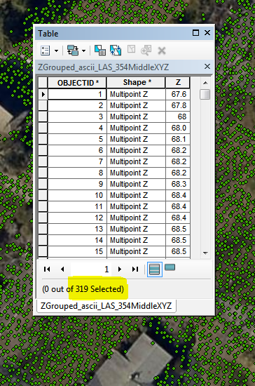
Now my redraw time is a snap and I have all that I need for this aspect of the elevation project requirements.
You must be a registered user to add a comment. If you've already registered, sign in. Otherwise, register and sign in.