Turn on suggestions
Auto-suggest helps you quickly narrow down your search results by suggesting possible matches as you type.
Cancel
- Home
- :
- All Communities
- :
- Products
- :
- 3D
- :
- 3D Blog
- :
- Significant update to the Local Government 3D Base...
Significant update to the Local Government 3D Basemaps Solution
Subscribe
2746
3
01-25-2019 09:10 PM
- Subscribe to RSS Feed
- Mark as New
- Mark as Read
- Bookmark
- Subscribe
- Printer Friendly Page
- Report Inappropriate Content
01-25-2019
09:10 PM
Make sure to check out the January 2019 release of the Local Government 3D basemap solution. This is a major release with a number of important updates:
- 40% reduction in steps required for elevation, 3D buildings, floors and 3D trees publishing.
- Faster processing speed when creating elevation layers.
- Faster processing speed when extracting and fusing buildings.
- Improved extraction quality and processing speed by adding the ability to:
- do automatic flat and sloped roof form segmentation.
- split building footprints by other features such as parcels.
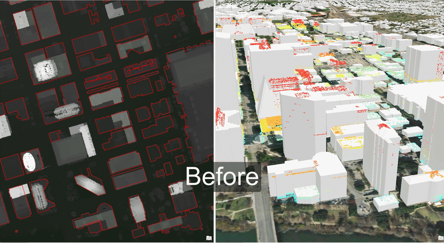
Before and after pre-processing the building footprints using splitting and auto-segmentation.
- Ability to add color to building roofs and facades.
- Tasks now work in any active scene.
- LOD1 Building creation now supports selection.
- Improved automatic unit conversion for default values in all tools.
- External Task files are included in the project.
- Support for ArcGIS Pro 2.3.
You can download the latest release of Local Government 3D basemaps solution here and please email feedback (bugs, enhancements) to gvanmaren@esri.com.
3 Comments
You must be a registered user to add a comment. If you've already registered, sign in. Otherwise, register and sign in.