- Subscribe to RSS Feed
- Mark as New
- Mark as Read
- Bookmark
- Subscribe
- Printer Friendly Page
- Report Inappropriate Content
Geometry Perhaps its due is overlooked.
A pictoral of some of the things you can do with a set of points with a basic license in ArcMap and PRO with a bit of python and a toolbox to house the scripts in.
:---- (1) -------------------------------------------------------------------------------------------------------------
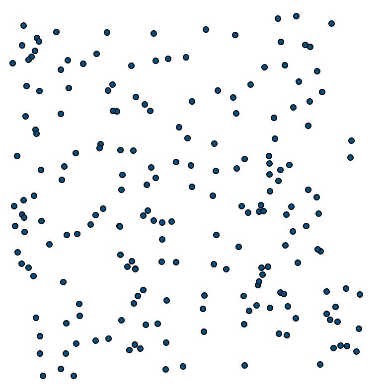
Begin with some points
Random they are, no order.
:---- (2) ------------------------------------------------------------------------------------------------------------------
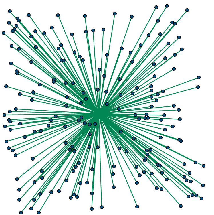
Put order to the set
A radial sort was performed so that the mess was ordered by their angle relative to the x-axis.
Lines were drawn to the center of the cloud (just because)
:---- (3) ------------------------------------------------------------------------------------------------------------------
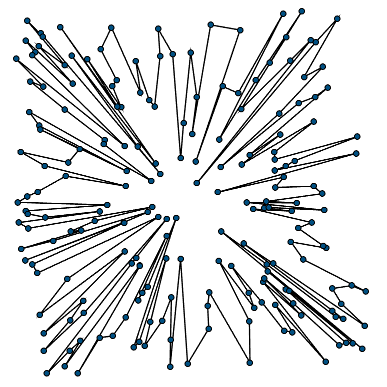
What do we have now
Since the points are ordered, connect the dots.
:---- (4) ------------------------------------------------------------------------------------------------------------------
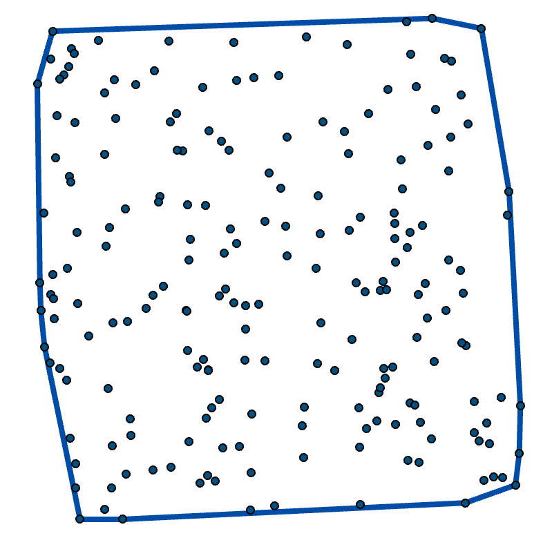
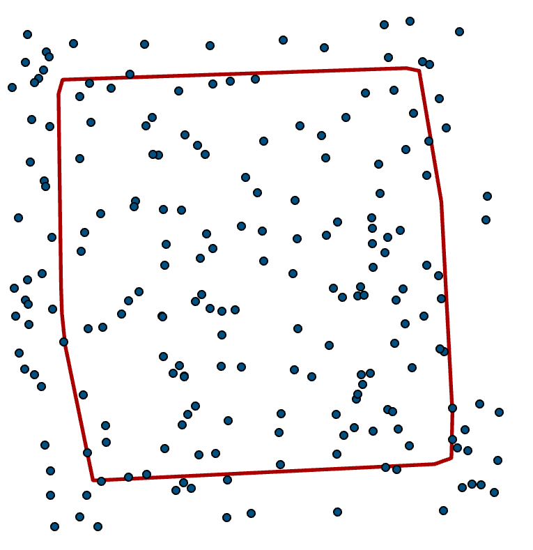
Lets look at things conventionally
Everyone loves a convex hull. It encompasses the points as a group. There are other containers.
:---- (5) ------------------------------------------------------------------------------------------------------------------
But some of the points are far from the center
A quick little negative buffer to only keep the points within 90% of the average distance to the center.
:---- (6) ------------------------------------------------------------------------------------------------------------------
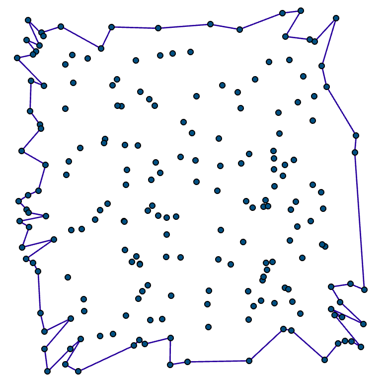
Convexity.... A different view on the data
Switching the selection in the above, then connecting the dots gives us a convex-ish hull..
Hmmm I wonder if you can change the rules to get a different view?
:---- (7) ------------------------------------------------------------------------------------------------------------------
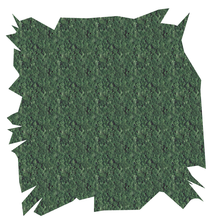
Every cool map has texture
Fill in boundary, obliterate the dots and 'forest' fill. Just because we can 
:---- (8) ------------------------------------------------------------------------------------------------------------------
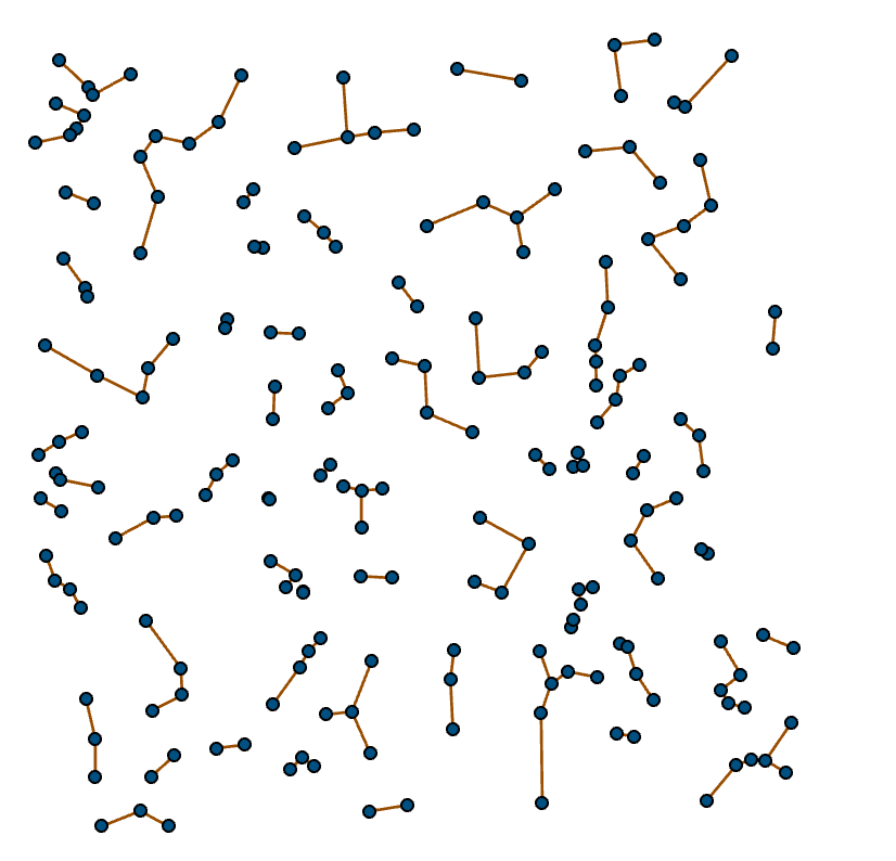
Connecting each point to its closest
:---- (9) ------------------------------------------------------------------------------------------------------------------
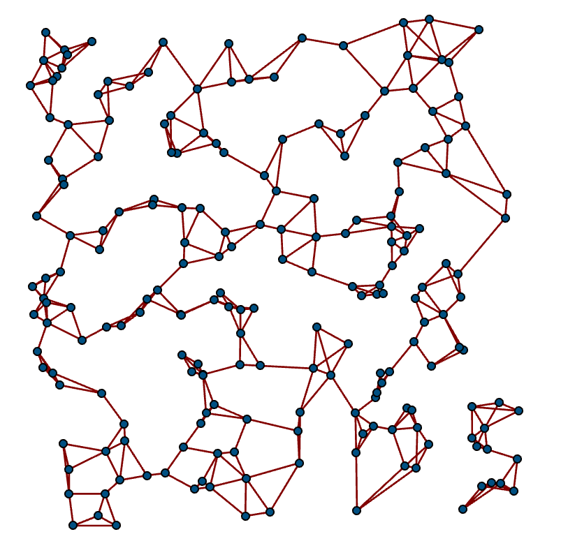
Connections to 3 closest
Starting to see groupings and spaces.
:---- (10) ------------------------------------------------------------------------------------------------------------------
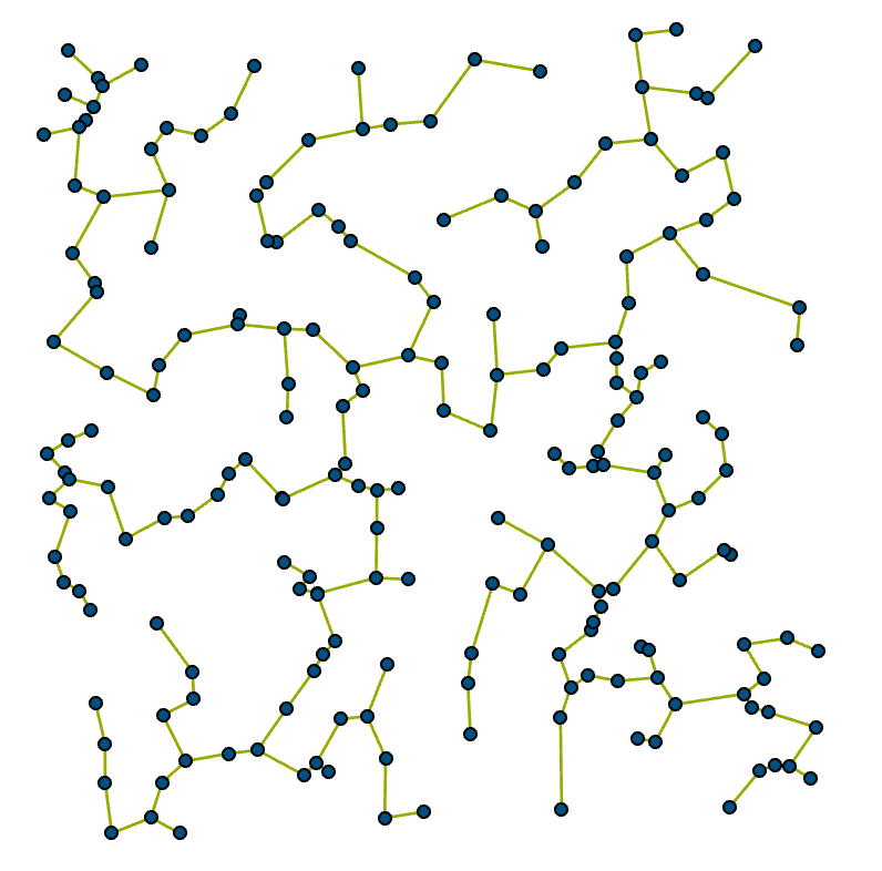
Trees are useful (MST)
:---- (11) ------------------------------------------------------------------------------------------------------------------
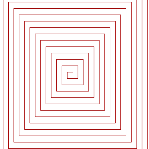
Make patterns from a single point (Ulam spiral)
:---- (12) ------------------------------------------------------------------------------------------------------------------
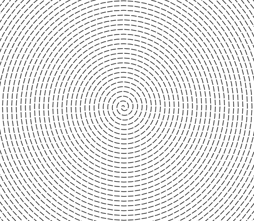
Archimedes only needed a single point
:---- (13) ------------------------------------------------------------------------------------------------------------------
:---- (14) ------------------------------------------------------------------------------------------------------------------
You must be a registered user to add a comment. If you've already registered, sign in. Otherwise, register and sign in.