- Home
- :
- All Communities
- :
- Products
- :
- ArcGIS Pro
- :
- ArcGIS Pro Questions
- :
- Re: How to “clear” the coordinate system of the “M...
- Subscribe to RSS Feed
- Mark Topic as New
- Mark Topic as Read
- Float this Topic for Current User
- Bookmark
- Subscribe
- Mute
- Printer Friendly Page
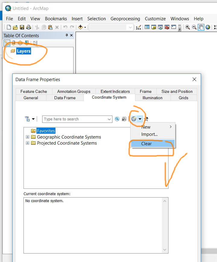
How to “clear” the coordinate system of the “Map” to get it to “unknown” in ArcGIS Pro,
- Mark as New
- Bookmark
- Subscribe
- Mute
- Subscribe to RSS Feed
- Permalink
- Report Inappropriate Content
How to “clear” the coordinate system of the “Map” to get it to “unknown” in ArcGIS Pro,
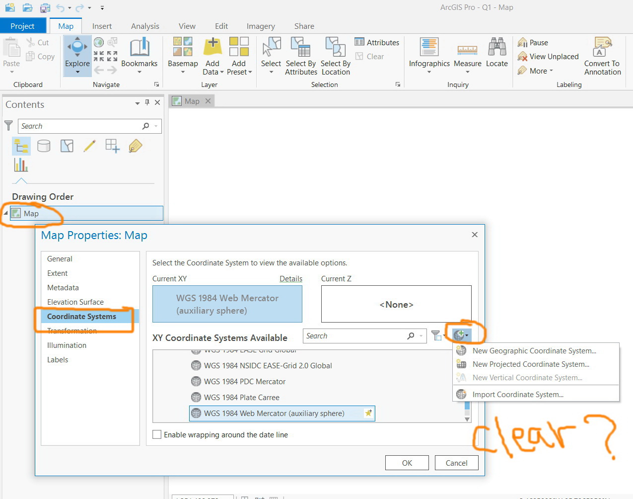
For example, in ArcMap, the clear option is available and one can set the “data frame” to unknown. I couldn’t figure out how to “clear” the coordinate system of the “Map” to get it to “unknown” in ArcGIS Pro as this option is not there
Jamal Numan
Geomolg Geoportal for Spatial Information
Ramallah, West Bank, Palestine
- Mark as New
- Bookmark
- Subscribe
- Mute
- Subscribe to RSS Feed
- Permalink
- Report Inappropriate Content
Hi Everyone,
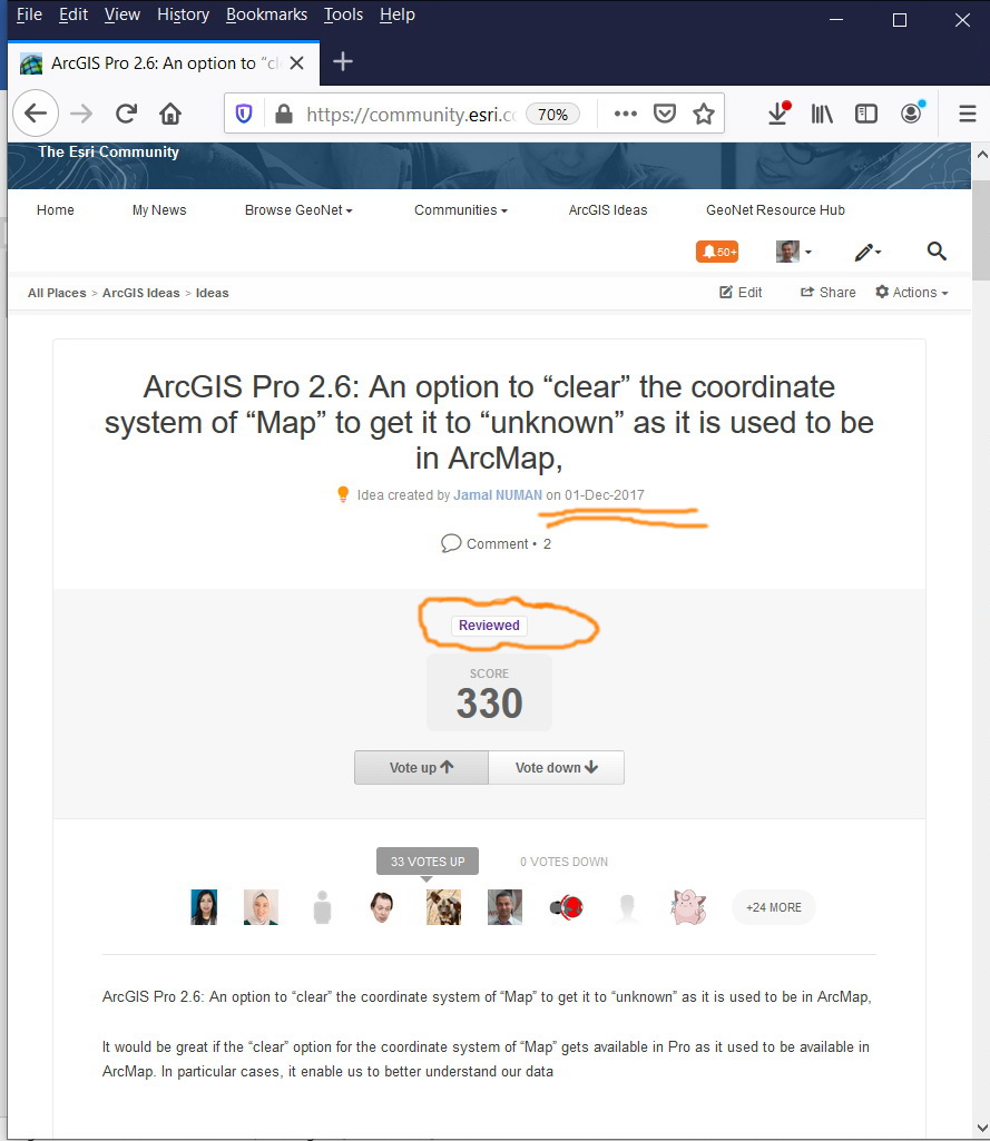
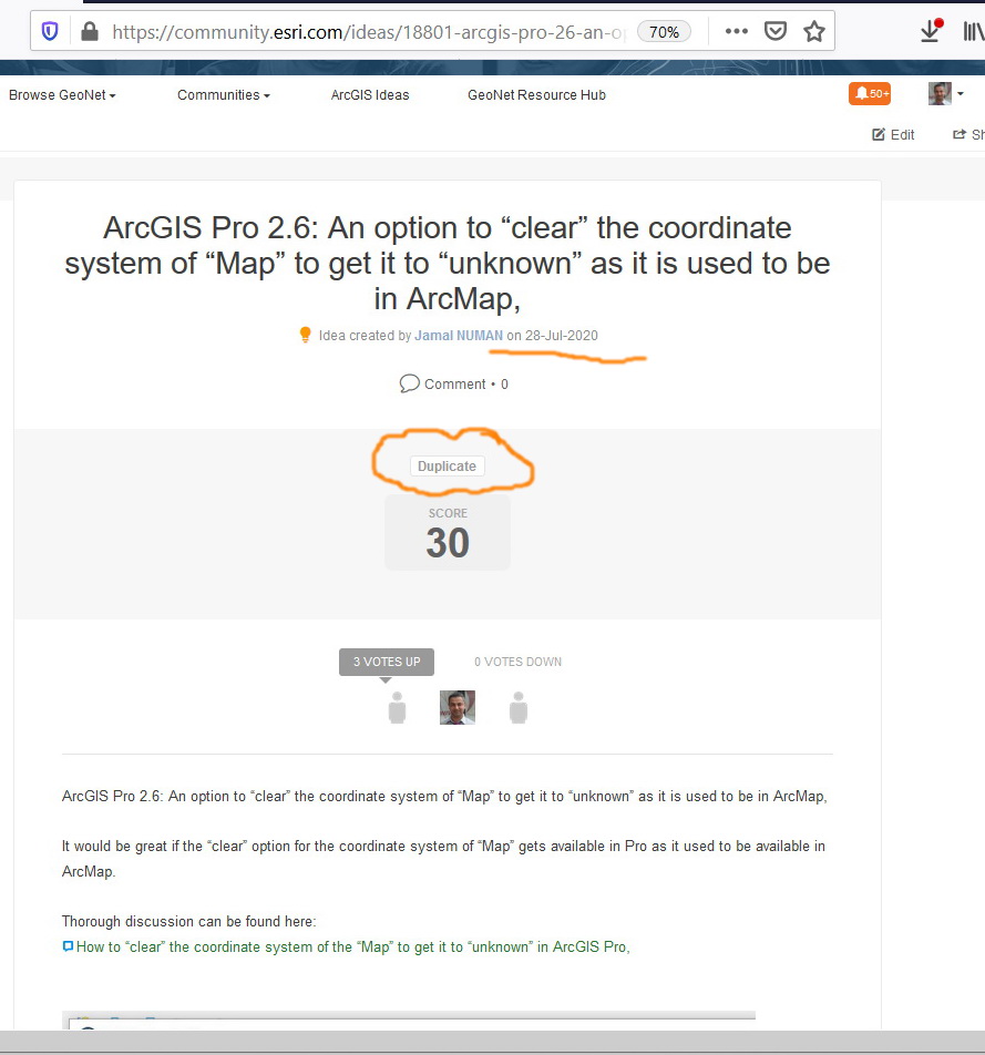
I forget myself that I have already posted this idea in December 2017. This is why I got duplicate mark for the new one.
Please, vote here on the old idea (juts I made little edit):
Jamal Numan
Geomolg Geoportal for Spatial Information
Ramallah, West Bank, Palestine
- Mark as New
- Bookmark
- Subscribe
- Mute
- Subscribe to RSS Feed
- Permalink
- Report Inappropriate Content
Workaround:
So I needed to correct an autocad generated shapefile coordinate reference system. The CRS defined was not correct and I didn't know what it was supposed to be until I troubleshoot a bit. I used to use "clear" projection or "define projection" and then set it to "None". Couldn't do it in ArcGIS Pro anywhere.
So I created a shapefile in ArcGIS pro - and didn't assign any CRS. Then I saved "unknown" projection as a favorite. Then I ran "Define Projection" on the one I needed to have cleared and set it to the other shapefile projection.
Ran successfully. Shapefile has no projection.
Alternatively I guess I could have just deleted the .prj from the shapefile.
Regardless, Project/Map interface would NOT clear or reset to unknown by any means. Please bring this option back. It really does help when trying to compare two shapefiles without a known transformation.
I guess I will use Global Mapper for that workaround.
(Be careful, ESRI. Global Mapper rocks on imagery and is a heck of alot cheaper!)
- Mark as New
- Bookmark
- Subscribe
- Mute
- Subscribe to RSS Feed
- Permalink
- Report Inappropriate Content
I just ran into this missing option today. We, too, need the Clear option for projections in Pro. I use this option like most of the others - a tool to "determine what projection/coordinate system are these coordinates REALLY in". For us, we sometimes receive data that has projection info set to one datum when really it is another datum. In other words, someone has used the define projection tool and defined it as one datum when it really isn't. (for SC is it HARN vs. not HARN which is not noticeable at small scales but is at large scales). We rarely receive "unknowns" anymore. I have run into quite a few people in GIS who do not have any experience with projections/transformations.
In fact, I was about to train someone in GIS on how to identify these issues with incoming data. I guess I will have to use ArcMAP!
We are never trying to use the Clear option for anything but data exploration to determine if there are projection issues.
I upvoted the idea.
Thanks,
Carmen
- Mark as New
- Bookmark
- Subscribe
- Mute
- Subscribe to RSS Feed
- Permalink
- Report Inappropriate Content
Dear Carmen,
Please, vote here:
https://community.esri.com/ideas/17163
hope this will be enhanced in 2.7
Jamal Numan
Geomolg Geoportal for Spatial Information
Ramallah, West Bank, Palestine
- Mark as New
- Bookmark
- Subscribe
- Mute
- Subscribe to RSS Feed
- Permalink
- Report Inappropriate Content
Hi Jamal - development work was started on the ability to clear the coordinate system of a dataset in ArcGIS Pro. However, it doesn't look like it will make it into 2.7. Because it was already well underway, I imagine it will likely be in the 2.8 release...
- Mark as New
- Bookmark
- Subscribe
- Mute
- Subscribe to RSS Feed
- Permalink
- Report Inappropriate Content
Not sure if it's implemented in 3.0
Jamal Numan
Geomolg Geoportal for Spatial Information
Ramallah, West Bank, Palestine
- Mark as New
- Bookmark
- Subscribe
- Mute
- Subscribe to RSS Feed
- Permalink
- Report Inappropriate Content
I have been tracking this thread and in the latest version of Pro and I do not see this option. Any other feedback from developers?
- Mark as New
- Bookmark
- Subscribe
- Mute
- Subscribe to RSS Feed
- Permalink
- Report Inappropriate Content
https://pro.arcgis.com/en/pro-app/latest/help/mapping/properties/specify-a-transformation.htm

According to this documentation you can select "Do not transform" for each layer in the map.
In TOC right click on the map name and select Properties.
In the Transformations pane select "Do not transform" from the drop down menu for each layer.

I know this doesn't do what the original post was asking but it might help for those who use the clear coordinate system feature to stop the on the fly transformations for QC or other purposes.
- « Previous
- Next »
- « Previous
- Next »