- Home
- :
- All Communities
- :
- Developers
- :
- Native Maps SDKs
- :
- Qt Maps SDK Questions
- :
- Colorization Based Elevation
- Subscribe to RSS Feed
- Mark Topic as New
- Mark Topic as Read
- Float this Topic for Current User
- Bookmark
- Subscribe
- Mute
- Printer Friendly Page
Colorization Based Elevation
- Mark as New
- Bookmark
- Subscribe
- Mute
- Subscribe to RSS Feed
- Permalink
- Report Inappropriate Content
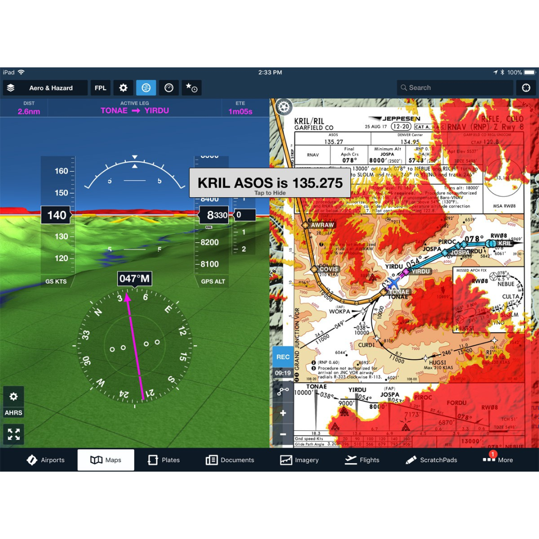
I want to be able to color the map according to elevation relative to an altitude. I am having trouble finding an example. Hopefully someone here can point me in the right direction. The attached image shows some colorization levels relative to the altitude of an aircraft on approach, red is at or above current aircraft levels and the other colors at lower and lower thresholds.
How can I use the terrain data to achieve similar colorization using the ArcGIS Qt C++ SDK? I need to do it on a 2D as well as a 3D map.
Any and all help is much appreciated!
Thanks!
- Mark as New
- Bookmark
- Subscribe
- Mute
- Subscribe to RSS Feed
- Permalink
- Report Inappropriate Content
Yes, you should be able to do this. I think a ColormapRenderer applied to a RasterLayer might be the best option. Check out this sample - arcgis-runtime-samples-qt/ArcGISRuntimeSDKQt_CppSamples/Layers/RasterColormapRenderer at master · Es...
The idea is that you map pixel values in the raster to a specific color. In our sample, anything over 150 is red and under is yellow.
- Mark as New
- Bookmark
- Subscribe
- Mute
- Subscribe to RSS Feed
- Permalink
- Report Inappropriate Content
Depending on your data, you might look at either the StretchRenderer (StretchRenderer Class | ArcGIS for Developers ) or applying a RasterFunction (Add raster data—ArcGIS Runtime SDK for Qt | ArcGIS for Developers )
The ColorRamp may work but may be better suited for discrete data vs continuous elevation data.