- Home
- :
- All Communities
- :
- Products
- :
- ArcGIS Pro
- :
- ArcGIS Pro Questions
- :
- ArcGIS Pro: How to set the DEFAULT coordinate syst...
- Subscribe to RSS Feed
- Mark Topic as New
- Mark Topic as Read
- Float this Topic for Current User
- Bookmark
- Subscribe
- Mute
- Printer Friendly Page
ArcGIS Pro: How to set the DEFAULT coordinate system for Maps in a Project?
- Mark as New
- Bookmark
- Subscribe
- Mute
- Subscribe to RSS Feed
- Permalink
- Report Inappropriate Content
ArcGIS Pro: How to set the DEFAULT coordinate system for Maps in a Project?
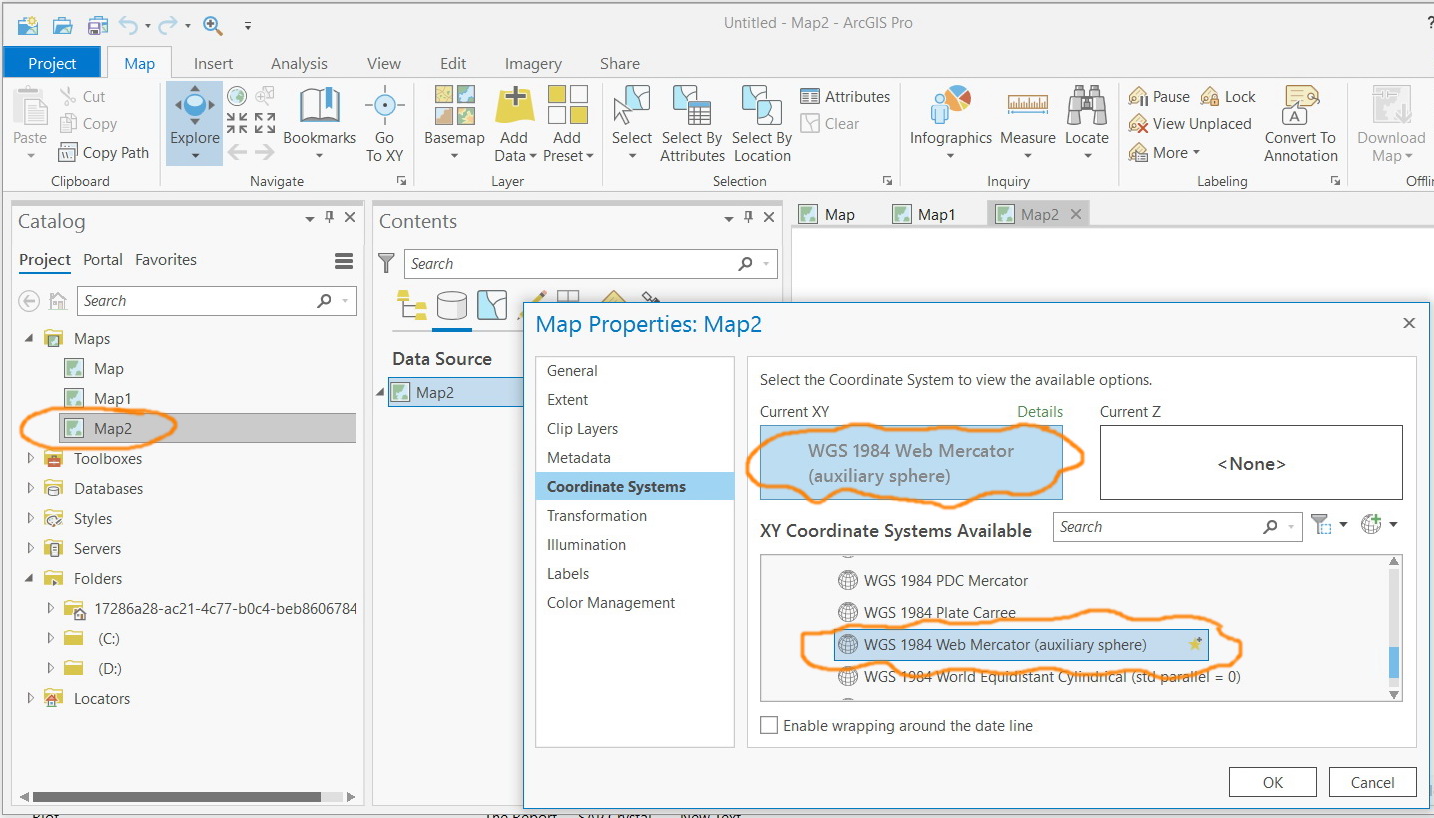
I observed that the default coordinate system for created maps is “WGS 1984 Web Mercator (auxiliary sphere)_1”.
How this can be switched at the level of Pro for all created projects (aprx) and their maps?
Jamal Numan
Geomolg Geoportal for Spatial Information
Ramallah, West Bank, Palestine
Solved! Go to Solution.
Accepted Solutions
- Mark as New
- Bookmark
- Subscribe
- Mute
- Subscribe to RSS Feed
- Permalink
- Report Inappropriate Content
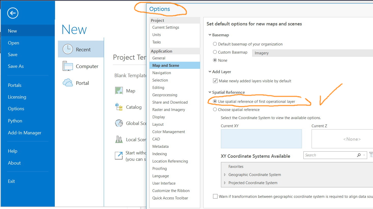
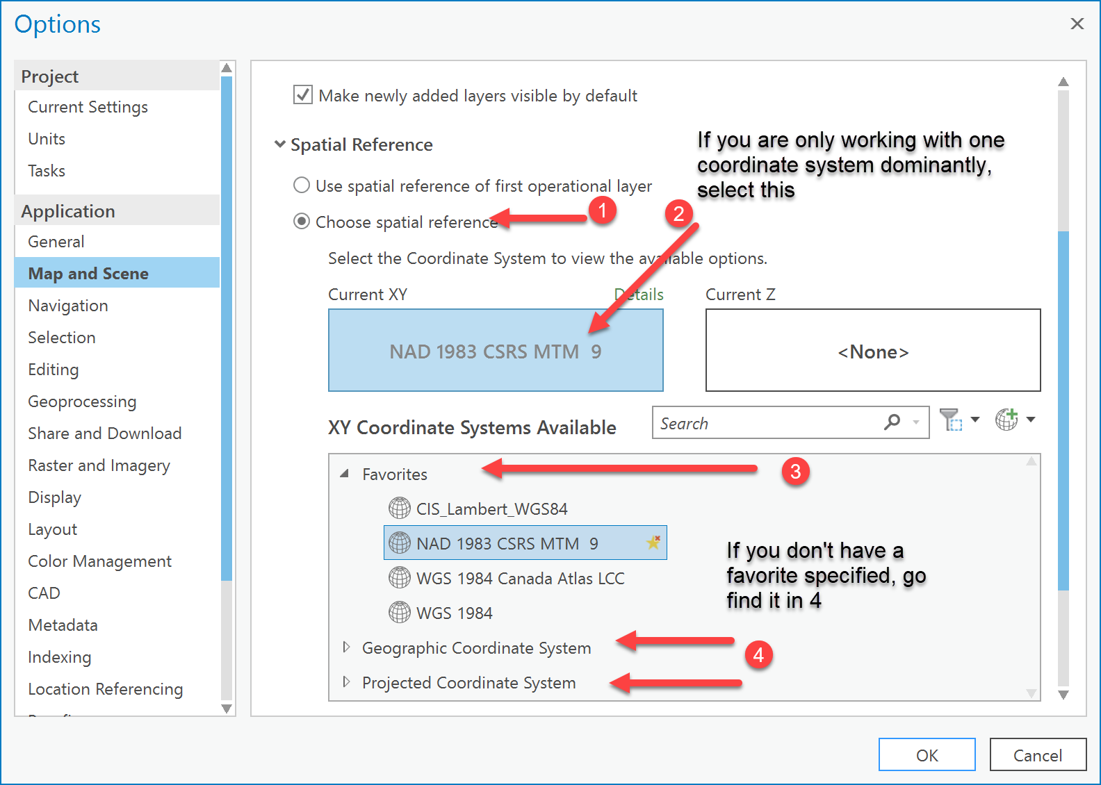
You select the radio button under your checkmark. If you have added one to Favorites, you should be able to select it otherwise you will have to scroll through the Geographic and Projected coordinate systems to find the one you want
- Mark as New
- Bookmark
- Subscribe
- Mute
- Subscribe to RSS Feed
- Permalink
- Report Inappropriate Content
Like this...
- Mark as New
- Bookmark
- Subscribe
- Mute
- Subscribe to RSS Feed
- Permalink
- Report Inappropriate Content
Thanks Dan. It works fine with me.
I do still prefer to work with the “undefined” Map that is used to be the default behavior for "data frame" in ArcMap
Jamal Numan
Geomolg Geoportal for Spatial Information
Ramallah, West Bank, Palestine
- Mark as New
- Bookmark
- Subscribe
- Mute
- Subscribe to RSS Feed
- Permalink
- Report Inappropriate Content
You have raised that before, but it doesn't seem to be in the cards, perhaps the User Interface options for projects again would be the best place. I do know that a number of tools are now disabled if the coordinate system and units are unknown or unspecified.