- Home
- :
- All Communities
- :
- User Groups
- :
- 911 GIS
- :
- Questions
- :
- Re: NENA Standard for NG 911 GIS Data Model
- Subscribe to RSS Feed
- Mark Topic as New
- Mark Topic as Read
- Float this Topic for Current User
- Bookmark
- Subscribe
- Mute
- Printer Friendly Page
NENA Standard for NG 911 GIS Data Model
- Mark as New
- Bookmark
- Subscribe
- Mute
- Subscribe to RSS Feed
- Permalink
- Report Inappropriate Content
Has anyone created a file geodatabase or xml schema document that, to the extent possible, implements the full data model defined in NENA NG911 for GIS standard?
If so, I (and perhaps others) would find it hugely helpful to get access to that in order to save the time it will take to define the feature classes.
Many thanks,
Adam
- Mark as New
- Bookmark
- Subscribe
- Mute
- Subscribe to RSS Feed
- Permalink
- Report Inappropriate Content
Bill, I don't understand your question, contact me offline
- Mark as New
- Bookmark
- Subscribe
- Mute
- Subscribe to RSS Feed
- Permalink
- Report Inappropriate Content
Hello Jon,
If all public agencies adopt the NENA NG911 GIS standards as production streets line, address points, etc. can commercial vendors consume them into their products?
For example, getting local data into the 911 systems faster.
Using the NENA GIS standards as our production enterprise geodatabase feature classes, we would COGO in a new tract map for a 200 lot subdivision including street lines, address points, etc.
Then we upload it to Esri StreetMap Premium, Here Maps, Apple Maps, Google Maps, Waze Maps, etc. and the vendors add-on additional attributes/features to make their products work as usual.
These are the same commercial products which are used by many Public Safety 911 systems struggling with this same issue as listed in at least 20 other areas of GeoNet.
References:
DevSummit 2018 User Presentation
GIS
Thank you,
-Bill
- Mark as New
- Bookmark
- Subscribe
- Mute
- Subscribe to RSS Feed
- Permalink
- Report Inappropriate Content
@Bill - Given that NG911 GIS Data model is an open standard, any software developer is free to study the model and develop the code necessary import data from this model into their own product's backend. The inverse is also true as it relates to exporting those vendors' data to the NG911 model.
Will they actually go to the trouble to do this? Ultimately, the software vendor has to decide it's in their interest to do so. But, you can always vote with your organization's dollars.
- Mark as New
- Bookmark
- Subscribe
- Mute
- Subscribe to RSS Feed
- Permalink
- Report Inappropriate Content
I downloaded the schema provided by John Hall in this thread " The GIS templates are a direct interpretation of the NG9-1-1 GIS Data Model (NENA-STA-006.1-2018)".
Since this comment is from July 2018 and it looks like it was just a proposed schema, can anyone tell me if this is still what the schema is going to be? FYI I am in the state of California.
Thanks
Katy
- Mark as New
- Bookmark
- Subscribe
- Mute
- Subscribe to RSS Feed
- Permalink
- Report Inappropriate Content
Katy-
STA-006.1 is the final, published version 1 schema definition. A version 2 update to the GIS Data Model schema is planned, future work, as NENA's NG9-1-1 "i3" architecture matures.
The Public Review version of "NENA GIS Data Template Zip Files", published August 27, 2019, were a "proposed" geodatabase implementation of the "final" version 1 schema definition. After the Public Review comments were discussed, a few final changes were made in the file geodatabase implementation, metadata was updated, and the work group wrapped-up last week. NENA should publish an announcement soon, when the "final" geodatabase implementation of the STA-006.1 schema is available to download from National Emergency Number Association
- Mark as New
- Bookmark
- Subscribe
- Mute
- Subscribe to RSS Feed
- Permalink
- Report Inappropriate Content
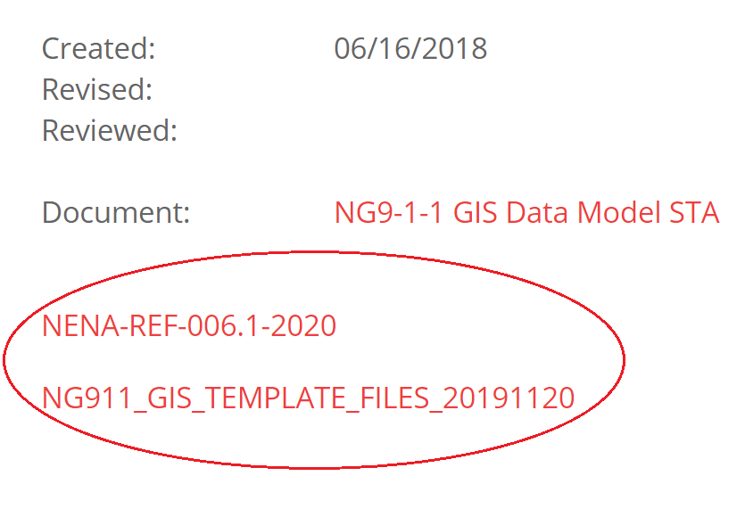
At the bottom of the GIS Data Model standard page, STA-006.1-2018, the download links have been posted for the 11/20/2019 release of an empty file geodatabase, "NG911_GIS_TEMPLATE_FILES_20191120.zip",
and a reference document "NENA-REF-006.1-2020.pdf"
https://www.nena.org/page/NG911GISDataModel
- Mark as New
- Bookmark
- Subscribe
- Mute
- Subscribe to RSS Feed
- Permalink
- Report Inappropriate Content
This schema is housed under the STA-006 document and can be found at the bottom of the following page: https://www.nena.org/page/NG911GISDataModel
a direct link to the zip file is below for your convenience.
https://www.nena.org/resource/resmgr/standards/NG911_GIS_TEMPLATE_FILES_201.zip
within the zip file, you will find multiple files, shown in the attached screenshot.

- Mark as New
- Bookmark
- Subscribe
- Mute
- Subscribe to RSS Feed
- Permalink
- Report Inappropriate Content
What is the status of 911 calls you receive regarding these two legal requirements?
Kari’s Law
- Not required to first dial a “9” to get an outside line
- Notification requirements to front desk or similar location intended to facilitate building entry by first responders
And
Ray Baum’s Act
- Automatic dispatchable location information requirements
Can you please include a few screen-shots of 911 calls placed from phones in your different agency offices and public ones?
I’m curious what dispatchable location information currently comes over automatically with 911 calls.
For example:
- Validated street address of the calling party
- Plus additional caller specific details mentioned in the NENA GIS NG911 layer design for address points such as:
- Complex Name
- Building Number
- Floor
- Unit
- Room/Office/Suite/Apartment Number
- Seat
Thank you,
-Bill
- « Previous
- Next »
- « Previous
- Next »