- Home
- :
- All Communities
- :
- Products
- :
- ArcGIS Pro
- :
- ArcGIS Pro Questions
- :
- Re: Where the RMSE of Georeferencing is displayed ...
- Subscribe to RSS Feed
- Mark Topic as New
- Mark Topic as Read
- Float this Topic for Current User
- Bookmark
- Subscribe
- Mute
- Printer Friendly Page
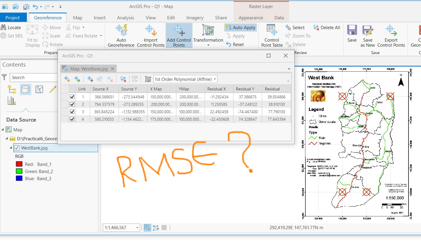
Where the RMSE of Georeferencing is displayed in ArcGIS Pro?
- Mark as New
- Bookmark
- Subscribe
- Mute
- Subscribe to RSS Feed
- Permalink
- Report Inappropriate Content
Where the RMSE of Georeferencing is displayed in ArcGIS Pro?
I couldn’t figure out where the RMSE of Georeferencing is displayed in ArcGIS Pro.

Jamal Numan
Geomolg Geoportal for Spatial Information
Ramallah, West Bank, Palestine
- Mark as New
- Bookmark
- Subscribe
- Mute
- Subscribe to RSS Feed
- Permalink
- Report Inappropriate Content
In 2.3 release, I could see values for the forward, inverse, and forward-inverse residuals but not for the Total RMSE as used to be in the ArcMap.
Is this by design?

Jamal Numan
Geomolg Geoportal for Spatial Information
Ramallah, West Bank, Palestine
- Mark as New
- Bookmark
- Subscribe
- Mute
- Subscribe to RSS Feed
- Permalink
- Report Inappropriate Content
Okay, so it's not currently reported but is being fixed. I see.
- Mark as New
- Bookmark
- Subscribe
- Mute
- Subscribe to RSS Feed
- Permalink
- Report Inappropriate Content
It would be great if we hear back from esri staff
Jamal Numan
Geomolg Geoportal for Spatial Information
Ramallah, West Bank, Palestine
- Mark as New
- Bookmark
- Subscribe
- Mute
- Subscribe to RSS Feed
- Permalink
- Report Inappropriate Content
Jamal - still in the Product Plan but don't know when. Sorry to be vague.
- Mark as New
- Bookmark
- Subscribe
- Mute
- Subscribe to RSS Feed
- Permalink
- Report Inappropriate Content
The total RMSE appears not to be available in 2.4.1

Jamal Numan
Geomolg Geoportal for Spatial Information
Ramallah, West Bank, Palestine
- Mark as New
- Bookmark
- Subscribe
- Mute
- Subscribe to RSS Feed
- Permalink
- Report Inappropriate Content
I subscribed to the bug to add to the pressure - but the bug now says it was addressed and fixed "near term" modified 8/9. That's a good sign it will be in 2.4.2. We can hope! Thank for pushing Jamal, I think the overall number is needed too!
- Mark as New
- Bookmark
- Subscribe
- Mute
- Subscribe to RSS Feed
- Permalink
- Report Inappropriate Content
As Jamal has already alluded to, the RMS errors are reported in the Heads up display.
There are 3 types of RMS that we report in both types of software. The Forward transformation is always the default RMS. But if you show all three types of errors in both software programs, you can see they are both available in both sortware.


As you can see the top Image from Pro is the same as the bottom image from ArcMap (slight difference in rounding).
Please let me know if there is still any confusion. There is no real bug; simply an enhancement that some users were requesting it in BOTH the heads-up display and the table.
- Mark as New
- Bookmark
- Subscribe
- Mute
- Subscribe to RSS Feed
- Permalink
- Report Inappropriate Content
I couldn’t find any information in the help that explains what these values mean in terms of geometry neither having figures (pictures) that better explain the idea. I would appreciate if you guide me for such integrated resources.
Jamal Numan
Geomolg Geoportal for Spatial Information
Ramallah, West Bank, Palestine
- Mark as New
- Bookmark
- Subscribe
- Mute
- Subscribe to RSS Feed
- Permalink
- Report Inappropriate Content
I do not have any illustrations, but the last third paragraph of this section should explain it.
It is not a mathematical concept we have created, so perhaps there are illustrations on some other math related sources on the web.
- Mark as New
- Bookmark
- Subscribe
- Mute
- Subscribe to RSS Feed
- Permalink
- Report Inappropriate Content
Thanks Simon. The link is not working
Jamal Numan
Geomolg Geoportal for Spatial Information
Ramallah, West Bank, Palestine