- Home
- :
- All Communities
- :
- User Groups
- :
- CAD/GIS Data Integration
- :
- Questions
- :
- Re: Spatial Adjustment in ArcPro?
- Subscribe to RSS Feed
- Mark Topic as New
- Mark Topic as Read
- Float this Topic for Current User
- Bookmark
- Subscribe
- Mute
- Printer Friendly Page
Spatial Adjustment in ArcPro?
- Mark as New
- Bookmark
- Subscribe
- Mute
- Subscribe to RSS Feed
- Permalink
- Report Inappropriate Content
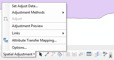
ArcMap Spatial Adjustment Toolbar..... How I miss you! Where did this go in ArcPro? I just want to move a dataset that is not projected into the correct location using established reference points. Georeferencing of rasters in ArcPro seems to be similar as in ArcMap, but editing a feature class to move/stretch it (or even multiple feature classes of different types in the same workspace) does not seem to be a possibility.
Do I need to be employing the Conflation toolset with rubbersheeting abilities? This seems overly awkward and not at all like the methodology (similar to georeferencing) employed in ArcMap. Maybe I need to use editing tools like "transform" or similar?
Just trying to establish a similar workflow for georeferencing unprojected CAD data in ArcPro. Any thoughts are appreciated. Thank you.
Justin
- Mark as New
- Bookmark
- Subscribe
- Mute
- Subscribe to RSS Feed
- Permalink
- Report Inappropriate Content
Related question and answer: https://community.esri.com/ideas/15484-add-spatial-adjustment-toolbar-to-arcgis-pro
- Mark as New
- Bookmark
- Subscribe
- Mute
- Subscribe to RSS Feed
- Permalink
- Report Inappropriate Content
Justin Bakken, has looking through the link Melita sent from Kory Kramer helped with your issue? Are you able to use the Rubber sheeting tools in Pro to do the adjustments you need?
- Mark as New
- Bookmark
- Subscribe
- Mute
- Subscribe to RSS Feed
- Permalink
- Report Inappropriate Content
Just figured out a good way to georeference vectors in ArcPro. The key is to export the source layer to a CAD file. This can be done with the tool Export to CAD. Once you have a CAD file (or *.dwg). Highlight in the TOC the part of it that you want to be georeferenced (usually the Polyline portion). Once that portion is highlighted there will be a purple "CAD Layer manage" tab at the top. Once you go into the "CAD Layer manage" tab you can select Georeference. Note** This Georeference tool is different from the tool found under the Imagery tab**. This tool will allow you to set 2 control points only, which is not ideal but it seems to get the job done. Once your source layer matches up with the target layer you can use CAD to Geodatabase to convert the *.dwg files back into *.shp files if needed for further analysis.
UConn Department of Geography
GEOG 2505 with Professor Yanning Wei
- Mark as New
- Bookmark
- Subscribe
- Mute
- Subscribe to RSS Feed
- Permalink
- Report Inappropriate Content
The Esri developers are emergency have to develop that Spatial Adjustment tool like before version ArcMap. Because, ArcGIS Pro function the Transform doesn't give links residual error results for each. For reason the users doesn't know which links are accrued. That is important for manipulate the links. Also the users need save the links coordinates, its can not seen possible. This process very important for reporting after georeferencing the vector data.
- Mark as New
- Bookmark
- Subscribe
- Mute
- Subscribe to RSS Feed
- Permalink
- Report Inappropriate Content
FAQ: Is the Spatial Adjustment Toolbar Available in ArcGIS Pro? (esri.com) mira esta opción , yo tenia un problema igual primero ajuste a mano es decir ubique cerca de mi capa base y luego utilice la herramienta que ves en ese link