- Home
- :
- Community Resources
- :
- Member Introductions
- :
- Re: Introduce Yourself!
- Subscribe to RSS Feed
- Mark Topic as New
- Mark Topic as Read
- Float this Topic for Current User
- Bookmark
- Subscribe
- Mute
- Printer Friendly Page
Introduce Yourself!
- Mark as New
- Bookmark
- Subscribe
- Mute
- Subscribe to RSS Feed
- Permalink
- Report Inappropriate Content

Welcome to GeoNet!
We are a community that collaborates, learns and shares together. To help you connect with other members, we started this introduction thread. Think of this as your intro to GeoNet networking and a chance to get to know each other as we begin our GeoNet journey.
Please introduce yourself to the rest of the community by sharing your answers to the questions in the comments section below.
- Where do you work and what is your role?
- What GIS success have you had this year and what product did you use? (big or small - no win is out of bounds)
- What is your expertise (GIS related or not), and how can that help the community?
Bonus Round! Post the coordinates to your favorite place on earth.
note: this post has been archived, and is available in read only mode. To create a new introduction, please visit the new GeoNet Member Introductions space. Thank you!
Manager, Community Experience & Programs
- Mark as New
- Bookmark
- Subscribe
- Mute
- Subscribe to RSS Feed
- Permalink
- Report Inappropriate Content
Where do you work and what is your role?
Hello World (mappers) - am currently a Senior GIS Specialist for an environmental consultancy in Tauranga, New Zealand.
What GIS success have you had this year and what product did you use? (big or small - no win is out of bounds)
The 3D component in ArcGIS Pro was helpful recently. I needed to compare two terrain models for a proposed development - one existing and one for proposed earthworks. Using Pro, I built two terrain models from LiDAR and CAD geometry, then created a 'difference' raster to see how they differed, and which areas were being built up or bulldozed. Then presented in Pro by linking the three 3D views in one screen, very effective.
What is your expertise (GIS related or not), and how can that help the community?
Have been using ESRI software since command-line ARC/INFO workstation in DOS. AML and watch-files anyone? These days I mainly focus on using GIS in Landscape Architecture (visibility analysis etc), but get easily distracted by uav piloting, vr, photography, cartography and using GIS to help conservation efforts in Tauranga and Hamilton.
Favorite Place
I've been to Hobbiton, actually only about a 2hr drive from Tauranga - and definitly worth a visit. Great to see some visitors in costume! but my favourite place is Golden Bay, Stewart Island, NZ.
168.121958°, -46.903213°
- Mark as New
- Bookmark
- Subscribe
- Mute
- Subscribe to RSS Feed
- Permalink
- Report Inappropriate Content
Hi John, Welcome to GeoNet! Wow, New Zealand, definitely on my bucket list, to visit the Shire of course!
I hope you find our community helpful, let us know if there is something we can help you find. Here are a few places to get you started:
3D
and help to navigate GeoNet:
Cheers!
Manager, Community Experience & Programs
- Mark as New
- Bookmark
- Subscribe
- Mute
- Subscribe to RSS Feed
- Permalink
- Report Inappropriate Content
OK except the wekas will steal your picnic sammies.
- Mark as New
- Bookmark
- Subscribe
- Mute
- Subscribe to RSS Feed
- Permalink
- Report Inappropriate Content
or the Kaka - cheaky blighters.
- Mark as New
- Bookmark
- Subscribe
- Mute
- Subscribe to RSS Feed
- Permalink
- Report Inappropriate Content
I was basically mugged by a takahe on Tiri island once, wanted our sandwiches. It got one. Keas are the worst. Trying to sleep in Loveridge’s hut in Tasman area and it knew how to slide down the tin roof with it's claws until it was fed. Worst was Temple Basin when the damn things could smell our food and stomped on the roof until they got roast pumpkin.
Sent from my Windows 10 device
- Mark as New
- Bookmark
- Subscribe
- Mute
- Subscribe to RSS Feed
- Permalink
- Report Inappropriate Content
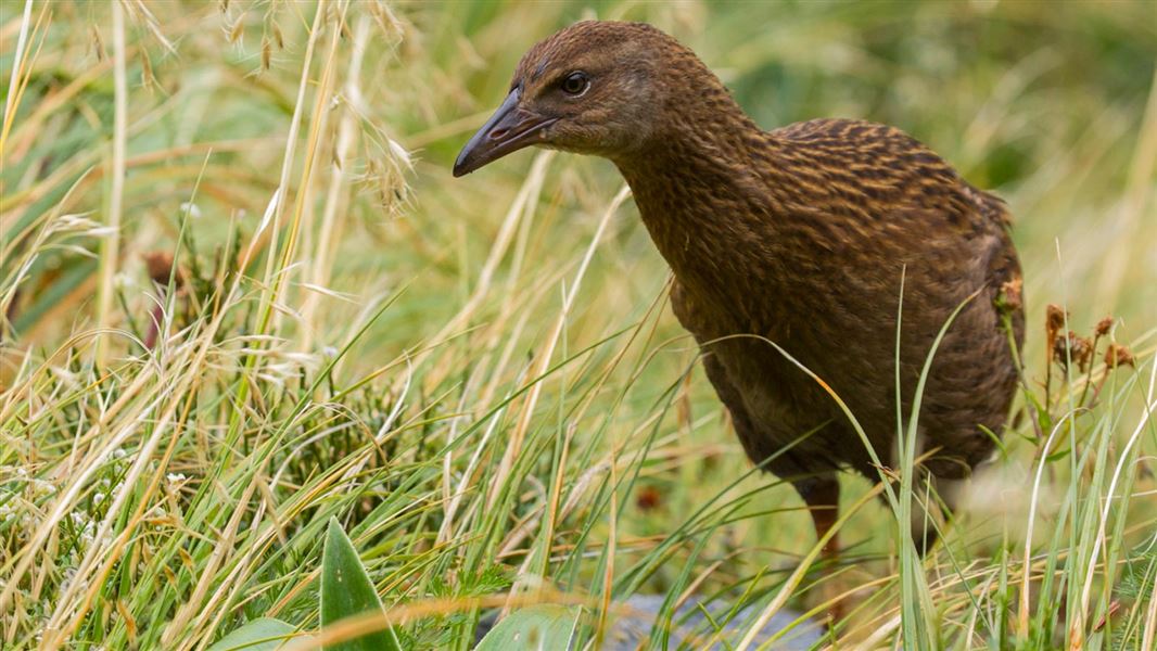
Weka bird.
- Mark as New
- Bookmark
- Subscribe
- Mute
- Subscribe to RSS Feed
- Permalink
- Report Inappropriate Content

Kaka bird.
- Mark as New
- Bookmark
- Subscribe
- Mute
- Subscribe to RSS Feed
- Permalink
- Report Inappropriate Content
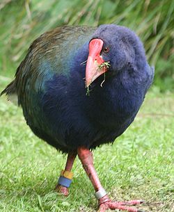
Takahe bird.
- Mark as New
- Bookmark
- Subscribe
- Mute
- Subscribe to RSS Feed
- Permalink
- Report Inappropriate Content

The cheeky Keas.
- Mark as New
- Bookmark
- Subscribe
- Mute
- Subscribe to RSS Feed
- Permalink
- Report Inappropriate Content
That's them.