- Home
- :
- All Communities
- :
- Industries
- :
- Health and Human Services
- :
- Health and Human Services Questions
- :
- Re: FYI: GIS Technology used to fight the Opioid E...
- Subscribe to RSS Feed
- Mark Topic as New
- Mark Topic as Read
- Float this Topic for Current User
- Bookmark
- Subscribe
- Mute
- Printer Friendly Page
FYI: GIS Technology used to fight the Opioid Epidemic
- Mark as New
- Bookmark
- Subscribe
- Mute
- Subscribe to RSS Feed
- Permalink
- Report Inappropriate Content
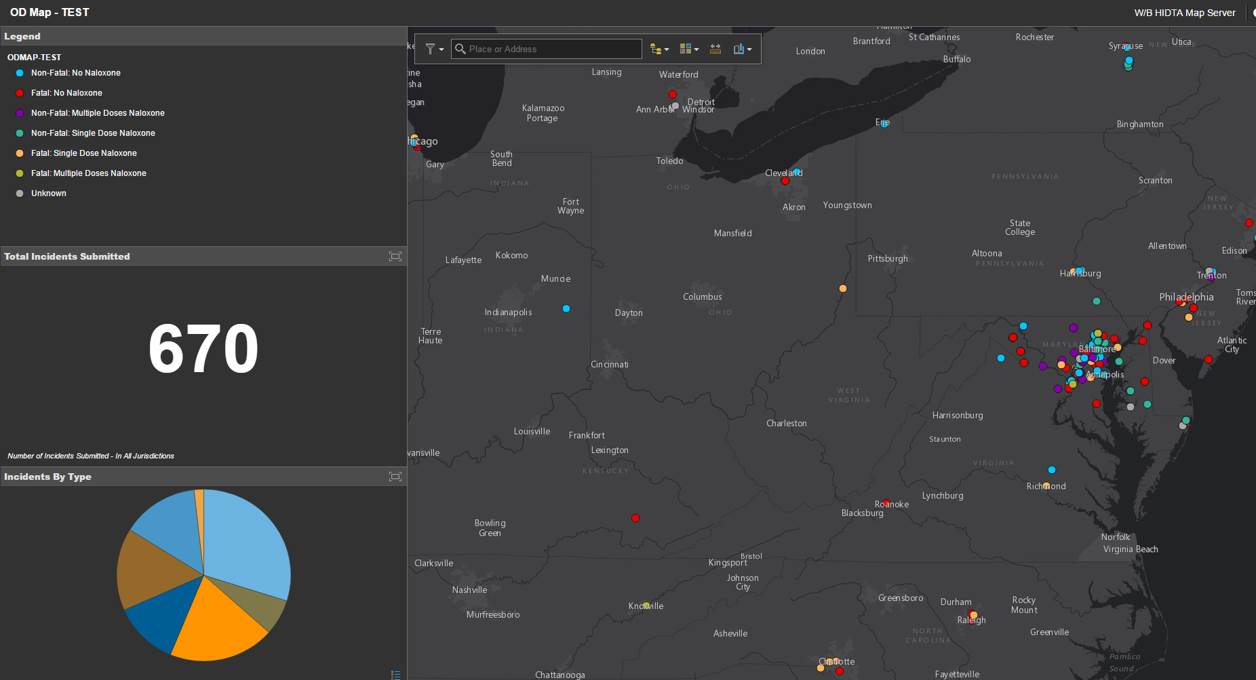
Wanted to share several articles that discusses how law enforcement agencies are fighting the US opioid epidemic with the ArcGIS Platform. More specifically, they are using Operations Dashboard for ArcGIS to help monitor and track overdoses in real-time. This app enables you to monitor, track, and assess your daily operations.
1. Tech's war on drugs: How big data is being used to fight the US opioid epidemic - ZDNet
2. This App Maps Opioid Overdoses in Real Time - Wired
3. NBC News - Digital War on Drugs: App Shows Opioid Overdoses Instantaneously
FYI, the next generation Operations Dashboard for ArcGIS - beta is now available!
Hope this is informative,
- Mark as New
- Bookmark
- Subscribe
- Mute
- Subscribe to RSS Feed
- Permalink
- Report Inappropriate Content
FYI, I just wanted to cross-reference these GeoNet threads,
Operations Dashboard for ArcGIS used to help address Opioid Epidemic
https://community.esri.com/thread/204766-arcgis-solutions-for-the-opioid-epidemic
Hope this helps,