- Home
- :
- All Communities
- :
- Products
- :
- Mapping and Charting Solutions
- :
- Mapping and Charting Questions
- :
- Re: Marker Line Symbols stacking and/or misaligned...
- Subscribe to RSS Feed
- Mark Topic as New
- Mark Topic as Read
- Float this Topic for Current User
- Bookmark
- Subscribe
- Mute
- Printer Friendly Page
Marker Line Symbols stacking and/or misaligned?
- Mark as New
- Bookmark
- Subscribe
- Mute
- Subscribe to RSS Feed
- Permalink
- Report Inappropriate Content
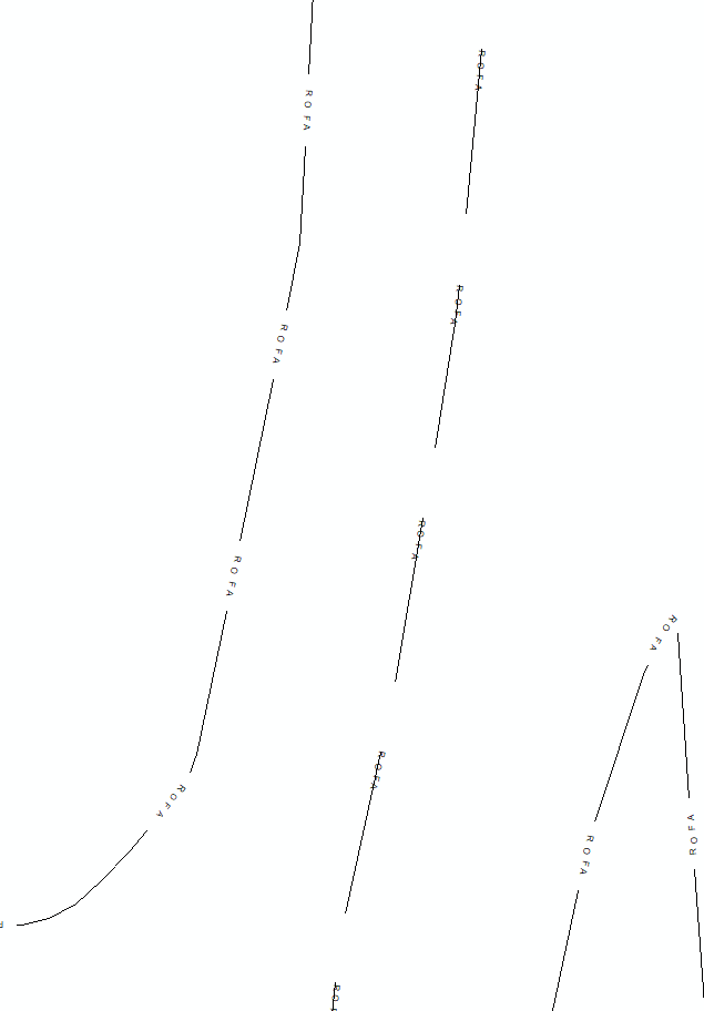
I've been working on converting some maps from CAD over to ArcMap and have been having some trouble reproducing the style. I'm trying to reproduce the CAD style line symbology with labels interspersed through the line as you can see below. I've created some line types that more or less match what I'm after by combining some marker lines symbols and a cartographic line symbol in the symbol property editor, but its not quite working how it should.
I'd say 90% of the time the lines and labels look perfect, but that remaining 10% is plagued with enough weird alignment issues to make this impossible to use. The text will occasionally get offset and cover up the line, stack up on sharp corners or at line endings and generally just look terrible.
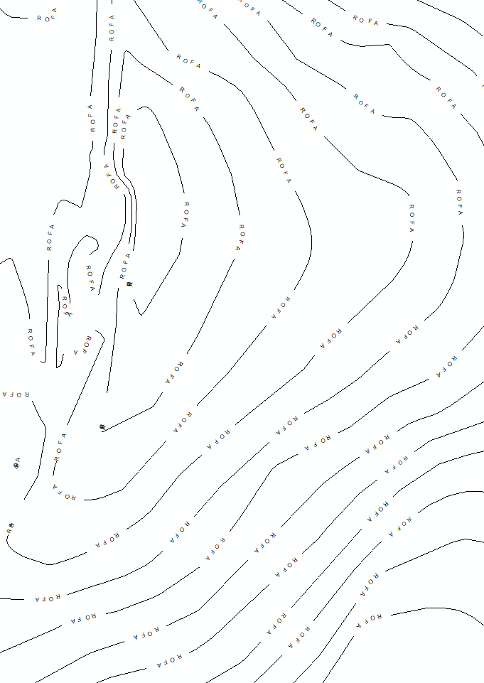
I used contour lines to show off the issues below, which really make them look worse than they normally are. In reality I'll be using these line type on pretty regular shapes and the issues are minimal, but I can't figure out whats going on here or how to fix it. I've already tried using some different fonts and placing the text in the middle and end of the template (instead of at the front as shown below). I feel like I'm missing something obvious, but I've got no idea what that could be.
Any help would be greatly appreciated!

- Mark as New
- Bookmark
- Subscribe
- Mute
- Subscribe to RSS Feed
- Permalink
- Report Inappropriate Content
Just encase anyone comes across this later, I'll fill in a little more about the issue and how I resolved it. I couldn't just use simple labels and text masking because the automatic masks within label properties only produces solid color maps. This need to go over a basemap, so that was a no go for me. You can also use the feature mask outlines tool after converting labels to annotation, but that ends up with a static map, which is also no good for this project.
In the end I used Cartographic Representations, which turned out to be a whole new set of tools I hadn't been aware of in the past and will probably improve the visuals of all my maps going forward.
Here is the ESRI page for it.