- Home
- :
- All Communities
- :
- Products
- :
- ArcGIS Explorer
- :
- ArcGIS Explorer Questions
- :
- Re: unable to open mobile map package
- Subscribe to RSS Feed
- Mark Topic as New
- Mark Topic as Read
- Float this Topic for Current User
- Bookmark
- Subscribe
- Mute
- Printer Friendly Page
unable to open mobile map package
- Mark as New
- Bookmark
- Subscribe
- Mute
- Subscribe to RSS Feed
- Permalink
- Report Inappropriate Content
Hi, I just uploaded a mobile map package, then downloaded to my explorer on an ipad. When the download completed it was labelled as an invalid map and when I tap to open I get this message: "unable to open map the package is required to be unpacked into individual files before use".
I also tried loading the mobile map package using Itunes. I got the same message with that one.
Here is a link to the package. https://ssp-community.maps.arcgis.com/home/item.html?id=bc7959d403824b769d176d7b764c44a1#overview
Please help.
b
- Mark as New
- Bookmark
- Subscribe
- Mute
- Subscribe to RSS Feed
- Permalink
- Report Inappropriate Content
Hey Bob Christensen
They reason you're getting this error is because rasters images are not yet supported in Explorer. As a workaround, you can Create Tile Package's out of the raster images. The resulting TPK's would then display in Explorer as expected.
- Mark as New
- Bookmark
- Subscribe
- Mute
- Subscribe to RSS Feed
- Permalink
- Report Inappropriate Content
Hi Joel, thanks for the help. Is it possible to load a .tpk to my ipad using itunes file sharing? I really need a solution that does not require internet to get started so I can do this kind of thing while out in the field.
I tried copying a map tile package for my project using file sharing but I do not see anything in either explorer or collector and wondering if this is supported or if I need to do something different.
Thanks again.
b
- Mark as New
- Bookmark
- Subscribe
- Mute
- Subscribe to RSS Feed
- Permalink
- Report Inappropriate Content
With current version of Explorer you cannot side load TPKs -- although this may come with a future release. You can side-load MMPKs that contain TPKs (see Make offline maps—Explorer for ArcGIS | ArcGIS for sideloading).
- Mark as New
- Bookmark
- Subscribe
- Mute
- Subscribe to RSS Feed
- Permalink
- Report Inappropriate Content
Hi Again, Joel. I am a bit confused. I started out with the MMPK file but it did no work because of the raster layers. Are you saying that there is a way to create an MMPK then import individual TPK files into the MMPK?
b
- Mark as New
- Bookmark
- Subscribe
- Mute
- Subscribe to RSS Feed
- Permalink
- Report Inappropriate Content
These two blog articles show how to include TPKs in Mobile Map Packages.
Basically, add a TPK to an ArcGIS Pro map, like you would any other layer.
Mark
- Mark as New
- Bookmark
- Subscribe
- Mute
- Subscribe to RSS Feed
- Permalink
- Report Inappropriate Content
Hey Bob Christensen,
Sorry for the confusion. You can create your MMPK using TPKs as layers in the map. So although Explorer cannot read a MMPK with raster layers (ie tif files), you can create a TPK from the raster layer and add that to the map prior to publishing.
- Mark as New
- Bookmark
- Subscribe
- Mute
- Subscribe to RSS Feed
- Permalink
- Report Inappropriate Content
I feel like such an idiot and that this should be easier.
I tried separating my vector and raster layers into two maps, then exporting TPK of raster map (includes several rasters), then added the TPK to the vector map, but only one raster of the many showed up.... Do I have to somehow export all my rasters as individual TPK files now? I do not see how to export a single raster layer as as TPK without uploading to arcgis online, which I am trying to avoid because I do not always have an internet connection.
Is there a straightforward set of instructions for how to get my own raster layer to display in explorer without downloading from the internet?
- Mark as New
- Bookmark
- Subscribe
- Mute
- Subscribe to RSS Feed
- Permalink
- Report Inappropriate Content
Bob,
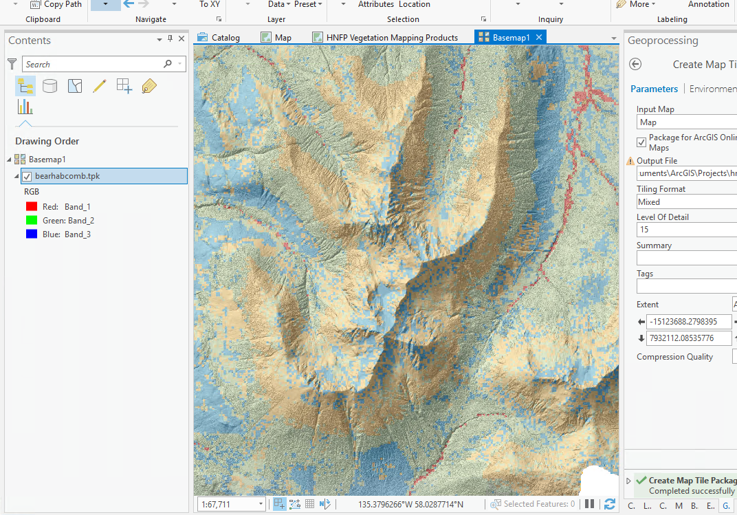
You could create a TPK version of each raster layer that you want to use. However it may be easier to create a TPK of the combined layers. For example you can use the Create Map Tile geoprocessing tool and create a TPK of your DEM base and Current Bear Habitat.
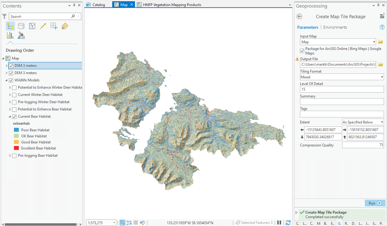
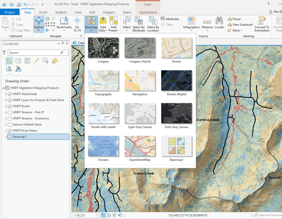
You can the Insert a Basemap into your project, and Add the result TPK as a basemap.
Then you can use the basemap with your other oeperational layers, like Roads and Watershed boundaries, that are in your map.
We do have support for raster files on our list of work to do for the future.
Mark
- Mark as New
- Bookmark
- Subscribe
- Mute
- Subscribe to RSS Feed
- Permalink
- Report Inappropriate Content
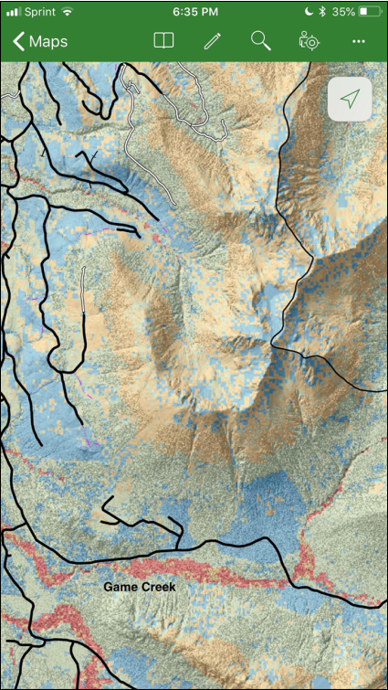
Hi Mark, thanks for the help. I was able to use that method to get a map package built for explorer that includes my project's vector and raster data. It was pretty tedious because I have 15 rasters in the project and each requires that I make a .tpk. Additionally, I think there is a bug in the software because I was unable to queue all these layers up and let them run. When I did that, most of the tpk files did not display the correct raster. Works fine if I wait for each tpk file creation process to finish before I start the next one. Sort of interestingly, I have had the same problem with Tilemill in the past.
Is there any way to retain the legend for the raster in the mobile map package?
What is the benefit of making these raster layers basemaps vs just regular layers?
Do you foresee layer transparency control coming to explorer?
Thanks again.
b