- Home
- :
- All Communities
- :
- Products
- :
- ModelBuilder
- :
- ModelBuilder Questions
- :
- Re: Model Builder Inquiry
- Subscribe to RSS Feed
- Mark Topic as New
- Mark Topic as Read
- Float this Topic for Current User
- Bookmark
- Subscribe
- Mute
- Printer Friendly Page
Model Builder Inquiry
- Mark as New
- Bookmark
- Subscribe
- Mute
- Subscribe to RSS Feed
- Permalink
- Report Inappropriate Content
I'm new to model building but I'm trying to create a model that will select 8" gas main in 5 specific areas, create a buffer around that main, and merge or dissolve the polygons together where buffers overlap. *Also if possible, I need to attach the Area Name to each polygon (buffer); if not I'm sure I could do this manually.
My model looks like this so far and doesn't work at the Feature To Line tool. Need some thoughts on this please! I am using the greater sign > to show the next input, tool, or output feature in the model.
Gas Main (Input) > Make Feature Layer (Tool) Mainsize = '8"' > GasMain8Inch (output) > Feature To Line (Inputs: GasMain8Inch and my 5 area feature) > Feature to Line (Tool) > Result
Like I said, it's crashing at the Feature to line tool. I've tried using, instead of the multi-polygon feature, using a singular polygon and it still wouldn't work.
Thanks for the help, Mike.
- Mark as New
- Bookmark
- Subscribe
- Mute
- Subscribe to RSS Feed
- Permalink
- Report Inappropriate Content
If the goal is to select the pipes that are 8" diameter that are overlapped by polygons and then buffer them, this is one approach that may work to get started. Note the Expression in the Make Feature Layer for the Pipes_test feature class to limit the results right from the start to just 8 inch diameter pipes.
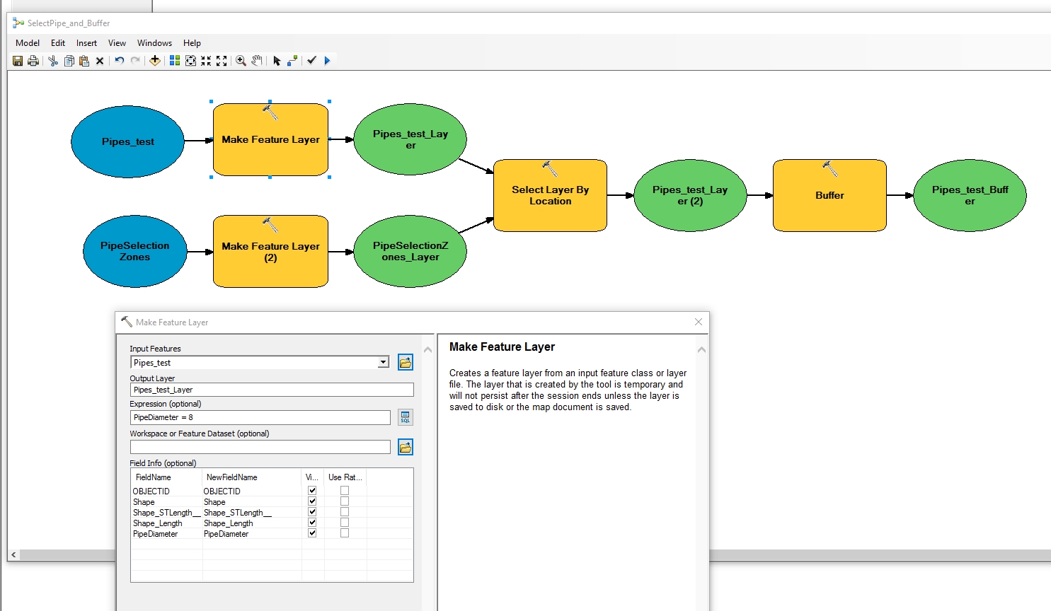
To improve on this, you may want to add a Spatial Join so the attributes transfer across from your selection areas (in this case the feature class PipeSelectionZones) to the output.
Spatial Join—Help | ArcGIS Desktop
About joining the attributes of features by their location—Help | ArcGIS for Desktop
After the buffer, one could Dissolve the result of the buffer.
Dissolve—Data Management toolbox | ArcGIS Desktop
Can you explain why the Feature to Line is being employed? Does the end product need to be lines from the end buffer? Or was the Feature to Line used originally as a potential solution but not needed?
Anyways, that's my guess on what is required based on what was stated. However, there may be other variations that accomplish the goal better - much would depend on further details of the project goals.
Chris Donohue, GISP
- Mark as New
- Bookmark
- Subscribe
- Mute
- Subscribe to RSS Feed
- Permalink
- Report Inappropriate Content
Hey Chris thanks for the response. I used the feature to line so that the main would be split at the polygon edges. I need to select all main within each polygon and used that tool to split the line at the polygon boundary.