- Home
- :
- All Communities
- :
- Developers
- :
- JavaScript Maps SDK
- :
- JavaScript Maps SDK Questions
- :
- Re: Buffer Geometry of a Dropdown Selection
- Subscribe to RSS Feed
- Mark Topic as New
- Mark Topic as Read
- Float this Topic for Current User
- Bookmark
- Subscribe
- Mute
- Printer Friendly Page
- Mark as New
- Bookmark
- Subscribe
- Mute
- Subscribe to RSS Feed
- Permalink
- Report Inappropriate Content
Hello all,
I am trying to buffer a polygon of a dropdown selection. I am hoping somebody can point me where I am going wrong.
var TRSSelect = dom.byId("selectTownshipPanel");
on(TRSSelect, "input", function(e) {
var type = e.target.value;
var task = new QueryTask({
url: panelurl + "2"
});
var params = new Query({
where: "trs = '" + type + "'",
returnGeometry: true
});
task.execute(params)
.then(function(response) {
console.log(response.features["0"].geometry);
console.log(response.features[0].geometry);
console.log(response.features[0].geometry + " TRS response FEATURES");
console.log(response.features["0"].geometry + " TRS response FEATURES");
buffer = geometryEngine.geodesicBuffer(response.features["0"].geometry, 100, "feet", false);
console.log(typeof buffer);
console.log("buffer completed");
bufferLayer.add(new Graphic({
geometry: buffer,
symbol: polySym
}));
});
});My output for this code is:

It is able to retrieve the geometry, but will not execute the buffer (does not lot to console "buffer completed") and add to the graphic layer.
I have isolated this to the buffer because if I pass in the response.features[0].geometry, the resulting geometry can be added to my graphic layer illustrated here:
//buffer = geometryEngine.GeodesicBuffer(response.features["0"].geometry, 100, "feet", false);
console.log(typeof buffer);
console.log("buffer completed");
bufferLayer.add(new Graphic({
geometry: response.features[0].geometry,
symbol: polySym
}));
});
});
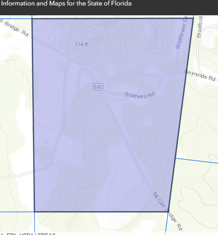
Graphic layer is displayed now when passing in just geometry of response features:
Solved! Go to Solution.
Accepted Solutions
- Mark as New
- Bookmark
- Subscribe
- Mute
- Subscribe to RSS Feed
- Permalink
- Report Inappropriate Content
It's very old. My records show both 102113 (3785) / 102100 (3857) as being added at 9.3.0, but I think that's wrong and 102100 was added at 9.3.1. Anyway, the switch to 102100 / 3857 occurred a lot of releases ago. EPSG:3857 was added by EPSG in 2008.
Other software often can't use the Esri or EPSG definition of 102100 / 3857 because they both use a variant of the "Mercator" map projection. So a software that has the regular Mercator might use EPSG:3785 which uses a sphere-based GCS instead to force the usage of a major auxiliary sphere (radius = semimajor axis).
The functions might be failing because the input/output GCS are actually different. There is a transformation, 15973, which converts between the two GCS.
- Mark as New
- Bookmark
- Subscribe
- Mute
- Subscribe to RSS Feed
- Permalink
- Report Inappropriate Content
...check the spelling of the geometryEngine method... geometryEngine.geodesicBuffer
- Mark as New
- Bookmark
- Subscribe
- Mute
- Subscribe to RSS Feed
- Permalink
- Report Inappropriate Content
John,
While I do feel very silly for that little typo, that did not make it work. I will update the code in my question to reflect that correction. Thank you!
- Mark as New
- Bookmark
- Subscribe
- Mute
- Subscribe to RSS Feed
- Permalink
- Report Inappropriate Content
What is the spatial reference of the geometry you're attempting to buffer? Is it WGS-84 or Web Mercator? If not, you'll have to use the GeometryService buffer method.
- Mark as New
- Bookmark
- Subscribe
- Mute
- Subscribe to RSS Feed
- Permalink
- Report Inappropriate Content
Ken, the spatial reference is listed as:
Spatial Reference: 102113 (3785)
This seems as though it is a deprecated form of Web Mercator?
- Mark as New
- Bookmark
- Subscribe
- Mute
- Subscribe to RSS Feed
- Permalink
- Report Inappropriate Content
Yes, according to this post from Melita Kennedy, Esri's guru on projections and spatial references. Although, according to the isWebMercator method, 102113 would return True.
- Mark as New
- Bookmark
- Subscribe
- Mute
- Subscribe to RSS Feed
- Permalink
- Report Inappropriate Content
Ken,
Forgive my ignorance, but does this deprecated spatial reference now mean that the geometryEngine will not work in this case?
In which case, I'd either have to use the GeometryService or change my layer to conform to this spatial reference requirement, correct?
Thank you,
Clinton
- Mark as New
- Bookmark
- Subscribe
- Mute
- Subscribe to RSS Feed
- Permalink
- Report Inappropriate Content
I don't know, unfortunately.
Is the wkid 3785 correct? That comes up as something else: Popular Visualisation CRS / Mercator: EPSG Projection -- Spatial Reference
- Mark as New
- Bookmark
- Subscribe
- Mute
- Subscribe to RSS Feed
- Permalink
- Report Inappropriate Content
Yes, that is correct. I was puzzled when I searched that wkid too.
- Mark as New
- Bookmark
- Subscribe
- Mute
- Subscribe to RSS Feed
- Permalink
- Report Inappropriate Content
It's very old. My records show both 102113 (3785) / 102100 (3857) as being added at 9.3.0, but I think that's wrong and 102100 was added at 9.3.1. Anyway, the switch to 102100 / 3857 occurred a lot of releases ago. EPSG:3857 was added by EPSG in 2008.
Other software often can't use the Esri or EPSG definition of 102100 / 3857 because they both use a variant of the "Mercator" map projection. So a software that has the regular Mercator might use EPSG:3785 which uses a sphere-based GCS instead to force the usage of a major auxiliary sphere (radius = semimajor axis).
The functions might be failing because the input/output GCS are actually different. There is a transformation, 15973, which converts between the two GCS.