- Home
- :
- All Communities
- :
- Industries
- :
- Land Records and Valuation
- :
- Land Records and Valuation Questions
- :
- Re: Handling Record Data w/ Large Misclose Distanc...
- Subscribe to RSS Feed
- Mark Topic as New
- Mark Topic as Read
- Float this Topic for Current User
- Bookmark
- Subscribe
- Mute
- Printer Friendly Page
Handling Record Data w/ Large Misclose Distances
- Mark as New
- Bookmark
- Subscribe
- Mute
- Subscribe to RSS Feed
- Permalink
- Report Inappropriate Content
In an effort to traverse some of our older maps into the parcel fabric, I've come across several maps where lots that have a record bearing and distance, do not close within the specified tolerance (0.3281), and also do not provide a stated area due to this large misclose once traversed.
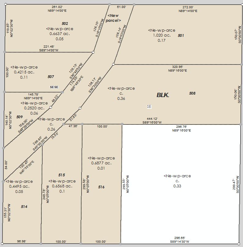
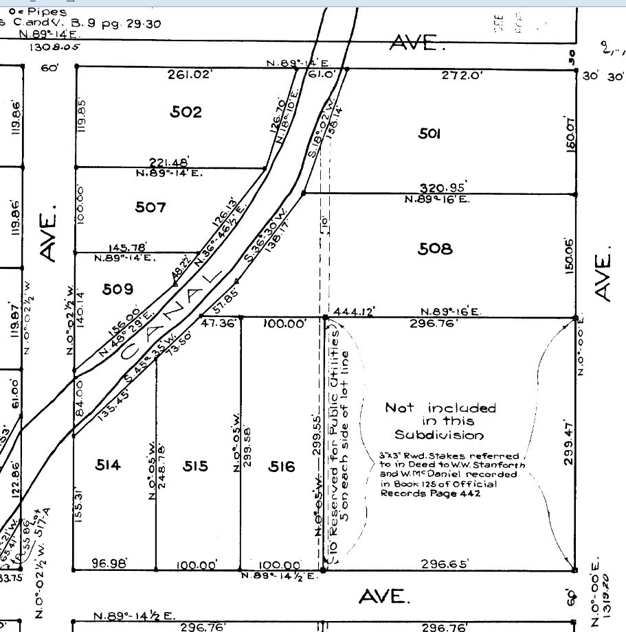
In the example attached below, on the tax parcels, you will see the parcel name, stated area, and misclose distance. As you can see, there are several tax parcels that do not have a stated area, and also have a large misclose distance. (I also attached the 1922 map for reference).
My question is, is it appropriate to keep these parcels within the fabric knowing that they do not close? How do you go about managing this type of data? Any information in situations such as these are greatly appreciated.
Walid
- Mark as New
- Bookmark
- Subscribe
- Mute
- Subscribe to RSS Feed
- Permalink
- Report Inappropriate Content
I'm not a surveyor but having worked with / for them for over 20 years there are a couple approaches you could take. According to Wattles ("Writing Legal Descriptions", 1979), monuments cited or existing physically hold over everything. So, if the record data had "calls" to a right-of-way or any other cited / recorded land corner or line will hold over distance and direction.
Next is distance. Distance is weighted over bearings particularly because of objectivity in portions of the basis-of-bearing or because of contrasting adjoining descriptions disagree. So, if any of your adjoining parcels are cited within one of the non-closing others, and one of them is closing within a reasonable error, then hold that parcel as described to test better alignment or fit.
This is one of the primary elements associated with raw record data requiring cogo to prepare parcel fabric data. It won't always be correct. In your traverse editor there are options to adjust a polygon and the results can be evaluated to see if they'll still agree with the rest of your fabric. In reality, the parcel is closed by 4 bounding monuments of some type. The misclosure is due to insufficient calculations or a scrivener's error
- Mark as New
- Bookmark
- Subscribe
- Mute
- Subscribe to RSS Feed
- Permalink
- Report Inappropriate Content
And keep in mind that the data model for the parcel fabric allows for record bearings and distances (and misclosure residuals) to stay with the parcel even after it has been joined to the adjacent parcels. As long as you are sure that your basis of bearings, point of commencement, and point of beginning are correct and the adjacent parcels are fitted to the rest of your fabric, those errors will still be part of the parcel's metadata.