- Home
- :
- All Communities
- :
- Industries
- :
- Water Resources
- :
- Water Resources Questions
- :
- Re: How to show flow direction?
- Subscribe to RSS Feed
- Mark Topic as New
- Mark Topic as Read
- Float this Topic for Current User
- Bookmark
- Subscribe
- Mute
- Printer Friendly Page
- Mark as New
- Bookmark
- Subscribe
- Mute
- Subscribe to RSS Feed
- Permalink
- Report Inappropriate Content
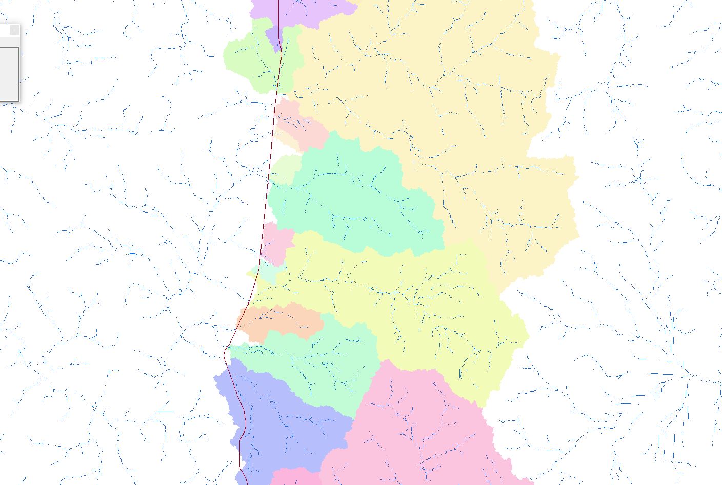
I was able to derive the catchments for each stream crossing. Now, I have two questions:
1. My question is how can i show flow direction? So that i can verify the upstream catchments generated are correct.
2. Is there a way eliminate the white gaps (between pour points and near the road alignment) between the catchments?
I have tried the vector field symbology in Flow direction raster but gives arrows not according to the streams.
I have tried the vector field symbology in the original dem raster and it gives better results but still alot of areas not in accordance with the stream generated.
I have attached a snapshot.
Thank you.
Ron
Solved! Go to Solution.
- Mark as New
- Bookmark
- Subscribe
- Mute
- Subscribe to RSS Feed
- Permalink
- Report Inappropriate Content
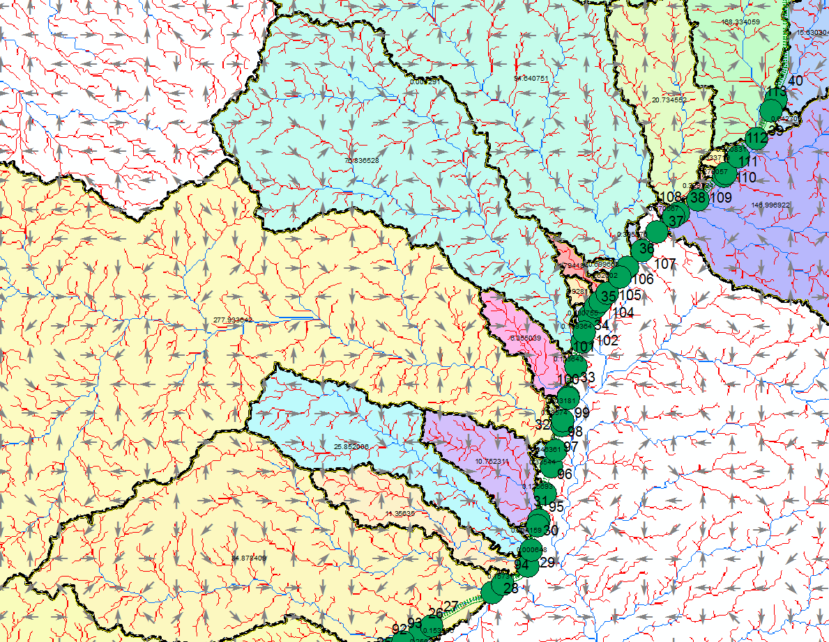
The screen shot you provided will not correctly symbolize the FDR raster. Were you able to convert the original, unsampled FDR raster to a point feature class, and use arrow symbols rotated by attribute (you'll have to convert the integers to a real azimuth using https://community.esri.com/external-link.jspa?url=http%3A%2F%2Fgisgeography.com%2Fwp-content%2Fuploa...
- Mark as New
- Bookmark
- Subscribe
- Mute
- Subscribe to RSS Feed
- Permalink
- Report Inappropriate Content
Yes Thomas, i have tried that too before resampling. It gives correct result after applying the symbol rotation for each integer representation of direction. I just resampled so that i don't arrive with congested arrows.
- Mark as New
- Bookmark
- Subscribe
- Mute
- Subscribe to RSS Feed
- Permalink
- Report Inappropriate Content
By resampling the flow direction, you are going to get different (and not one of the 8 "legal") pixel values, that have nothing to do with flow direction. Use a symbol weighting scheme that will only show one arrow per 8 pixels with the original. However, completing the Arc Hydro Hydro Network Generation will accomplish the same thing. You really can't symbolize flow direction the way you're trying to.
- Mark as New
- Bookmark
- Subscribe
- Mute
- Subscribe to RSS Feed
- Permalink
- Report Inappropriate Content
Thank you for pointing that out Thomas, much appreciated. I do have another question. How can i associate the pour points with the catchment area? What i have right now are two shape files. First shape file contains the catchment polygons with additional field for the area. And the other shape file contains only the pour points.
Thanks.
Best Regards,
Ron
- Mark as New
- Bookmark
- Subscribe
- Mute
- Subscribe to RSS Feed
- Permalink
- Report Inappropriate Content
If you run through EACH TOOL in the terrain processing and the hydro network tabs, you will get a hydro point layer, which represents the pour points, and can be related to the catchments using the hydroID field.
- Mark as New
- Bookmark
- Subscribe
- Mute
- Subscribe to RSS Feed
- Permalink
- Report Inappropriate Content
Thomas, do you mean Arc hydro for the Hydro Network Generation tools?
- « Previous
-
- 1
- 2
- Next »
- « Previous
-
- 1
- 2
- Next »