- Home
- :
- All Communities
- :
- Developers
- :
- Python
- :
- Python Questions
- :
- How to create Grid Index of hundreds of Aerial TIF...
- Subscribe to RSS Feed
- Mark Topic as New
- Mark Topic as Read
- Float this Topic for Current User
- Bookmark
- Subscribe
- Mute
- Printer Friendly Page
How to create Grid Index of hundreds of Aerial TIF Images
- Mark as New
- Bookmark
- Subscribe
- Mute
- Subscribe to RSS Feed
- Permalink
- Report Inappropriate Content
Hey All,
I am trying to find the tool that would be useful in creating a grid index showing the extent (and ideally, the associated filename), of each of my several hundred TIF files containing our Aerial Photography.
I am sure I can automate something with Python if I knew what tool to use.
In the past we had been supplied this file from the creator of the Aerial Imagery, but this time they did not, and unfortunately I did not specify this in our contract.
This is what I am after:


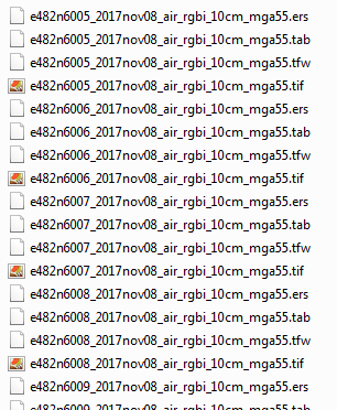
This is all that I have got:@
Any direction for someone in need??
Cheers
Solved! Go to Solution.
Accepted Solutions
- Mark as New
- Bookmark
- Subscribe
- Mute
- Subscribe to RSS Feed
- Permalink
- Report Inappropriate Content
Just a note to Future Me, there is a Geoprocessing tool called Add Geometry Attributes, works a treat!
- Mark as New
- Bookmark
- Subscribe
- Mute
- Subscribe to RSS Feed
- Permalink
- Report Inappropriate Content
Fishnet or Mosaic Dataset you might want to look at these prior to springing into full-fledge coding. At least fishnet can provide a simple framework and mosaic dataset may remove the need altogether
- Mark as New
- Bookmark
- Subscribe
- Mute
- Subscribe to RSS Feed
- Permalink
- Report Inappropriate Content
Just a note to Future Me, there is a Geoprocessing tool called Add Geometry Attributes, works a treat!