- Home
- :
- All Communities
- :
- User Groups
- :
- 911 GIS
- :
- Questions
- :
- Re: Knowing pixel values
- Subscribe to RSS Feed
- Mark Topic as New
- Mark Topic as Read
- Float this Topic for Current User
- Bookmark
- Subscribe
- Mute
- Printer Friendly Page
Knowing pixel values
- Mark as New
- Bookmark
- Subscribe
- Mute
- Subscribe to RSS Feed
- Permalink
- Report Inappropriate Content
I have a large raster layer that has aridity values assigned to each pixel. I also have latitude and longitude data of some locations in USA. I would like to know the pixel value according to my latitude and longitude locations . I first clipped the raster to my area of interest (USA) in Arcmap the I converted my clipped raster in to a .tif file. I don't know how to extract the pixel values according to the locations that I have. I tried a few things but it either doesn't work or I don't have the license (such as for extract).
Thank You for your help^^
I have attached an image of what I have. 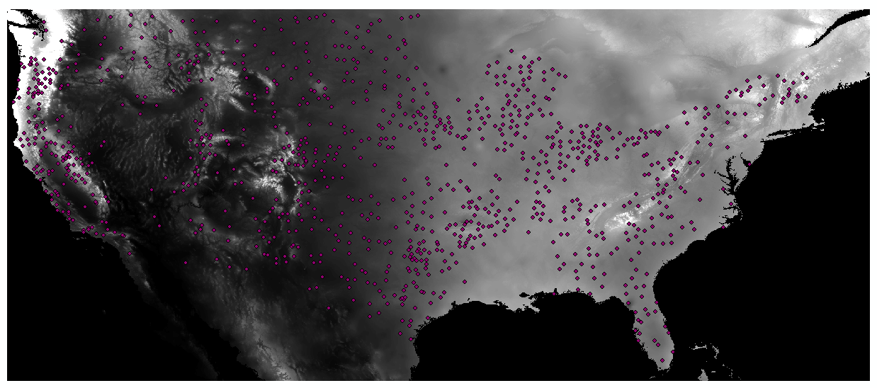
- Mark as New
- Bookmark
- Subscribe
- Mute
- Subscribe to RSS Feed
- Permalink
- Report Inappropriate Content
Extract Values to Points or its brethren Extract MultiValues to Points IF you have the spatial analyst extension
- Mark as New
- Bookmark
- Subscribe
- Mute
- Subscribe to RSS Feed
- Permalink
- Report Inappropriate Content
Hello Dan thank you for your reply^^
I unfortunately don't have the spatial analyst extension, is there a way around this?
- Mark as New
- Bookmark
- Subscribe
- Mute
- Subscribe to RSS Feed
- Permalink
- Report Inappropriate Content
There is... but it requires programming in python and numpy... sorry... so short of the info tool, you are a bit stuck
- Mark as New
- Bookmark
- Subscribe
- Mute
- Subscribe to RSS Feed
- Permalink
- Report Inappropriate Content
It's alright^^
Again thank you Dan 
- Mark as New
- Bookmark
- Subscribe
- Mute
- Subscribe to RSS Feed
- Permalink
- Report Inappropriate Content
Here is a document that could get you started, but you will have to program using Python: https://community.esri.com/docs/DOC-2954
- Mark as New
- Bookmark
- Subscribe
- Mute
- Subscribe to RSS Feed
- Permalink
- Report Inappropriate Content
I will have a look at it^^
Thank You Xander