- Home
- :
- All Communities
- :
- Developers
- :
- Python
- :
- Python Questions
- :
- Re: Calculate mean in 8 day intervals for thousand...
- Subscribe to RSS Feed
- Mark Topic as New
- Mark Topic as Read
- Float this Topic for Current User
- Bookmark
- Subscribe
- Mute
- Printer Friendly Page
Calculate mean in 8 day intervals for thousand of daily raster files using cell statistics
- Mark as New
- Bookmark
- Subscribe
- Mute
- Subscribe to RSS Feed
- Permalink
- Report Inappropriate Content
Hi everyone, I have folder with thousands of average daily relative humidity raster files that I would like to use cell statistics to calculate the mean in 8 day intervals. The data has dates in the format YYYYMMDD. I've looked at a similar code written after a similar question was asked but it doesnt do the 8 day averaging. I've included the link to the other answered question and a picture of what the data look like. Your help is greatly appreciated.Calculate daily average of raster files based on their names in python xander_bakker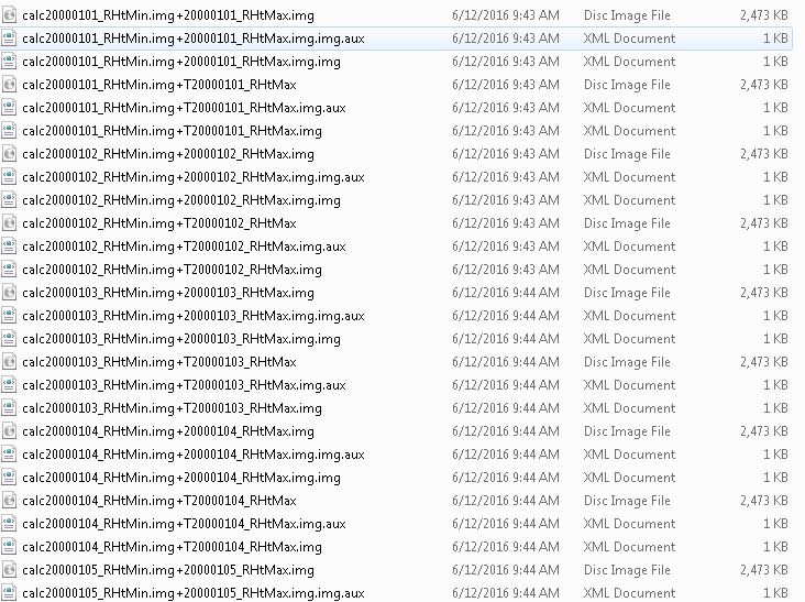
Solved! Go to Solution.
Accepted Solutions
- Mark as New
- Bookmark
- Subscribe
- Mute
- Subscribe to RSS Feed
- Permalink
- Report Inappropriate Content
Hi larry32 , can you try this code?
Change:
- input folder with .img files on line 6
- output folder or fgdb on line 9 and the corresponding extension on line 10
def main():
import arcpy
import os
# change this folder to the folder with the renamed img files
input_folder = r'C:\GeoNet\Average8Days\output_files'
# define the output workspace and extension
output_ws = r'C:\GeoNet\Average8Days\gdb\myFileGeoDB.gdb'
out_ext = ""
# create list of rasters in input workspace
arcpy.env.workspace = input_folder
my_list = arcpy.ListRasters()
# checkout a Spatial Analyst license
arcpy.CheckExtension("Spatial")
# loop through chunks of 8 rasters
for my_list_chunk in chunks(my_list, 8):
# define the output name
first_name = my_list_chunk[0]
name, ext = os.path.splitext(first_name)
first_date = name[-8:]
out_ras_name = "mean" + first_date + out_ext
print out_ras_name, my_list_chunk
# now we have:
# - an output raster filename
# - the list of rasters for calculating the mean value
# perform the cellstatistics with MEAN
cellstat = arcpy.sa.CellStatistics(my_list_chunk, "MEAN", "DATA")
# define file path of output raster and save cell statistics result
outname = os.path.join(output_ws, out_ras_name)
cellstat.save(outname)
def chunks(l, n):
""" Yield successive n-sized chunks from l."""
for i in xrange(0, len(l), n):
yield l[i:i+n]
if __name__ == '__main__':
main()- Mark as New
- Bookmark
- Subscribe
- Mute
- Subscribe to RSS Feed
- Permalink
- Report Inappropriate Content
Hi Larry Biodun ,
First thing I notice is the "+" sign in the name of the img files. This may generate problems when you use them in any mathematical operation in ArcGIS / Python. So it might be necessary to start with renaming the rasters and shorten the names. This can be done with Python. Would this be an option?
Edit:
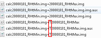
I also notice that half of the raster have a "T" after the "+" sign. And 2 rasters will reference the same date. Should the 8 day calculation include 16 rasters?
- Mark as New
- Bookmark
- Subscribe
- Mute
- Subscribe to RSS Feed
- Permalink
- Report Inappropriate Content
Hi Xander, thanks for your quick response. That was an error in that sample list i sent. Thanks for picking that up. The 8 day calculation should only include 8 rasters. I have included another pix of the actual correct data. I am happy to shorten the names. Infact anything after the first 14 characters dont matter.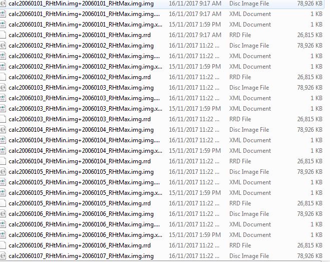
- Mark as New
- Bookmark
- Subscribe
- Mute
- Subscribe to RSS Feed
- Permalink
- Report Inappropriate Content
there is a thread here which Xander Bakker led the charge on. https://community.esri.com/message/584750?commentID=584750#comment-584750
Then a parallel incarnation here https://community.esri.com/thread/173806 shoul
you require more statistical style calculations in either a block or running style calculation
- Mark as New
- Bookmark
- Subscribe
- Mute
- Subscribe to RSS Feed
- Permalink
- Report Inappropriate Content
The first step would be to apply some proper naming for the files. See below a snippet of code that could do this:
def main():
from shutil import copyfile, move
import os
# list of extensions you want to copy or rename
lst_ext = ['.img']
input_folder = r'C:\GeoNet\Average8Days\input_files'
output_folder = r'C:\GeoNet\Average8Days\output_files'
for path, dirs, files in os.walk(input_folder):
for filename in files:
name, ext = os.path.splitext(filename)
if ext in lst_ext:
in_file = os.path.join(path, filename)
print in_file
out_name = name[:12] + ext
out_file = os.path.join(output_folder, out_name)
print out_file
# decide to copy
copyfile(in_file, out_file)
# or move:
move(in_file, out_file)
# or rename:
os.rename(in_file, out_file)
if __name__ == '__main__':
main()On line 6, you will have to include the extensions of the files you want to copy, move or rename.
On line 8 and 9 specify the paths of the input and output folder
Line 21 to 28, decide if you want to copy, which is safest, but you will need to additional disk space, or move or rename. If you have any dependencies on the current file name and locations I recommend you to copy the data.
Once you have the files in with usable names, you are ready for the next step.
- Mark as New
- Bookmark
- Subscribe
- Mute
- Subscribe to RSS Feed
- Permalink
- Report Inappropriate Content
Thanks Xander. The renaming is done. I chose the copy part of the code. I'll wait on the averaging code. Here is a snapshot of the copied files.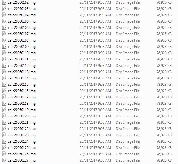
- Mark as New
- Bookmark
- Subscribe
- Mute
- Subscribe to RSS Feed
- Permalink
- Report Inappropriate Content
You can prep by reading Xander's post here, where the shell is outlined
https://community.esri.com/thread/171685?commentID=584750#comment-584750
- Mark as New
- Bookmark
- Subscribe
- Mute
- Subscribe to RSS Feed
- Permalink
- Report Inappropriate Content
Thanks for that Dan
- Mark as New
- Bookmark
- Subscribe
- Mute
- Subscribe to RSS Feed
- Permalink
- Report Inappropriate Content
Can you check if the renamed files open properly in ArcGIS (just open one), since only the .img file was copied. It will probably recreate the aux and xml files, but just to be sure that the data is valid.
- Mark as New
- Bookmark
- Subscribe
- Mute
- Subscribe to RSS Feed
- Permalink
- Report Inappropriate Content
Yes they do open in ArcGIS properly. The associated files were created when I opened it in ArcGIS.