- Home
- :
- All Communities
- :
- Products
- :
- Mapping and Charting Solutions
- :
- Mapping and Charting Questions
- :
- Re: Generate Near Table Analysis
- Subscribe to RSS Feed
- Mark Topic as New
- Mark Topic as Read
- Float this Topic for Current User
- Bookmark
- Subscribe
- Mute
- Printer Friendly Page
- Mark as New
- Bookmark
- Subscribe
- Mute
- Subscribe to RSS Feed
- Permalink
- Report Inappropriate Content
Hello all,
I have two point layers on a map. One of which is the centroid of a polygon, the other is points from a KML layer. I am trying to use the generate near table analysis tool to find the distance from these centroids to the nearest point from the KML-to-layer layer. However, every time I try and use this tool, the table generates zero results. Any suggestions on how to fix this problem?
Solved! Go to Solution.
Accepted Solutions
- Mark as New
- Bookmark
- Subscribe
- Mute
- Subscribe to RSS Feed
- Permalink
- Report Inappropriate Content
There is a similar post in StackExchange. The workaround apparently is to use the Copy Features (Data Management) geoprocessing tool to do the export.
Copy Features—Help | ArcGIS for Desktop
Chris Donohue, GISP
- Mark as New
- Bookmark
- Subscribe
- Mute
- Subscribe to RSS Feed
- Permalink
- Report Inappropriate Content
Try exporting each to a shapefile, use the data frame coordinate system upon export, and try again.
- Mark as New
- Bookmark
- Subscribe
- Mute
- Subscribe to RSS Feed
- Permalink
- Report Inappropriate Content
Hi Joseph, thanks for your response! I had no problem converting one of the layers, however the other won't convert. Is that because it is part of a geodatabase?
- Mark as New
- Bookmark
- Subscribe
- Mute
- Subscribe to RSS Feed
- Permalink
- Report Inappropriate Content
It is suspicious that the layer does not convert. Was there an error message that accompanied it when the conversion was attempted?
Also, I would check to be certain that both layers have assigned coordinate systems. It may be that one layer does not have an assigned coordinate system, but visually lines up in ArcMap as the coordinate system is already set for the Data Frame that is being used to view it (the data frame inherits the coordinate system from the first layer brought in).
Chris Donohue, GISP
- Mark as New
- Bookmark
- Subscribe
- Mute
- Subscribe to RSS Feed
- Permalink
- Report Inappropriate Content
Hi Chris,
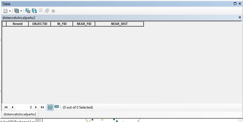
There is no error code, it simply shows up with this. 
It is on a coordinate system- WGS_GCS_1984
- Mark as New
- Bookmark
- Subscribe
- Mute
- Subscribe to RSS Feed
- Permalink
- Report Inappropriate Content
There is a similar post in StackExchange. The workaround apparently is to use the Copy Features (Data Management) geoprocessing tool to do the export.
Copy Features—Help | ArcGIS for Desktop
Chris Donohue, GISP
- Mark as New
- Bookmark
- Subscribe
- Mute
- Subscribe to RSS Feed
- Permalink
- Report Inappropriate Content
Oh wow, that worked! Thank you so much.