- Home
- :
- All Communities
- :
- Products
- :
- Data Management
- :
- Data Management Questions
- :
- Re: How to combine/mosaic rasters (geotiffs)
- Subscribe to RSS Feed
- Mark Topic as New
- Mark Topic as Read
- Float this Topic for Current User
- Bookmark
- Subscribe
- Mute
- Printer Friendly Page
How to combine/mosaic rasters (geotiffs)
- Mark as New
- Bookmark
- Subscribe
- Mute
- Subscribe to RSS Feed
- Permalink
- Report Inappropriate Content
Hej all,
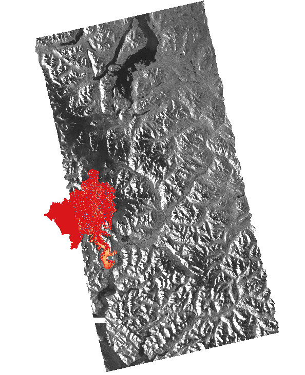
I want to combine two georeferenced rasterfiles. One rasterfile should be in background, the ohter smaller image should lay over the background image. I've tried combine, composite, mosaic and other tools without success. When I used this methods I get only a one channel image. I want to combine to one image that have two channels that each present one of the input images, so that I can assign color ramp to overlap region like the screeshot below. I know I could export the map, but I need the combined image in same dimensions and projection like inputs for further processing with other software.
Any ideas how I can solve that?
Thanks in advance!
Uwe
- Mark as New
- Bookmark
- Subscribe
- Mute
- Subscribe to RSS Feed
- Permalink
- Report Inappropriate Content
Try Mosaic Tool, it worked for me.
similar Discussion - How to merge raster files in ArcGIS?
- Mark as New
- Bookmark
- Subscribe
- Mute
- Subscribe to RSS Feed
- Permalink
- Report Inappropriate Content
Same result like before. I only get a one channel image, so I can't change the color from the 'overlay' part, only from the hole image.